Old Maps of Bayville, Delaware for Genealogy
Trace your family roots with 17 historic maps of Bayville. These high-res maps reveal old neighborhoods, homesites, landmarks, and streets — helping you uncover where your ancestors lived and how the area evolved over time.
- Explore historic neighborhoods: Identify where your relatives may have lived in the 1800s or 1900s.
- Compare maps over time: Trace the changes in streets, buildings, and landmarks for multi-generational research.
- Perfect for genealogy & ancestry research: Used by family historians and researchers to map out lineage and migration.
These maps are an incredible resource for exploring your personal connection to Bayville's past.
Bayville, DE maps
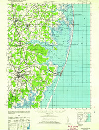
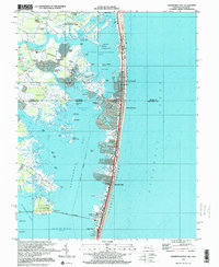
(17)- 1901 Map of Ocean City
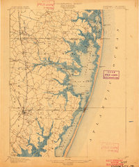 1901 Ocean City1901 Print · USGSCovers Bayville, including Ocean Pines, Ocean City, and other nearby areas5 unique versions available
 - 1942 Map of Ocean City
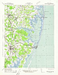 1942 Ocean City1942 Print · USGSCovers Bayville, including Ocean Pines, Ocean City, and other nearby areas2 unique versions available
 - 1943 Map of Assawoman Bay
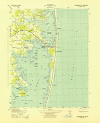 1943 Assawoman Bay1943 Print · USGSCovers Bayville, including Ocean City, Fenwick Island, and other nearby areas
 - 1946 Map of Salisbury, 1948 Print
 1946 Salisbury1948 Print · USGSCovers Bayville, including Salisbury, Lower Township, and other nearby areas4 unique versions available
 - 1947 Map of Salisbury, 1948 Print
 1947 Salisbury1948 Print · USGSCovers Bayville, including Salisbury, Lower Township, and other nearby areas
 - 1948 Map of Salisbury, 1951 Print
 1948 Salisbury1951 Print · USGSCovers Bayville, including Salisbury, Lower Township, and other nearby areas
 - 1953 Map of Assawoman Bay
 1953 Assawoman Bay1953 Print · USGSCovers Bayville, including Ocean City, Fenwick Island, and other nearby areas
 - 1957 Map of Salisbury
 1957 Salisbury1957 Print · USGSCovers Bayville, including Salisbury, Lower Township, and other nearby areas
 - 1961 Map of Ocean City
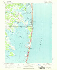
 1961 Ocean City1961 Print · USGSCovers Bayville, including Ocean Pines, Ocean City, and other nearby areas
 - 1961 Map of Salisbury
 1961 Salisbury1961 Print · USGSCovers Bayville, including Salisbury, Lower Township, and other nearby areas
 - 1965 Map of Salisbury
 1965 Salisbury1965 Print · USGSCovers Bayville, including Salisbury, Lower Township, and other nearby areas
 - 1967 Map of Assawoman Bay, 1969 Print
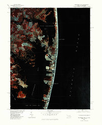
 1967 Assawoman Bay1969 Print · USGSCovers Bayville, including Ocean City, Fenwick Island, and other nearby areas4 unique versions available
 - 1980 Map of Assawoman Bay, 1982 Print
 1980 Assawoman Bay1982 Print · USGSCovers Bayville, including Ocean City, Fenwick Island, and other nearby areas
 - 1983 Map of Salisbury, 1984 Print
 1983 Salisbury1984 Print · USGSCovers Bayville, including Salisbury, Ocean Pines, and other nearby areas
 - 1992 Map of Assawoman Bay
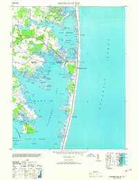
 1992 Assawoman Bay1992 Print · USGSCovers Bayville, including Ocean City, Fenwick Island, and other nearby areas
 - 1997 Map of Assawoman Bay, 2000 Print
 1997 Assawoman Bay2000 Print · USGSCovers Bayville, including Ocean City, Fenwick Island, and other nearby areas
 - 2023 Map of Assawoman Bay, 2023 Print
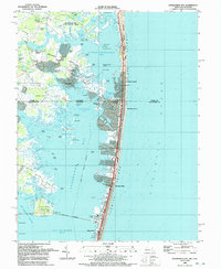
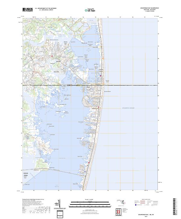 2023 Assawoman Bay2023 Print · USGSCovers Bayville, including Ocean City, Fenwick Island, and other nearby areas
End of results
Showing maps 1-17 of 17
Top cities near Bayville
- Ocean Pines historical maps
- Ocean City historical maps
- West Ocean City historical maps
- Berlin historical maps
- Millsboro historical maps
- Selbyville historical maps
See more
Frequently asked questions
- What are the different types of historical maps available for Bayville?
- What is the oldest map of Bayville?
- Where can I purchase historical maps of Bayville for my home or office?
- Where can I download high-res historical maps of Bayville?
- Are there historical topographic maps available for Bayville?
- Is there historical aerial imagery available for Bayville?
- Where are historical maps of Bayville sourced from?