2000s (21st Century) Maps of Belltown, Delaware
Explore 5 historic maps of Belltown from the 2000s (21st Century). These maps offer a rare glimpse into what life looked like during the 2000s — showing old roads, neighborhoods, homes, and landmarks that have changed or disappeared over time.
Whether you're researching your family's past, planning a metal detecting trip, or studying how Belltown's landscape evolved across the 2000s, these high-resolution maps are a powerful tool for exploring the history of this region.
- Focus on a specific era: All maps on this page are from the 2000s, giving you a focused view of this time period.
- See what’s changed: Compare century-old streets, trails, and buildings to today's modern landscape using overlays and satellite layers.
- Research with precision: Use these maps for genealogy, historical research, land use analysis, or educational projects.
- View, download, or print: Maps are fully viewable online in high resolution, and can be downloaded or printed for your own records.
Start exploring Belltown's history through authentic maps from the 2000s. This is your window into the past.
Belltown, DE maps
(5)- 2011 Map of Fairmount, 2011 Print
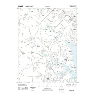 2011 Fairmount2011 Print · USGSCovers Belltown, including Cool Spring Farms Mobile Home Park, Broad Meadows, and other nearby areas
 - 2014 Map of Fairmount, 2014 Print
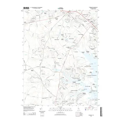 2014 Fairmount2014 Print · USGSCovers Belltown, including Cool Spring Farms Mobile Home Park, Broad Meadows, and other nearby areas
 - 2016 Map of Fairmount, 2016 Print
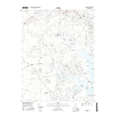 2016 Fairmount2016 Print · USGSCovers Belltown, including Cool Spring Farms Mobile Home Park, Broad Meadows, and other nearby areas
 - 2019 Map of Fairmount, 2019 Print
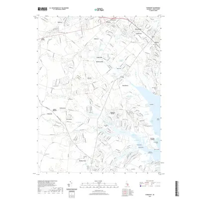 2019 Fairmount2019 Print · USGSCovers Belltown, including Cool Spring Farms Mobile Home Park, Broad Meadows, and other nearby areas
 - 2023 Map of Fairmount, 2023 Print
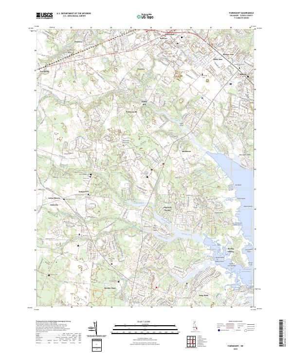 2023 Fairmount2023 Print · USGSCoastal Sussex County is shown here in the early 2020s, where traditional inland settlements meet the tidal marshes of Rehoboth Bay. Genealogists can locate family landmarks like Conley's Chapel Cem and the Henry Lingo Farm Cem amidst the reaches of Herring Creek.
End of results
Showing maps 1-5 of 5
Top cities near Belltown
- Lower Township historical maps
- Milford historical maps
- Georgetown historical maps
- Lewes historical maps
- Millsboro historical maps
- Milton historical maps
See more
Frequently asked questions
- What are the different types of historical maps available for Belltown?
- What is the oldest map of Belltown?
- Where can I purchase historical maps of Belltown for my home or office?
- Where can I download high-res historical maps of Belltown?
- Are there historical topographic maps available for Belltown?
- Is there historical aerial imagery available for Belltown?
- Where are historical maps of Belltown sourced from?