1900s (20th Century) Maps of Starke, Florida
Explore 12 historic maps of Starke from the 1900s (20th Century). These maps offer a rare glimpse into what life looked like during the 1900s — showing old roads, neighborhoods, homes, and landmarks that have changed or disappeared over time.
Whether you're researching your family's past, planning a metal detecting trip, or studying how Starke's landscape evolved across the 1900s, these high-resolution maps are a powerful tool for exploring the history of this region.
- Focus on a specific era: All maps on this page are from the 1900s, giving you a focused view of this time period.
- See what’s changed: Compare century-old streets, trails, and buildings to today's modern landscape using overlays and satellite layers.
- Research with precision: Use these maps for genealogy, historical research, land use analysis, or educational projects.
- View, download, or print: Maps are fully viewable online in high resolution, and can be downloaded or printed for your own records.
Start exploring Starke's history through authentic maps from the 1900s. This is your window into the past.
Starke, FL maps
(12)- 1941 Map of Starke, 1942 Print
 1941 Starke1942 Print · USGSNorth Florida at the start of the 1940s reveals a region rapidly transforming with the mobilization for war. Genealogists and historians can trace old rail lines like the Seaboard Air Line and find communities like Sampson City or the expansive Camp Blanding Military Reservation.
 - 1948 Map of Starke
 1948 Starke1948 Print · USGSThe Florida lake country south of Starke is captured here shortly after the war, showing a landscape defined by citrus-era rail lines and massive military training grounds. Genealogists can trace family roots through settlements like Sampson City, Waldo, and the lakeside community of Keystone Heights.
 - 1949 Map of Sampson, 1953 Print
 1949 Sampson1953 Print · USGSFlorida's lake country in the late 1940s was a landscape of steam rail and rural schoolhouses. Genealogists can trace the location of homes near Sampson City Sta and local gathering places like Rising Sch or the Pine Level Ch.4 unique versions available
 - 1949 Map of Starke, 1953 Print
 1949 Starke1953 Print · USGSStarke and the surrounding Florida pine lands are captured here just after the war, showing the area's transition between agricultural life and new industrial and military uses. Genealogists and local historians can trace rural congregations at Bethel Ch and Nebo Ch or locate the early workings of the Trail Ridge Mine.4 unique versions available
 - 1949 Map of Starke, 1955 Print
 1949 Starke1955 Print · USGSNorth Florida at the mid-century reveals a landscape of lakeside settlements and vital rail junctions centered on Starke. Genealogists and historians can trace family roots through rural landmarks like Rising Sch, New Hope Ch, and the station at Sampson City Sta.2 unique versions available
 - 1954 Map of Gainesville, 1965 Print
 1954 Gainesville1965 Print · USGSMid-century North Central Florida comes into focus as a landscape of timber, rails, and river towns along the Gulf. Trace family roots in established centers like Gainesville or follow the path of the Suwannee River to the coastal docks of Cedar Key.3 unique versions available
 - 1958 Map of Gainesville
 1958 Gainesville1958 Print · USGSNorth Central Florida’s rail and river networks are frozen in time just before the interstate era. Genealogists and historians can trace the paths of the Atlantic Coast Line through Gainesville or locate coastal settlements like Steinhatchee and Cedar Key.
 - 1959 Map of Gainesville
 1959 Gainesville1959 Print · USGSNorth Florida in the mid-fifties is seen here from the Gulf coast to the inland lakes, showing the rail-and-river network before modern highways dominated. Researchers can trace the paths of the Seaboard Air Line through towns like Chiefland and Micanopy, or explore the coastal inlets of Waccasassa Bay.
 - 1981 Map of Gainesville, 1982 Print
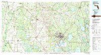 1981 Gainesville1982 Print · USGSGainesville and its surrounding North Central Florida counties are captured in the early eighties, showcasing a mix of university growth and rural agriculture. Genealogists and historians can trace small settlements like Arredondo, Wacahoota, and Island Grove alongside major rail lines like the Seaboard Coast Line.2 unique versions available
 - 1991 Map of Starke
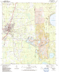 1991 Starke1991 Print · USGSStarke and its surrounding Bradford County rural districts are shown in the early nineties, revealing a mix of municipal growth and heavy industrial extraction. Researchers can locate several community landmarks including the Bethlehem Mem Cem, New Hope Ch, and the extensive Strip Mines near Kingsley Village.
 - 1991 Map of Sampson
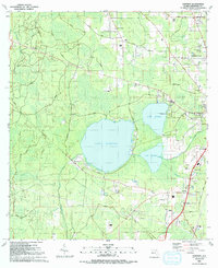 1991 Sampson1991 Print · USGSBradford County’s lake country is surveyed here in the early nineties, centered on the interconnected waters of Lake Sampson and Lake Rowell. Genealogists and local historians can trace legacy sites like Crosby Lake Cem, Lee Cem, and the community of Pleasant Grove.
 - 1999 Map of Starke, 2001 Print
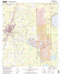 1999 Starke2001 Print · USGSIn the late nineties, the area around Starke was a hub of industrial mining and military training. Researchers can trace local genealogy through numerous rural landmarks like Bethlehem Mem Cem and Morgan Road Ch, or study the footprint of the Trail Ridge Mine.
End of results
Showing maps 1-12 of 12
Top cities near Starke
- Jacksonville historical maps
- Gainesville historical maps
- Lake Butler historical maps
- Keystone Heights historical maps
- Waldo historical maps
- Lawtey historical maps
See more
Frequently asked questions
- What are the different types of historical maps available for Starke?
- What is the oldest map of Starke?
- Where can I purchase historical maps of Starke for my home or office?
- Where can I download high-res historical maps of Starke?
- Are there historical topographic maps available for Starke?
- Is there historical aerial imagery available for Starke?
- Where are historical maps of Starke sourced from?