Old Maps of Titusville, Florida for Metal Detecting
Plan your next treasure hunt with 27 historic maps of Titusville. Find old homesites, ghost towns, trails, and gathering spots that may be lost to time — perfect for identifying promising metal detecting locations.
- Locate forgotten sites: Uncover places like long-lost settlements, abandoned rail lines, or gathering spots.
- Plan better hunts: Use map overlays combined with LiDAR or satellite views to narrow in on historically rich areas.
- Made for detectorists: Thousands of hobbyists use these maps to discover relics, coins, and hidden history.
Use these historic maps to boost your research and find new opportunities beneath the surface of Titusville.
Titusville, FL maps
(27)- 1949 Map of Titusville, 1960 Print
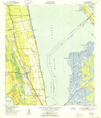
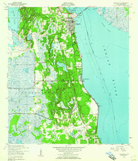 1949 Titusville1960 Print · USGSBrevard County’s riverfront comes alive in this late-1940s survey of the bustling rail and water hub of the Indian River. Genealogists and historians can trace the foundations of Titusville, locate the County Farm, and explore early aviation at the Titusville Cocoa Airport.6 unique versions available
 - 1949 Map of Mims, 1961 Print
 1949 Mims1961 Print · USGSCoastal Brevard County is captured in the late 1940s as the rail-side citrus and fishing communities of the Indian River thrived. Researchers can trace the layout of early Spanish land grants or find local landmarks like the Indian Mound, the community of La Grange, and the waterfront at Allenhurst.5 unique versions available
 - 1949 Map of Sharpes, 1962 Print
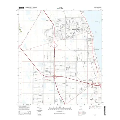
 1949 Sharpes1962 Print · USGSBrevard County’s riverfront communities are captured here in the late 1940s, just as the coastal infrastructure was maturing along the Indian River. Researchers can trace early settlements like Frontenac, City Point, and Sharpes along the Florida East Coast rail corridor.6 unique versions available
 - 1951 Map of Sharpes
 1951 Sharpes1951 Print · USGSIn the early 1950s, the Brevard County coast was defined by riverside settlements and narrow rail corridors. Researchers can trace the Florida East Coast rail line through Sharpes and City Point, or locate the old Cem and Pinkerton Pier (C).
 - 1952 Map of Mims
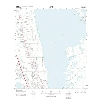
 1952 Mims1952 Print · USGSBrevard County's citrus and rail corridor is captured here in the early fifties, where the coastal landscape is still defined by large Spanish-era land grants. Genealogists and historians can trace the early layout of Mims, La Grange, and Allenhurst, or locate the Indian Mound and the strategic Haulover Canal.
 - 1952 Map of Titusville
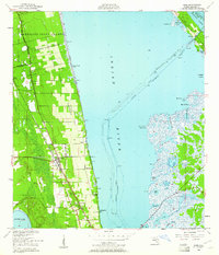
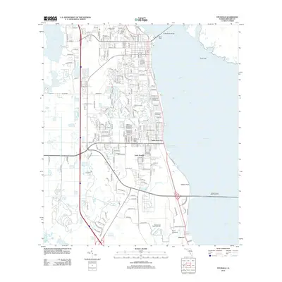
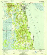 1952 Titusville1952 Print · USGSThe Space Coast was just beginning its modern transformation in the early fifties, with Titusville serving as a vital rail and river hub. Local historians can trace the early layout of Indian River City, the grounds of the County Farm, and the vast Delespine Grant.
 - 1955 Map of Orlando, 1969 Print
 1955 Orlando1969 Print · USGSCentral Florida was entering the space age in the mid-fifties, balancing its citrus heritage with new military and aerospace frontiers. You can trace early developments at Kennedy Space Center or locate interior settlements like Eatonville and Pine Castle.3 unique versions available
 - 1957 Map of Orlando
 1957 Orlando1957 Print · USGSCovers Titusville, including Orlando, Palm Bay, and other nearby areas
 - 1958 Map of Orlando
 1958 Orlando1958 Print · USGSCentral Florida was a landscape of citrus, rail, and emerging aerospace technology during the late fifties. Researchers can trace the early footprints of Cape Canaveral and Patrick Air Force Base or locate inland citrus and rail hubs like Sanford and Lakeland.
 - 1962 Map of Orlando
 1962 Orlando1962 Print · USGSCentral Florida was transformed by aerospace and citrus at the start of the sixties. Genealogists and historians can trace old community footprints from Eau Gallie to Leesburg, alongside landmarks like McCoy AFB and the winding Econlockhatchee River.
 - 1979 Map of Titusville, 1980 Print
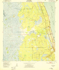
 1979 Titusville1980 Print · USGSThe Florida coast near Titusville shows a unique duality in the late seventies between aerospace ambition and coastal wilderness. Genealogists and historians can trace property boundaries of early land grants like Joseph Wales alongside the John F Kennedy Space Center (NASA).
 - 1981 Map of Cape Canaveral, 1983 Print
 1981 Cape Canaveral1983 Print · USGSThe Space Coast and the Florida marshlands meet in the early eighties as aerospace technology and nature preserves sit side-by-side. Trace the development of Cocoa Beach, the sprawling grounds of the Kennedy Space Center, and the inland waters of Lake Poinsett.
 - 2012 Map of Mims, 2012 Print
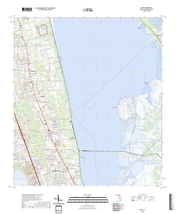
 2012 Mims2012 Print · USGSCovers Titusville, including Turnbull, Allenhurst, and other nearby areas
 - 2012 Map of Sharpes, 2012 Print
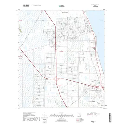
 2012 Sharpes2012 Print · USGSCovers Titusville, including Port Saint John, Frontenac, and other nearby areas
 - 2012 Map of Titusville, 2012 Print
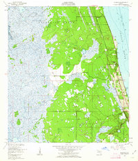
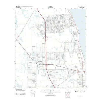
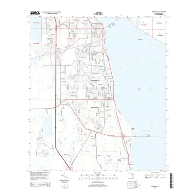
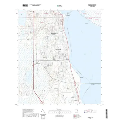
 2012 Titusville2012 Print · USGSCovers Titusville, including Indian River City, Bellwood, and other nearby areas
 - 2015 Map of Sharpes, 2015 Print
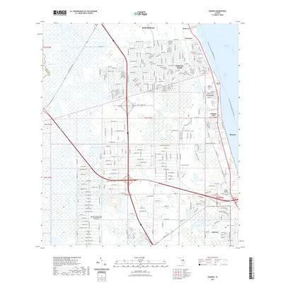
 2015 Sharpes2015 Print · USGSCovers Titusville, including Port Saint John, Frontenac, and other nearby areas
 - 2015 Map of Mims, 2015 Print
 2015 Mims2015 Print · USGSCovers Titusville, including Turnbull, Allenhurst, and other nearby areas
 - 2015 Map of Titusville, 2015 Print
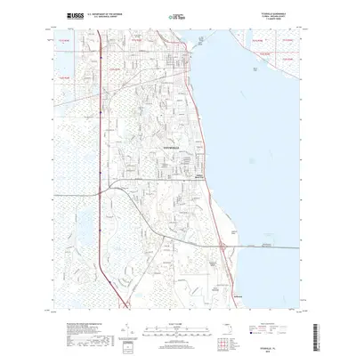
 2015 Titusville2015 Print · USGSCovers Titusville, including Indian River City, Bellwood, and other nearby areas
 - 2018 Map of Mims, 2018 Print
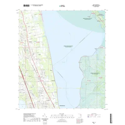
 2018 Mims2018 Print · USGSCovers Titusville, including Turnbull, Allenhurst, and other nearby areas
 - 2018 Map of Titusville, 2018 Print
 2018 Titusville2018 Print · USGSCovers Titusville, including Indian River City, Bellwood, and other nearby areas
 - 2018 Map of Sharpes, 2018 Print
 2018 Sharpes2018 Print · USGSCovers Titusville, including Port Saint John, Frontenac, and other nearby areas
 - 2021 Map of Sharpes, 2021 Print
 2021 Sharpes2021 Print · USGSCovers Titusville, including Port Saint John, Frontenac, and other nearby areas
 - 2021 Map of Titusville, 2021 Print
 2021 Titusville2021 Print · USGSCovers Titusville, including Indian River City, Bellwood, and other nearby areas
 - 2021 Map of Mims, 2021 Print
 2021 Mims2021 Print · USGSCovers Titusville, including Turnbull, Allenhurst, and other nearby areas
 - 2024 Map of Mims, 2024 Print
 2024 Mims2024 Print · USGSCoastal Brevard County comes to life in this survey of the communities along the Indian River Lagoon. Genealogists and local historians can trace the foundations of La Grange and the Lagrange Community Cem or locate the historic Haulover Canal crossing.
Showing maps 1-25 of 27
Top cities near Titusville
- Merritt Island historical maps
- Cocoa historical maps
- Cape Canaveral historical maps
- Cocoa West historical maps
- Christmas historical maps
Top neighborhoods of Titusville
- Indian River City historical maps
- Whispering Hills Golf Estates historical maps
- Country Club Estates historical maps
Frequently asked questions
- What are the different types of historical maps available for Titusville?
- What is the oldest map of Titusville?
- Where can I purchase historical maps of Titusville for my home or office?
- Where can I download high-res historical maps of Titusville?
- Are there historical topographic maps available for Titusville?
- Is there historical aerial imagery available for Titusville?
- Where are historical maps of Titusville sourced from?