1970s Maps of Clay County, Florida
Explore 3 historic maps of Clay County from the 1970s. These maps offer a rare glimpse into what life looked like during the 1970s — showing old roads, neighborhoods, homes, and landmarks that have changed or disappeared over time.
Whether you're researching your family's past, planning a metal detecting trip, or studying how Clay County's landscape evolved across the 1970s, these high-resolution maps are a powerful tool for exploring the history of this region.
- Focus on a specific era: All maps on this page are from the 1970s, giving you a focused view of this time period.
- See what’s changed: Compare century-old streets, trails, and buildings to today's modern landscape using overlays and satellite layers.
- Research with precision: Use these maps for genealogy, historical research, land use analysis, or educational projects.
- View, download, or print: Maps are fully viewable online in high resolution, and can be downloaded or printed for your own records.
Start exploring Clay County's history through authentic maps from the 1970s. This is your window into the past.
Clay County, FL maps
(3)- 1970 Map of Lawtey, 1973 Print
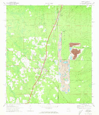 1970 Lawtey1973 Print · USGSFlorida's Trail Ridge region is captured here in the 1970s as industrial mining and military training shaped the landscape around Lawtey. Researchers can trace the Seaboard Coast Line through Highland and find local landmarks like the Anderson Sch.4 unique versions available
 - 1970 Map of Maxville, 1973 Print
 1970 Maxville1973 Print · USGSNorth Florida's timberlands and rail corridors are captured here in the early 1970s at the meeting of four counties. Genealogists and historians can trace the rural communities of Maxville and Hugh or locate old crossings at Turkey Creek and Bessent.2 unique versions available
 - 1977 Map of Jacksonville, 1983 Print
 1977 Jacksonville1983 Print · USGSNortheast Florida during the late seventies shows a region defined by its deep-water naval bases and burgeoning riverfront suburbs. You can trace the rail networks of the Seaboard Coast Line, locate the Kingsley Plantation, and study the sprawling grounds of Cecil Field Naval Air Station.
End of results
Showing maps 1-3 of 3
Top cities of Clay County
- Middleburg historical maps
- Orange Park historical maps
- Green Cove Springs historical maps
- Keystone Heights historical maps
- Penney Farms historical maps
Frequently asked questions
- What are the different types of historical maps available for Clay County?
- What is the oldest map of Clay County?
- Where can I purchase historical maps of Clay County for my home or office?
- Where can I download high-res historical maps of Clay County?
- Are there historical topographic maps available for Clay County?
- Is there historical aerial imagery available for Clay County?
- Where are historical maps of Clay County sourced from?