Old Maps of DeSoto County, Florida for Hiking & Exploration
Hike through history with 101 historic maps of DeSoto County. Explore old trails, ghost towns, and forgotten backroads — perfect for outdoor adventurers and local explorers.
- Rediscover forgotten places: Map out old mining camps, roads, and footpaths that no longer exist on modern maps.
- Layer with modern tools: Combine with LiDAR or satellite views to plan hikes through historical terrain.
- Made for exploration: Popular among hikers, overlanders, and local history lovers.
Use these maps to find adventure and explore the hidden past of DeSoto County.
DeSoto County, FL maps
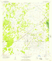
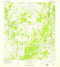
(101)- 1953 Map of Crewsville SE, 1954 Print
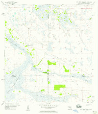
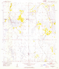 1953 Crewsville SE1954 Print · USGSFlorida's interior wetlands and cattle country are captured here in the early fifties, showing a landscape defined by seasonal water. Researchers can trace the path of the Footman Trail and locate local landmarks like Niggertown Knoll and Hog Island Hammock.4 unique versions available
 - 1956 Map of Gardner, 1957 Print
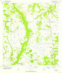
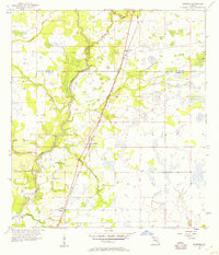 1956 Gardner1957 Print · USGSMid-century central Florida comes alive along the Peace River during this period of rural growth. Local historians can trace the old rail stops at Gardner and Brownville or locate family-named landmarks like McBride Branch and Walker Branch.3 unique versions available
 - 1956 Map of Arcadia SE, 1957 Print
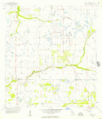 1956 Arcadia SE1957 Print · USGSDe Soto and Charlotte counties appear as a sprawling network of wetlands and seasonal drainages in the mid-1950s. Trace the natural flow of Prairie Creek and Myrtle Slough across a landscape of isolated hammocks and early ranch roads.3 unique versions available
 - 1956 Map of Edgeville, 1957 Print
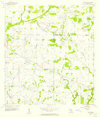 1956 Edgeville1957 Print · USGSManatee County in the mid-fifties remains a landscape of remote pine flats and cypress sloughs. Genealogists and historians can trace early inland settlements like Edgeville and Sandy or follow the winding courses of Wildcat Slough and Owen Creek.3 unique versions available
 - 1956 Map of Murdock SE, 1957 Print
 1956 Murdock SE1957 Print · USGSFlorida's coastal interior in the mid-1950s shows a landscape of expansive wetlands at the meeting point of three counties. Genealogists and historians can trace the Seaboard Air Line Railroad Grade and locate the small settlement of Platt near the Peace River.3 unique versions available
 - 1956 Map of Murdock NE, 1957 Print
 1956 Murdock NE1957 Print · USGSThe Florida interior near the meeting of DeSoto, Sarasota, and Manatee counties is shown here in the mid-1950s. Genealogists and historians can trace the Old Railroad Grade and find local landmarks like Pine Level Ch and Bud Slough.4 unique versions available
 - 1956 Map of Limestone, 1957 Print
 1956 Limestone1957 Print · USGSThe Hardee and De Soto county line area in the mid-fifties shows a landscape of creek-side settlements and rural railroads. Trace the routes of the Seaboard Air Line near Limestone or locate the site of Oak Hill Cem (Abandoned).4 unique versions available
 - 1956 Map of Ft. Ogden, 1957 Print
 1956 Ft. Ogden1957 Print · USGSDeSoto and Charlotte counties during the mid-fifties show a landscape defined by the winding Peace River and a developing rail network. Genealogists and historians can trace family roots through the Ft Ogden Cem, Hull Cem, and early settlements like Southfort and Morgantown.4 unique versions available
 - 1956 Map of Nocatee, 1957 Print
 1956 Nocatee1957 Print · USGSDeSoto County's river-and-rail landscape is captured here during the mid-1950s, showing the agricultural heart of the Florida interior. Researchers can trace the junctions of the Seaboard Air Line Railroad or locate local landmarks like Mt Eben Ch and Owens Cem.3 unique versions available
 - 1956 Map of Crewsville SW, 1957 Print
 1956 Crewsville SW1957 Print · USGSFlorida's rural heartland near the Hardee and De Soto county line is shown here in the mid-fifties, dominated by vast wetlands and seasonal drainages. Researchers can trace the winding paths of Fish Branch and Joshua Creek, or locate the site of a Flowing Well.3 unique versions available
 - 1956 Map of Long Island Marsh SW, 1957 Print
 1956 Long Island Marsh SW1957 Print · USGSThe DeSoto and Charlotte county line in the mid-fifties was a landscape of intricate wetlands and prairie. Genealogists and environmental historians can trace the natural drainage of Long Island Marsh and locate landmarks like Myrtle Slough and Rattlesnake Gully.3 unique versions available
 - 1956 Map of Tampa, 1964 Print
 1956 Tampa1964 Print · USGSThe Florida Gulf Coast thrived in the mid-fifties, from the bustling docks of Tampa to the quiet shores of Sanibel. Genealogists and historians can trace old rail lines like the Atlantic Coast Line or find early layouts of Port Charlotte and Bokeelia.2 unique versions available
 - 1956 Map of Fort Pierce, 1965 Print
 1956 Fort Pierce1965 Print · USGSCentral and coastal Florida appear here during a period of rapid post-war growth and industrial expansion. Researchers can trace the mid-century rail-to-highway transition along the Sunshine State Parkway or locate old settlements like Ankona, Walton, and Indrio.4 unique versions available
 - 1957 Map of Long Island Marsh NW, 1958 Print
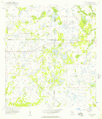
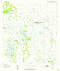 1957 Long Island Marsh NW1958 Print · USGSDeSoto County's marshlands are documented here in the late fifties, showcasing a landscape defined by institutional development and natural sloughs. Researchers can trace the footprint of the State Hospital and follow the Old Railroad Grade past Parker Ranch.3 unique versions available
 - 1957 Map of Long Island Marsh SE, 1958 Print
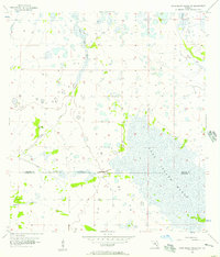
 1957 Long Island Marsh SE1958 Print · USGSThe Florida interior during the late fifties reveals a vast wetland where four counties meet amidst a landscape of sloughs and ranch land. Researchers can trace the path of the Old Railroad Grade and locate local landmarks such as Montgomery Ranch and Rainey Slough.3 unique versions available
 - 1957 Map of Arcadia, 1958 Print
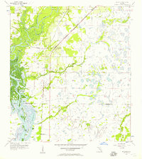
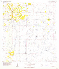
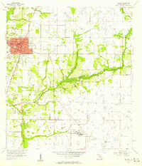 1957 Arcadia1958 Print · USGSDeSoto County in the late fifties was a crossroads of major rail lines and developing Florida citrus country. Local researchers can trace the old corridors of the Atlantic Coast Line, locate the State Hospital, or find family names at Oak Ridge Cemetery.4 unique versions available
 - 1957 Map of Long Island Marsh NE, 1958 Print
 1957 Long Island Marsh NE1958 Print · USGSCentral Florida wetlands and property boundaries are documented here in the mid-1950s. Trace old overland routes like the Footman Trail and drainage features like Cow Slough along the De Soto Co Highlands Co border.2 unique versions available
 - 1958 Map of Fort Pierce
 1958 Fort Pierce1958 Print · USGSCentral and South Florida are captured here in the late fifties as the citrus and ranching interior met the modern highway era. Researchers can trace the early path of the Sunshine State Parkway and locate established rail depots in Sebring, Okeechobee, and Arcadia.
 - 1959 Map of Fort Pierce
 1959 Fort Pierce1959 Print · USGSCentral Florida and the Treasure Coast are shown here in the late fifties, during a period of steady citrus and coastal growth. Trace the historic routes of the Florida East Coast Ry or locate the boundaries of the Seminole Indian Reservation and Highlands Hammock State Park.3 unique versions available
 - 1959 Map of Tampa
 1959 Tampa1959 Print · USGSThe Florida Gulf Coast appears in this late fifties survey during a period of steady coastal growth and established rail commerce. Researchers can trace historic neighborhoods and transit lines from Tampa to St Petersburg, or locate landmarks like Mac Dill AFB and Boca Grande.
 - 1960 Map of Tampa
 1960 Tampa1960 Print · USGSThe Florida Gulf Coast was undergoing a major transformation at the start of the sixties, with new bridges linking burgeoning cities across the bays. Researchers can trace the mid-century footprints of St Petersburg and Tampa, or locate coastal landmarks like Mac Dill AFB and the Sunshine Skyway.2 unique versions available
 - 1972 Map of Tampa, 1974 Print
 1972 Tampa1974 Print · USGSThe Florida Gulf Coast appears in a period of significant growth during the early seventies, from the urban centers of the bay to the quiet southern keys. Researchers can trace the expansion of St Petersburg or locate family sites near Safety Harbor, Valrico, and Boca Ciega.
 - 1978 Map of Arcadia, 1980 Print
 1978 Arcadia1980 Print · USGSDeSoto and Highlands counties are shown here in the late seventies, a landscape defined by the Peace River and extensive citrus groves. Genealogists and researchers can trace the SEABOARD COAST LINE railroad through old settlements like Nocatee, Zolfo Springs, and Fort Ogden.
 - 1979 Map of Sarasota, 1980 Print
 1979 Sarasota1980 Print · USGSCoastal Florida in the late seventies reveals the rapid growth of the Gulf shoreline from Bradenton down to Port Charlotte. Trace the expansion of coastal communities like Bayshore Gardens, find long-standing landmarks like Trailer Estates, or explore the vast preserve of Myakka River State Park.
 - 1988 Map of Fort Pierce
 1988 Fort Pierce1988 Print · USGSThe Atlantic coast and Florida’s interior lakelands are captured in the late eighties, just as the Treasure Coast was experiencing rapid development. Genealogists and historians can trace the rail lines of the Florida East Coast and explore the bounds of the Brighton Indian Reservation.
Showing maps 1-25 of 101
Top cities of DeSoto County
Frequently asked questions
- What are the different types of historical maps available for DeSoto County?
- What is the oldest map of DeSoto County?
- Where can I purchase historical maps of DeSoto County for my home or office?
- Where can I download high-res historical maps of DeSoto County?
- Are there historical topographic maps available for DeSoto County?
- Is there historical aerial imagery available for DeSoto County?
- Where are historical maps of DeSoto County sourced from?