
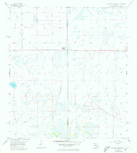
1957 Map of Long Island Marsh NE
USGS Topo · Published 1958About this map
Cow Slough meanders across this low-lying Florida landscape, which was mapped in 1957 using a combination of aerial photography and planetable surveys. The terrain is defined by a dense network of marshes and seasonal wetlands, illustrating the drainage patterns of the interior peninsula before significant modern water management. Along the western edge, the De Soto Co Highlands Co boundary divides the territory, while a prominent Fence Line bisects the central sections, marking large-scale land divisions in this rural expanse. This 1950s survey captures a moment in South-Central Florida's history when the landscape remained dominated by traditional overland routes like the Footman Trail, which cuts through the northeastern corner of the quadrangle. The map is a detailed record of a sparsely populated region, showing primarily natural drainage and established livestock or property boundaries.
Find a feature on this map
4 named features on this map. Tap any name to fly to it.
Don’t see what you’re looking for? This feature index may not catch every label — zoom into the map to look around manually.
Map Details
Editions of this 1957 Long Island Marsh NE Map
2 editions found
Other maps of this area

1953 · Lake June In Winter
USGS Topo · 1:24,000

1953 · Venus NW
USGS Topo · 1:24,000

1953 · Crewsville SE
USGS Topo · 1:24,000

1956 · Crewsville SW
USGS Topo · 1:24,000

1956 · Long Island Marsh SW
USGS Topo · 1:24,000

1956 · Fort Pierce
USGS Topo · 1:250,000

1957 · Long Island Marsh NW
USGS Topo · 1:24,000

1957 · Long Island Marsh SE
USGS Topo · 1:24,000

1957 · Venus SW
USGS Topo · 1:24,000

1958 · Fort Pierce
USGS Topo · 1:250,000