
1953 Map of Lake June In Winter
USGS Topo · Published 1954About this map
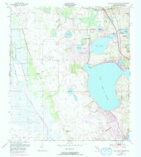
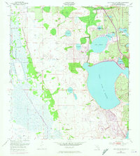
Lake June In Winter dominates the eastern half of this landscape, its expansive waters situated at seventy-three feet above sea level. This central Highlands County terrain is defined by a dense network of freshwater lakes and low-lying marshlands, including Lake Francis, Red Water Lake, and the clustered bodies of Nellie. To the west, the topography shifts toward the wetlands of Hog Island Hammock and the winding course of Fisheating Creek, which drains toward the south. The presence of a Pumping Station and several Spoil Banks indicates early efforts in water management and land modification typical of the mid-century Florida interior. Boundary lines for Lake Placid are visible at the southeastern edge, illustrating the proximity of the growing town to these major water bodies during a period of steady regional development.
Find a feature on this map
22 named features on this map. Tap any name to fly to it.
Don’t see what you’re looking for? This feature index may not catch every label — zoom into the map to look around manually.
Map Details
Editions of this 1953 Lake June In Winter Map
3 editions found
Other maps of this area

1952 · Lake Placid
USGS Topo · 1:24,000

1952 · Lorida
USGS Topo · 1:24,000

1952 · Sebring
USGS Topo · 1:24,000

1953 · Venus NW
USGS Topo · 1:24,000

1953 · Crewsville SE
USGS Topo · 1:24,000

1953 · Crewsville
USGS Topo · 1:24,000

1953 · Childs
USGS Topo · 1:24,000

1956 · Fort Pierce
USGS Topo · 1:250,000

1957 · Long Island Marsh NE
USGS Topo · 1:24,000

1958 · Fort Pierce
USGS Topo · 1:250,000