
1952 Map of Lake Placid
USGS Topo · Published 1953About this map
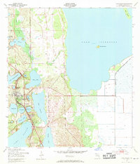
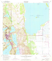
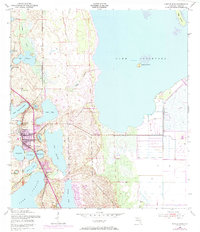
Lake Placid serves as the focal point of this Highlands County region in the early 1950s, surrounded by a dense network of freshwater lakes and developing orange groves. The landscape is defined by its hydrology, with large bodies like Lake Istokpoga and Lake June in Winter flanking the central settlement. Transportation and commerce are anchored by two major rail lines: the Atlantic Coast Line running north-south through the town center and the Seaboard Air Line cutting across the eastern wetlands near Sunvale. Local landmarks such as Oak Hill Cem and the Highlands Park Cam provide specific points of interest for genealogists tracing mid-century residency. The presence of numerous named smaller lakes, including Lake Sirena, Lake Pearl, and Lake McCoy, illustrates the intricate shoreline of the Florida sand ridge before extensive modern drainage and development altered the natural margins.
Find a feature on this map
32 named features on this map. Tap any name to fly to it.
Don’t see what you’re looking for? This feature index may not catch every label — zoom into the map to look around manually.
Map Details
Editions of this 1952 Lake Placid Map
4 editions found
Other maps of this area

1952 · Lorida
USGS Topo · 1:24,000

1952 · Sebring
USGS Topo · 1:24,000

1953 · Brighton NW
USGS Topo · 1:24,000

1953 · Lake June In Winter
USGS Topo · 1:24,000

1953 · Venus NW
USGS Topo · 1:24,000

1953 · Basinger SW
USGS Topo · 1:24,000

1953 · Basinger NW
USGS Topo · 1:24,000

1953 · Childs
USGS Topo · 1:24,000

1956 · Fort Pierce
USGS Topo · 1:250,000

1958 · Fort Pierce
USGS Topo · 1:250,000