Old Maps of Highlands County, Florida
Explore 182 old maps of Highlands County, spanning from 1952 to today. These high-resolution historic maps reveal how streets, neighborhoods, landmarks, and natural features evolved over time — perfect for genealogy, metal detecting, research, and local history exploration.
What you can do with these maps:
- See how Highlands County changed over time: Compare historical maps to modern-day views to trace roads, homesites, rail lines & more.
- View detailed metadata: Each map includes creators, publishers, year, scale, and archive source.
- Overlay maps with satellite & LiDAR: Visualize the past alongside modern tools to explore terrain & human change.
- Trusted historical sources: Maps sourced from the USGS, Library of Congress, and other archives.
- Access maps your way: View online, download high-res files, or order prints for personal or research use.
Start exploring old maps of Highlands County to uncover forgotten places, hidden landmarks, and the deep history beneath your feet.
Highlands County, FL maps
(182)- 1952 Map of Fort Kissimmee, 1953 Print
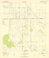
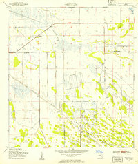
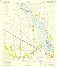
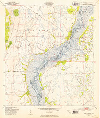 1952 Fort Kissimmee1953 Print · USGSThe Florida cattle country and river marshes are captured here in the early fifties, before major channelization altered the watershed. Researchers can trace the riverfront settlement of Fort Kissimmee, the Fort Kissimmee Cem, and named landmarks like Mc Guire Hammock.4 unique versions available
 - 1952 Map of Lake Placid, 1953 Print
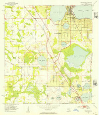
 1952 Lake Placid1953 Print · USGSFlorida's lake country is captured here in the early fifties as citrus groves and rail lines shaped the Highlands County interior. Researchers can trace the dual routes of the Atlantic Coast Line and Seaboard Air Line through Lake Placid and Sunvale.4 unique versions available
 - 1952 Map of Lake Arbuckle SW, 1953 Print
 1952 Lake Arbuckle SW1953 Print · USGSThe Florida highlands south of Avon Park are captured here in the early fifties, showing a landscape of citrus groves and rail-side towns. Genealogists and historians can locate Lakeside Cem, the Fish Hatchery (Abandoned), and the rail junctions of Lakemont.4 unique versions available
 - 1952 Map of Fort Kissimmee NW, 1953 Print
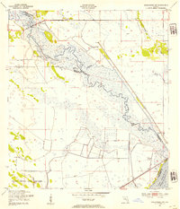
 1952 Fort Kissimmee NW1953 Print · USGSCentral Florida's interior in the early fifties is captured here as a landscape of military range lands and winding river wetlands. Researchers can trace the original path of the Kissimmee River and explore named landmarks like Hard Luck Hammock and Ice Cream Slough.3 unique versions available
 - 1952 Map of Lake Arbuckle NE, 1953 Print
 1952 Lake Arbuckle NE1953 Print · USGSAcross the Polk and Highlands county line in the early fifties, this area was defined by the massive footprint of the Avon Park Air Force Base. Researchers can trace the Government Railroad and the engineering of the Rim Canal along Lake Arbuckle.4 unique versions available
 - 1952 Map of Lake Arbuckle SE, 1953 Print
 1952 Lake Arbuckle SE1953 Print · USGSFlorida's military and marshland history meet in the early 1950s within the Avon Park Bombing Range. Genealogists and local historians can trace the original wetlands of Arbuckle Creek and landmarks like Bonny Bloom Pond and Submarine Lake.4 unique versions available
 - 1952 Map of Lake Arbuckle, 1953 Print
 1952 Lake Arbuckle1953 Print · USGSThe Florida interior during the early fifties reveals a landscape shaped by military expansion and natural hydrology. Genealogists and historians can trace the U S Government Railroad and the small settlement of Alpine near Lake Pythias.3 unique versions available
 - 1952 Map of Lorida, 1953 Print
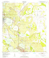
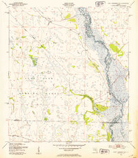
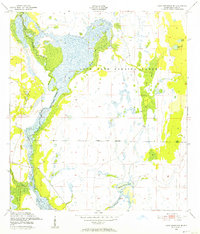
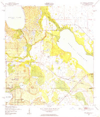
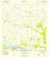
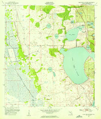
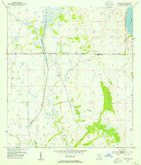
 1952 Lorida1953 Print · USGSHighlands County's interior wetlands and aviation history are preserved here in the early fifties. Researchers can trace the massive Sebring Air Terminal, the settlement of Lorida, and the northern shoreline of Lake Istokpoga.4 unique versions available
 - 1952 Map of Sebring, 1953 Print
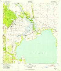
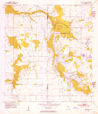
 1952 Sebring1953 Print · USGSFlorida's lake country around the middle of the century shows a landscape defined by citrus groves and rail junctions. Genealogists and historians can trace the early footprints of Sebring and De Soto City, alongside landmarks like the Courthouse and the Atlantic Coast Line.4 unique versions available
 - 1952 Map of Okeechobee NW, 1954 Print
 1952 Okeechobee NW1954 Print · USGSThe Florida Everglades and Kissimmee basin are captured here in the early 1950s, documenting a landscape of complex water management and indigenous lands. Researchers can trace the original winding course of the Kissimmee River and its proximity to the Brighton Seminole Indian Reservation and Paradise Run.3 unique versions available
 - 1953 Map of Frostproof, 1954 Print
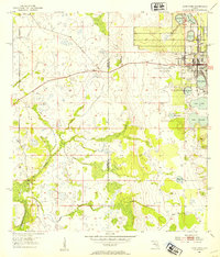
 1953 Frostproof1954 Print · USGSFrostproof and the surrounding Florida lake country are shown in the early fifties as the region's citrus and rail economy flourished. Researchers can trace the junction of the Seaboard Air Line and find rural landmarks like Maxcy Quarters and Corinth Ch.5 unique versions available
 - 1953 Map of Basinger, 1954 Print
 1953 Basinger1954 Print · USGSThe settlement of Basinger is documented in the early 1950s along the natural, winding course of the Kissimmee River. Genealogists and historians can locate the Basinger Cem, Basinger Sch, and the isolated Peavine Trail through the sawgrass.3 unique versions available
 - 1953 Map of Avon Park, 1954 Print
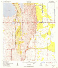
 1953 Avon Park1954 Print · USGSCovers Highlands County, including Avon Park, Hardee County, and other nearby areas4 unique versions available
 - 1953 Map of Brighton NW, 1954 Print
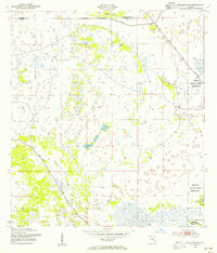
 1953 Brighton NW1954 Print · USGSFlorida's interior wetlands underwent a dramatic transformation in the early fifties as new water management projects took hold. Researchers can trace the massive dredging efforts along the Indian Prairie Canal and find remote outposts like Cabbage Island or several isolated Windmill sites.3 unique versions available
 - 1953 Map of Lake June In Winter, 1954 Print
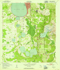
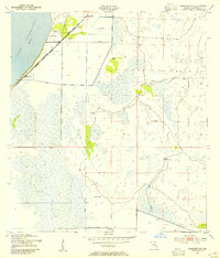
 1953 Lake June In Winter1954 Print · USGSHighlands County in the early fifties is characterized here by its vast network of lakes and shifting wetlands before extensive modern drainage. Researchers can trace the early boundaries of Lake Placid and locate local landmarks like Hog Island Hammock or the Pumping Station near Fisheating Creek.3 unique versions available
 - 1953 Map of Brighton SW, 1954 Print
 1953 Brighton SW1954 Print · USGSThe Florida Everglades interior at the start of the fifties shows a landscape of expansive wetlands and early water control projects. Researchers can trace the original extent of the Brighton Seminole Indian Reservation and the course of Gator Slough.3 unique versions available
 - 1953 Map of Fort Basinger, 1954 Print
 1953 Fort Basinger1954 Print · USGSCentral Florida in the early fifties shows a landscape shaped by the winding Kissimmee River and its intricate wetlands. Genealogists and historians can trace the riverside community at Fort Basinger and the Seaboard Air Line rail route.2 unique versions available
 - 1953 Map of Brighton, 1954 Print
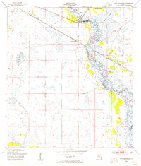
 1953 Brighton1954 Print · USGSThe Florida prairie interior comes into focus during the early 1950s, showing the early engineering of the South Florida drainage system. Local historians can trace the early layout of the Brighton Seminole Indian Reservation and the path of the Indian Prairie Canal.2 unique versions available
 - 1953 Map of Venus NW, 1954 Print
 1953 Venus NW1954 Print · USGSCovers Highlands County, including Placid Lakes, United States, and other nearby areas3 unique versions available
 - 1953 Map of Crewsville SE, 1954 Print
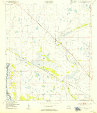
 1953 Crewsville SE1954 Print · USGSFlorida's interior wetlands and cattle country are captured here in the early fifties, showing a landscape defined by seasonal water. Researchers can trace the path of the Footman Trail and locate local landmarks like Niggertown Knoll and Hog Island Hammock.4 unique versions available
 - 1953 Map of Basinger SW, 1954 Print
 1953 Basinger SW1954 Print · USGSHighlands County in the early fifties shows a landscape of reclaimed wetlands and early ranching infrastructure along the edge of Lake Istokpoga. Researchers can trace the Seaboard Air Line rail route and locate old settlements like Marland and Wild Island.3 unique versions available
 - 1953 Map of Basinger NW, 1954 Print
 1953 Basinger NW1954 Print · USGSFlorida's interior wetlands and river systems are documented here in the early fifties, before the significant alteration of the northern Everglades watershed. Genealogists and historians can trace the Seaboard Air Line rail route through Plains and locate the Sunnyland Sch.3 unique versions available
 - 1953 Map of Taylor Creek SW, 1954 Print
 1953 Taylor Creek SW1954 Print · USGSThe Florida interior near the Highlands and Okeechobee county line is shown here in the early fifties, before the Kissimmee was channelized. Genealogists and historians can trace the Seaboard Air Line tracks past Mildred and the Dixie Ranch.2 unique versions available
 - 1953 Map of Crewsville, 1954 Print
 1953 Crewsville1954 Print · USGSCovers Highlands County, including Crewsville, Hardee County, and other nearby areas4 unique versions available
 - 1953 Map of Childs, 1955 Print
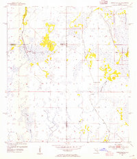
 1953 Childs1955 Print · USGSHighlands County's ridge country and wetlands meet in the early 1950s, showing the early infrastructure of the Lake Wales Ridge. Local researchers can trace the Atlantic Coast Line rail stops at Childs and Hicoria or locate the original bounds of the Archbold Biological Station.3 unique versions available
Showing maps 1-25 of 182
Top cities of Highlands County
Frequently asked questions
- What are the different types of historical maps available for Highlands County?
- What is the oldest map of Highlands County?
- Where can I purchase historical maps of Highlands County for my home or office?
- Where can I download high-res historical maps of Highlands County?
- Are there historical topographic maps available for Highlands County?
- Is there historical aerial imagery available for Highlands County?
- Where are historical maps of Highlands County sourced from?