
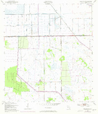
1953 Map of Brighton NW
USGS Topo · Published 1954About this map
Indian Prairie Canal and Harney Pond Canal dominate this 1950s landscape, illustrating the intensive hydrological engineering of the Florida Everglades. The sheet reveals a grid-like network of water control infrastructure, where massive Levee systems and elevated Spoil Bank ridges dictate the flow of water across the flat terrain. This era of modification was designed to manage the wetlands for ranching and agriculture, yet the survival of Bay Swamp and slightly elevated hammocks like Cabbage Island provides a glimpse into the original ecological character of the region. Numerous Windmill sites are scattered throughout the quadrangle, serving as essential landmarks for remote ranching operations. The boundary between Highlands Co and Glades Co bisects the area, following these artificial watercourses and roads that reshaped the interior of South Florida.
Find a feature on this map
8 named features on this map. Tap any name to fly to it.
Don’t see what you’re looking for? This feature index may not catch every label — zoom into the map to look around manually.
Map Details
Editions of this 1953 Brighton NW Map
3 editions found
Other maps of this area

1952 · Lake Placid
USGS Topo · 1:24,000

1953 · Brighton SW
USGS Topo · 1:24,000

1953 · Fort Basinger
USGS Topo · 1:24,000

1953 · Brighton
USGS Topo · 1:24,000

1953 · Brighton SE
USGS Topo · 1:24,000

1953 · Basinger SW
USGS Topo · 1:24,000

1953 · Childs
USGS Topo · 1:24,000

1956 · Fort Pierce
USGS Topo · 1:250,000

1957 · Venus
USGS Topo · 1:24,000

1958 · Fort Pierce
USGS Topo · 1:250,000