
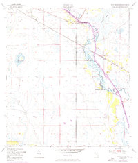
1953 Map of Fort Basinger
USGS Topo · Published 1954About this map
The Kissimmee River meanders through the heart of this central Florida territory in the early 1950s, defining a landscape of wetlands and water management before modern channelization. The settlement at Fort Basinger serves as a focal point along the river's edge, joined downstream by the Kissimmee River Camp. The presence of the Doughtry Cutoff and the branching Chandler Slough illustrates the complex natural drainage patterns of the region prior to major hydrological shifts.
Find a feature on this map
10 named features on this map. Tap any name to fly to it.
Don’t see what you’re looking for? This feature index may not catch every label — zoom into the map to look around manually.
Map Details
Editions of this 1953 Fort Basinger Map
2 editions found
Other maps of this area

1952 · Okeechobee NW
USGS Topo · 1:24,000

1953 · Taylor Creek NW
USGS Topo · 1:24,000

1953 · Basinger
USGS Topo · 1:24,000

1953 · Brighton NW
USGS Topo · 1:24,000

1953 · Brighton
USGS Topo · 1:24,000

1953 · Basinger SW
USGS Topo · 1:24,000

1953 · Basinger NW
USGS Topo · 1:24,000

1953 · Taylor Creek SW
USGS Topo · 1:24,000

1956 · Fort Pierce
USGS Topo · 1:250,000

1958 · Fort Pierce
USGS Topo · 1:250,000