
1952 Map of Fort Kissimmee
USGS Topo · Published 1953About this map
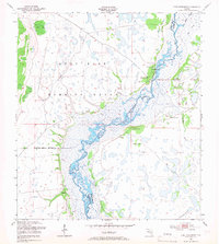
The Kissimmee River meanders through this landscape, marking the boundary between Highlands and Okeechobee counties as it appeared in the early 1950s. The settlement of Fort Kissimmee and its associated Fort Kissimmee Cem sit along the eastern bank, providing a point of historical interest for genealogists and local historians. Much of the western terrain is dominated by the Avon Park Bombing Range, with a clear Bombing Range Boundary cutting through the marshy wetlands. The landscape is characterized by numerous hammocks—elevated islands of vegetation such as Rodgers Hammock, Saddle Hammock, and Mosquito Hammock—which stand out against the network of waterways like Pine Slough and Starvation Slough. This survey captures the river's natural, complex drainage system prior to the major channelization projects of the mid-20th century, including a noted Levee and a Gaging Station used for monitoring water levels.
Find a feature on this map
20 named features on this map. Tap any name to fly to it.
Don’t see what you’re looking for? This feature index may not catch every label — zoom into the map to look around manually.
Map Details
Editions of this 1952 Fort Kissimmee Map
4 editions found
Other maps of this area

1952 · Fort Kissimmee NW
USGS Topo · 1:24,000

1952 · Lake Arbuckle NE
USGS Topo · 1:24,000

1952 · Lake Arbuckle SE
USGS Topo · 1:24,000

1952 · Lorida
USGS Topo · 1:24,000

1953 · Basinger
USGS Topo · 1:24,000

1953 · Fort Kissimmee NE
USGS Topo · 1:24,000

1953 · Basinger NW
USGS Topo · 1:24,000

1953 · Fort Kissimmee SE
USGS Topo · 1:24,000

1956 · Fort Pierce
USGS Topo · 1:250,000

1958 · Fort Pierce
USGS Topo · 1:250,000