
1953 Map of Fort Kissimmee SE
USGS Topo · Published 1954About this map
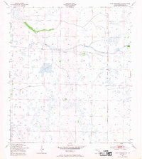
Hydrological patterns and early transportation routes define this landscape in rural Okeechobee County. Surveyed by the Corps of Engineers in the early 1950s, the terrain is dominated by complex wetlands such as Sevenmile Slough and Duck Slough. These natural drainage systems are punctuated by distinct features like the Dead Pine Island Marsh in the northeast. The presence of the Old Railroad Grade and the Peavine Trail suggests a history of timber extraction or early agricultural transport through these wetlands. The map provides a precise look at the section lines and township boundaries of the era, revealing how human infrastructure was carefully engineered to navigate the persistent waters of the Florida interior.
Find a feature on this map
9 named features on this map. Tap any name to fly to it.
Don’t see what you’re looking for? This feature index may not catch every label — zoom into the map to look around manually.
Map Details
Editions of this 1953 Fort Kissimmee SE Map
3 editions found
Other maps of this area

1952 · Fort Kissimmee
USGS Topo · 1:24,000

1952 · Fort Kissimmee NW
USGS Topo · 1:24,000

1953 · Taylor Creek NW
USGS Topo · 1:24,000

1953 · Basinger
USGS Topo · 1:24,000

1953 · Fort Kissimmee NE
USGS Topo · 1:24,000

1953 · Fort Drum SW
USGS Topo · 1:24,000

1953 · Fort Drum NW
USGS Topo · 1:24,000

1953 · Basinger NW
USGS Topo · 1:24,000

1956 · Fort Pierce
USGS Topo · 1:250,000

1958 · Fort Pierce
USGS Topo · 1:250,000