
1953 Map of Fort Kissimmee NE
USGS Topo · Published 1954About this map
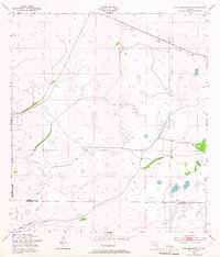
The Osceola Co Okeechobee Co line cuts through a landscape defined by seasonal wetlands and early infrastructure in the early 1950s. This interior Florida terrain is dominated by the Pine Island Slough and numerous unnamed marshes, illustrating the natural drainage patterns before modern development. Transport and industry in this period are concentrated along the Old Railroad Grade and the Peavine Trail, which serve as primary corridors through the low-lying scrub. Several isolated Sand Pit sites are scattered along these routes, indicating the local extraction of materials for road or rail maintenance. The map provides a look at a transitional era when transit relied on these older grades and trails to navigate the wet prairies of South Central Florida.
Find a feature on this map
5 named features on this map. Tap any name to fly to it.
Don’t see what you’re looking for? This feature index may not catch every label — zoom into the map to look around manually.
Map Details
Editions of this 1953 Fort Kissimmee NE Map
3 editions found
Other maps of this area

1952 · Fort Kissimmee
USGS Topo · 1:24,000

1952 · Fort Kissimmee NW
USGS Topo · 1:24,000

1953 · Fort Drum SW
USGS Topo · 1:24,000

1953 · Lake Marian SE
USGS Topo · 1:24,000

1953 · Fort Drum NW
USGS Topo · 1:24,000

1953 · Kenansville SW
USGS Topo · 1:24,000

1953 · Lake Marian SW
USGS Topo · 1:24,000

1953 · Fort Kissimmee SE
USGS Topo · 1:24,000

1956 · Fort Pierce
USGS Topo · 1:250,000

1958 · Fort Pierce
USGS Topo · 1:250,000