
1953 Map of Lake Marian SE
USGS Topo · Published 1954About this map
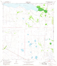
Lake Marian defines the northern edge of this landscape, its shoreline giving way to a vast network of wetlands and sloughs in Osceola County. The small settlement of Whittier sits near the northeastern corner, accompanied by a small Cem and evidence of local ranching or agricultural operations. The terrain is marked by numerous small depressions and ponds, with water features like Blanket Bay Slough cutting through the western sections. The Peavine Trail provides a primary point of transit through this flat, water-dominated interior during the early 1950s. Surveyed by the U.S. Corps of Engineers, the map includes markers of rural infrastructure such as a Windmill and a Gaging Sta, reflecting the mid-century management of Florida's central drainage basins before significant modern development altered the region.
Find a feature on this map
8 named features on this map. Tap any name to fly to it.
Don’t see what you’re looking for? This feature index may not catch every label — zoom into the map to look around manually.
Map Details
Editions of this 1953 Lake Marian SE Map
4 editions found
Other maps of this area

1952 · Fort Kissimmee NW
USGS Topo · 1:24,000

1953 · Lake Marian NW
USGS Topo · 1:24,000

1953 · Fort Kissimmee NE
USGS Topo · 1:24,000

1953 · Fort Drum NW
USGS Topo · 1:24,000

1953 · Kenansville SW
USGS Topo · 1:24,000

1953 · Lake Marian SW
USGS Topo · 1:24,000

1953 · Kenansville
USGS Topo · 1:24,000

1953 · Lake Marian NE
USGS Topo · 1:24,000

1956 · Fort Pierce
USGS Topo · 1:250,000

1958 · Fort Pierce
USGS Topo · 1:250,000