
1953 Map of Lake Marian NW
USGS Topo · Published 1954About this map
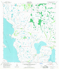
The eastern shores of Lake Kissimmee dominate this mid-century Osceola County landscape, defined by a complex network of wetlands and cattle-ranching ground. The terrain is characterized by numerous "hammocks"—islands of hardwood vegetation within the marshy prairie—including Camp Hammock, Sawgrass Hammock, and the larger Parker Hammocks near the eastern margin. These features reflect the historic land use of the region before significant modern drainage, where higher ground provided critical sites for seasonal camps and livestock management. Hydrographic features like Canoe Creek and Jackson Canal facilitate the movement of water between Lake Jackson and Lake Marian. Prominent landforms such as Brahma Island and Bird Island rise within the lakes, while sluggish waterways like Orange Hammock Slough and Fodderstack Slough weave through the low-lying interior, illustrating the intricate hydrology of the Kissimmee River basin at this time.
Find a feature on this map
28 named features on this map. Tap any name to fly to it.
Don’t see what you’re looking for? This feature index may not catch every label — zoom into the map to look around manually.
Map Details
Editions of this 1953 Lake Marian NW Map
4 editions found
Other maps of this area

1952 · Lake Weohyakapka SE
USGS Topo · 1:24,000

1952 · Lake Weohyakapka NE
USGS Topo · 1:24,000

1953 · Cypress Lake
USGS Topo · 1:24,000

1953 · Lake Marian SE
USGS Topo · 1:24,000

1953 · Holopaw SE
USGS Topo · 1:24,000

1953 · Lake Marian SW
USGS Topo · 1:24,000

1953 · Holopaw SW
USGS Topo · 1:24,000

1953 · Lake Marian NE
USGS Topo · 1:24,000

1955 · Orlando
USGS Topo · 1:250,000

1956 · Fort Pierce
USGS Topo · 1:250,000