Old Maps of Osceola County, Florida
Explore 229 old maps of Osceola County, spanning from 1952 to today. These high-resolution historic maps reveal how streets, neighborhoods, landmarks, and natural features evolved over time — perfect for genealogy, metal detecting, research, and local history exploration.
What you can do with these maps:
- See how Osceola County changed over time: Compare historical maps to modern-day views to trace roads, homesites, rail lines & more.
- View detailed metadata: Each map includes creators, publishers, year, scale, and archive source.
- Overlay maps with satellite & LiDAR: Visualize the past alongside modern tools to explore terrain & human change.
- Trusted historical sources: Maps sourced from the USGS, Library of Congress, and other archives.
- Access maps your way: View online, download high-res files, or order prints for personal or research use.
Start exploring old maps of Osceola County to uncover forgotten places, hidden landmarks, and the deep history beneath your feet.
Osceola County, FL maps
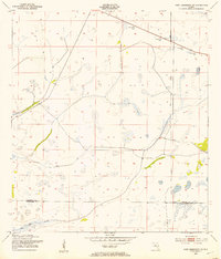
(229)- 1952 Map of Lake Weohyakapka SE, 1953 Print
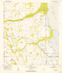
 1952 Lake Weohyakapka SE1953 Print · USGSCentral Florida's lake country in the early fifties shows a landscape of wetlands and early transport corridors at the Polk and Osceola county line. Researchers can trace the path of an Old Railroad Grade or explore the shoreline of Brahma Island and Lake Kissimmee.5 unique versions available
 - 1952 Map of Lake Weohyakapka NE, 1953 Print
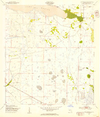
 1952 Lake Weohyakapka NE1953 Print · USGSOsceola and Polk counties appear here in the early fifties, showing the expansive wetland systems of the Florida interior. Researchers can trace the original shoreline and named features like Sturm Island, Brahma Island, and the winding Kissimmee River.4 unique versions available
 - 1952 Map of Fort Kissimmee NW, 1953 Print
 1952 Fort Kissimmee NW1953 Print · USGSCentral Florida's interior in the early fifties is captured here as a landscape of military range lands and winding river wetlands. Researchers can trace the original path of the Kissimmee River and explore named landmarks like Hard Luck Hammock and Ice Cream Slough.3 unique versions available
 - 1952 Map of Hesperides, 1953 Print
 1952 Hesperides1953 Print · USGSPolk County at the start of the 1950s was a landscape defined by expansive lakes and the citrus-belt rail lines. Genealogists and historians can trace local landmarks like the St Anne Shrine and Beulah Ch or the rural stops at Alcoma and Hesperides.4 unique versions available
 - 1953 Map of Lake Poinsett
 1953 Lake Poinsett1953 Print · USGSBrevard County was a land of transition in the 1950s as modern highways began to bypass the traditional river life of the St. Johns. Genealogists and local historians can trace early outposts like Lone Cabbage Camp, the Trailer Park Cem, and the riverfront Poinsett Lodge.4 unique versions available
 - 1953 Map of Deer Park NE
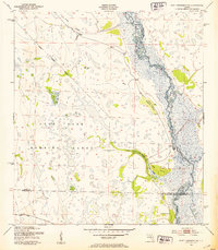
 1953 Deer Park NE1953 Print · USGSFlorida's inland marshes at the mid-century mark reveal a landscape defined by the winding St Johns River. Genealogists and environmental historians can trace the old county lines and water features like Lake Winder, Pennywash Creek, and early Spoil Banks.5 unique versions available
 - 1953 Map of Lake Marian NW, 1954 Print
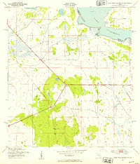
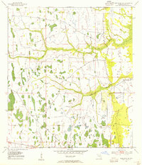
 1953 Lake Marian NW1954 Print · USGSOsceola County’s cattle country and wetlands appear here in the early 1950s, a landscape shaped by seasonal water and prairie hammocks. Researchers can trace the wild shorelines of Lake Kissimmee and locate remote outposts like Camp Hammock or Parker Hammocks.4 unique versions available
 - 1953 Map of Cypress Lake, 1954 Print
 1953 Cypress Lake1954 Print · USGSOsceola and Polk counties meet in this mid-century survey of the Florida wetlands before extensive modern development altered the region's hydrology. Genealogists and local historians can trace family-named landmarks like Ike Hammock, Johnson Island, and the early route of Canoe Creek Road.4 unique versions available
 - 1953 Map of Fort Kissimmee NE, 1954 Print
 1953 Fort Kissimmee NE1954 Print · USGSOsceola and Okeechobee counties meet in this early 1950s survey of the Florida interior during a time of early resource extraction. Trace the historical path of the Old Railroad Grade and Peavine Trail near the Pine Island Slough.3 unique versions available
 - 1953 Map of Lake Marian SE, 1954 Print
 1953 Lake Marian SE1954 Print · USGSOsceola County is shown here as a landscape of prairie and slough in the early fifties, before widespread modern drainage. Researchers can locate the settlement at Whittier, trace the Peavine Trail, and find a rural Cem near the shore of Lake Marian.4 unique versions available
 - 1953 Map of Holopaw SE, 1954 Print
 1953 Holopaw SE1954 Print · USGSIn the early 1950s, this portion of Osceola County remained a landscape of vast wetlands and remote ranchland. Genealogists and historians can trace the Old Railroad Grade and locate former landmarks such as the Site of Illahaw and 5T Ranch.4 unique versions available
 - 1953 Map of Fort Drum NW, 1954 Print
 1953 Fort Drum NW1954 Print · USGSOsceola County and the surrounding marshlands are captured in the early 1950s, centered on the remote crossroads of the interior. Genealogists and historians can trace the paths of the Old Railroad Grade and the early layout of Yeehaw Junction near Blue Cypress Creek.4 unique versions available
 - 1953 Map of Kenansville SW, 1954 Print
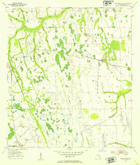
 1953 Kenansville SW1954 Print · USGSThe Florida interior near the Osceola and Indian River county line was a landscape of wetlands and drainage projects in the early 1950s. Local history researchers can trace the Old Railroad Grade and locate the settlements of Kenansville and Lokosee.2 unique versions available
 - 1953 Map of Lake Marian SW, 1954 Print
 1953 Lake Marian SW1954 Print · USGSOsceola and Polk Counties appear here in the early fifties, showing the wild wetlands at the head of the Kissimmee River. Genealogists and local historians can trace family-named landmarks like Godwin Hammock or follow the paths of Buttermilk Slough and Ice Cream Slough.3 unique versions available
 - 1953 Map of Deer Park SE, 1954 Print
 1953 Deer Park SE1954 Print · USGSThe Upper St. Johns River Basin in the early 1950s is a landscape of vast wetlands and early water management. Researchers can trace the path of the Old Railroad Grade and locate significant archaeological sites such as North Indian Field and Middle Indian Field.5 unique versions available
 - 1953 Map of Narcoossee SE, 1954 Print
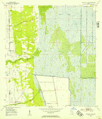
 1953 Narcoossee SE1954 Print · USGSCovers Osceola County, including Orange County, United States, and other nearby areas4 unique versions available
 - 1953 Map of Lake Hatchineha, 1954 Print
 1953 Lake Hatchineha1954 Print · USGSCentral Florida's wetlands and hammocks are captured in the early 1950s along the Osceola and Polk County line. Researchers can trace the natural shoreline of Lake Hatchineha and find local landmarks like Lyle Camp and Johnson Island.4 unique versions available
 - 1953 Map of St Cloud North, 1954 Print
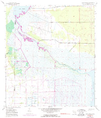
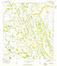
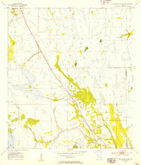
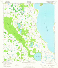
 1953 St Cloud North1954 Print · USGSOsceola County and the northern reaches of the lake country are mapped here in the early fifties. Genealogists and researchers can trace the vicinity of St Cloud and find rural markers like Mt Carmel Cem, Barber Cem, and Lock Haven Ch.7 unique versions available
 - 1953 Map of Kenansville, 1954 Print
 1953 Kenansville1954 Print · USGSOsceola County cattle country and wetlands are captured here in the early fifties, showing a landscape defined by the winding Bull Creek. Genealogists and local historians can trace early routes like Canoe Creek Rd and the settlement at Kenansville.3 unique versions available
 - 1953 Map of Narcoossee, 1954 Print
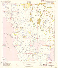
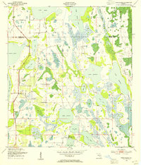 1953 Narcoossee1954 Print · USGSOsceola County was a land of interconnected lakes and small interior settlements in the early fifties. Researchers can trace the old footprints of Narcoossee and Runnymede or locate family landmarks like St Luke Ch and the Windmill.5 unique versions available
 - 1953 Map of Fort Drum NE, 1954 Print
 1953 Fort Drum NE1954 Print · USGSCovers Osceola County, including Indian River County, Okeechobee County, and other nearby areas3 unique versions available
 - 1953 Map of Deer Park NW, 1954 Print
 1953 Deer Park NW1954 Print · USGSOsceola County ranch lands and wetlands are documented here in the early fifties before major modern development. Local historians can trace the Old Railroad Grade and the footprint of the Orlando Ranch among the windings of Pennywash Creek.4 unique versions available
 - 1953 Map of St Cloud South, 1954 Print
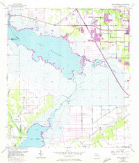
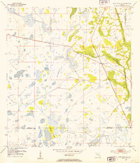
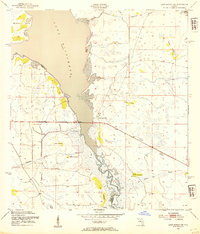
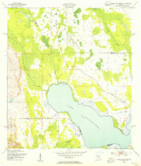
 1953 St Cloud South1954 Print · USGSOsceola County at the start of the 1950s shows a landscape of citrus, cattle, and complex water management. Genealogists and local historians can trace the early developments of St Cloud, locate the Mt Peace Cem, and see the early layout of Kissimmee Park near the shores of Lake Tohopekaliga.5 unique versions available
 - 1953 Map of Lake Tohopekaliga, 1954 Print
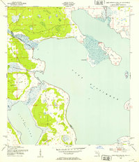
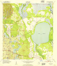
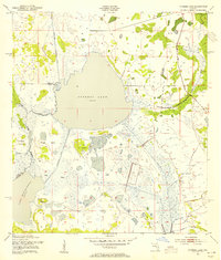
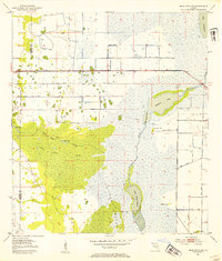
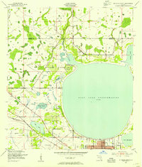
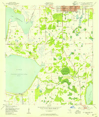
 1953 Lake Tohopekaliga1954 Print · USGSThe Florida interior near Lake Tohopekaliga was a landscape of expansive wetlands and scattered upland islands in the early fifties. Genealogists and historians can locate Pleasant Hill Cem and trace the original reaches of Reedy Creek Swamp.5 unique versions available
 - 1953 Map of Kenansville NE, 1954 Print
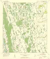
 1953 Kenansville NE1954 Print · USGSFlorida’s interior wetlands come into focus in the early fifties as engineers began to reshape the landscape. Local historians can trace the early infrastructure of Tenmile Ranch, find several Flowing Well sites, and locate landmarks like Mulberry Mound.3 unique versions available
Showing maps 1-25 of 229
Top cities of Osceola County
- Poinciana historical maps
- Kissimmee historical maps
- Buenaventura Lakes historical maps
- Saint Cloud historical maps
- Celebration historical maps
- Campbell historical maps
See more
Frequently asked questions
- What are the different types of historical maps available for Osceola County?
- What is the oldest map of Osceola County?
- Where can I purchase historical maps of Osceola County for my home or office?
- Where can I download high-res historical maps of Osceola County?
- Are there historical topographic maps available for Osceola County?
- Is there historical aerial imagery available for Osceola County?
- Where are historical maps of Osceola County sourced from?