
1953 Map of Deer Park NW
USGS Topo · Published 1954About this map
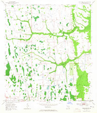
Wetlands and winding watercourses dominate this central Florida landscape, where Wolf Creek and Pennywash Creek snake through a mosaic of marshes and cypress strands. The terrain reveals the region's mid-century rural character, largely defined by ranching and the remnants of earlier industrial transport. Evidence of this past infrastructure is marked by the Old Railroad Grade cutting across the northern sections, suggesting the former importance of timber or cattle transport before modern roads. Settlement is exceptionally sparse, centered on the Orlando Ranch near the eastern boundary. This 1953 survey captures the area just as aerial photography began to supplement traditional plane-table mapping, providing a clear record of the intricate drainage patterns and small hammocks that dictated the placement of early ranching operations and roads in Osceola County.
Find a feature on this map
4 named features on this map. Tap any name to fly to it.
Don’t see what you’re looking for? This feature index may not catch every label — zoom into the map to look around manually.
Map Details
Editions of this 1953 Deer Park NW Map
4 editions found
Other maps of this area

1953 · Lake Poinsett
USGS Topo · 1:24,000

1953 · Deer Park NE
USGS Topo · 1:24,000

1953 · Holopaw SE
USGS Topo · 1:24,000

1953 · Deer Park SE
USGS Topo · 1:24,000

1953 · Narcoossee SE
USGS Topo · 1:24,000

1953 · Lake Poinsett SW
USGS Topo · 1:24,000

1953 · Deer Park
USGS Topo · 1:24,000

1953 · Holopaw
USGS Topo · 1:24,000

1955 · Orlando
USGS Topo · 1:250,000

1957 · Orlando
USGS Topo · 1:250,000