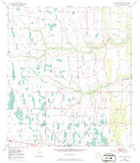
1953 Map of Deer Park NW
USGS Topo · Published 1971About this map
The marshy lowlands of Osceola County define this 1950s landscape, where intermittent wetlands and meandering waterways dictate the patterns of human activity. The passage of time is marked by the Old Railroad Grade, a linear remnant cutting across the northern reaches that signifies a shift away from earlier transport networks toward the contemporary road system. In the eastern portion of the quadrangle, the Orlando Ranch stands as the primary named settlement point, set against a backdrop of complex drainage. The slow-moving waters of Wolf Creek and Pennywash Creek snake through the terrain, illustrating the hydrologic character of this interior Florida region before extensive modern development. These features provide a clear view of the natural landscape and the sparse agricultural and industrial footprint during the mid-20th century.
Find a feature on this map
5 named features on this map. Tap any name to fly to it.
Don’t see what you’re looking for? This feature index may not catch every label — zoom into the map to look around manually.
Map Details
Editions of this 1953 Deer Park NW Map
4 editions found
Other maps of this area

1953 · Lake Poinsett
USGS Topo · 1:24,000

1953 · Deer Park NE
USGS Topo · 1:24,000

1953 · Holopaw SE
USGS Topo · 1:24,000

1953 · Deer Park SE
USGS Topo · 1:24,000

1953 · Narcoossee SE
USGS Topo · 1:24,000

1953 · Deer Park NW
USGS Topo · 1:24,000

1953 · Lake Poinsett SW
USGS Topo · 1:24,000

1953 · Deer Park
USGS Topo · 1:24,000

1953 · Holopaw
USGS Topo · 1:24,000

1955 · Orlando
USGS Topo · 1:250,000