
1953 Map of Holopaw SE
USGS Topo · Published 1954About this map
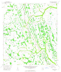
Bull Creek and a complex network of wetlands dominate this Osceola County landscape as it appeared in the early 1950s. The terrain is defined by its seasonal water features, ranging from named bays like Saplin Bay and Johnson Bay to the numerous sloughs that cut through the flatwoods, including Rattlesnake Slough and Sawgrass Slough. Human presence is sparse, marked primarily by the 5T Ranch and the Site of Illahaw, a former settlement location along the creek. An Old Railroad Grade runs through the eastern and southern portions of the quadrangle, serving as a reminder of the area’s earlier logging or industrial connectivity. This survey, compiled in part by the U.S. Corps of Engineers, details a transition from open wetlands to organized ranching, capturing specific landmarks like Oakey Pond and the clustered Bee Ponds before more intensive modern development.
Find a feature on this map
25 named features on this map. Tap any name to fly to it.
Don’t see what you’re looking for? This feature index may not catch every label — zoom into the map to look around manually.
Map Details
Editions of this 1953 Holopaw SE Map
4 editions found
Other maps of this area

1953 · Lake Marian NW
USGS Topo · 1:24,000

1953 · Kenansville
USGS Topo · 1:24,000

1953 · Deer Park NW
USGS Topo · 1:24,000

1953 · Holopaw SW
USGS Topo · 1:24,000

1953 · Deer Park
USGS Topo · 1:24,000

1953 · Ashton
USGS Topo · 1:24,000

1953 · Holopaw
USGS Topo · 1:24,000

1953 · Lake Marian NE
USGS Topo · 1:24,000

1955 · Orlando
USGS Topo · 1:250,000

1956 · Fort Pierce
USGS Topo · 1:250,000