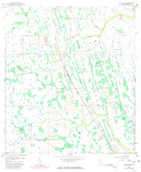
1953 Map of Holopaw SE
USGS Topo · Published 1981About this map
The Site of Illahaw and the 5T Ranch anchor this landscape in Osceola County, Florida, illustrating a period when cattle ranching and small, isolated hubs defined the interior. The terrain is a complex network of seasonal wetlands and drainage systems, characterized by features like Hog Pen Slough, Crabgrass Slough, and Rattlesnake Slough. This 1953 topography reflects an era before large-scale modern development, where land use was primarily dictated by the rise and fall of the water table across the various bays and ponds.
Find a feature on this map
29 named features on this map. Tap any name to fly to it.
Don’t see what you’re looking for? This feature index may not catch every label — zoom into the map to look around manually.
Map Details
Editions of this 1953 Holopaw SE Map
4 editions found
Other maps of this area

1953 · Lake Marian NW
USGS Topo · 1:24,000

1953 · Holopaw SE
USGS Topo · 1:24,000

1953 · Kenansville
USGS Topo · 1:24,000

1953 · Deer Park NW
USGS Topo · 1:24,000

1953 · Holopaw SW
USGS Topo · 1:24,000

1953 · Deer Park
USGS Topo · 1:24,000

1953 · Ashton
USGS Topo · 1:24,000

1953 · Holopaw
USGS Topo · 1:24,000

1953 · Lake Marian NE
USGS Topo · 1:24,000

1955 · Orlando
USGS Topo · 1:250,000