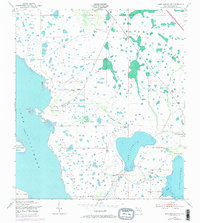
1953 Map of Lake Marian NW
USGS Topo · Published 1973About this map
Lake Kissimmee and its intricate eastern shoreline dominate this Osceola County landscape, where the Department of the Army and Geological Survey documented a vast network of wetlands and hammock islands in the early 1950s. The map reveals the transitional nature of the Florida interior, alternating between open water at Lake Marian and Lake Jackson and the dense vegetation of Orange Hammock and Sawgrass Hammock.
Find a feature on this map
21 named features on this map. Tap any name to fly to it.
Don’t see what you’re looking for? This feature index may not catch every label — zoom into the map to look around manually.
Map Details
Editions of this 1953 Lake Marian NW Map
4 editions found
Other maps of this area

1952 · Lake Weohyakapka SE
USGS Topo · 1:24,000

1952 · Lake Weohyakapka NE
USGS Topo · 1:24,000

1953 · Lake Marian NW
USGS Topo · 1:24,000

1953 · Cypress Lake
USGS Topo · 1:24,000

1953 · Lake Marian SE
USGS Topo · 1:24,000

1953 · Holopaw SE
USGS Topo · 1:24,000

1953 · Lake Marian SW
USGS Topo · 1:24,000

1953 · Holopaw SW
USGS Topo · 1:24,000

1953 · Lake Marian NE
USGS Topo · 1:24,000

1955 · Orlando
USGS Topo · 1:250,000