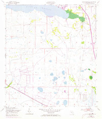
1953 Map of Lake Marian SE
USGS Topo · Published 1973About this map
Lake Marian defines the northern reaches of this Osceola County landscape, where the waters of the lake give way to a complex network of wetlands and sloughs. This mid-century survey captures the region as development began to touch the shoreline, notably at Lake Marian Highlands. Further east, the small settlement of Whittier sits near the edge of the sheet, providing a focal point for local history researchers and genealogists tracing family roots in this part of Florida.
Find a feature on this map
10 named features on this map. Tap any name to fly to it.
Don’t see what you’re looking for? This feature index may not catch every label — zoom into the map to look around manually.
Map Details
Editions of this 1953 Lake Marian SE Map
4 editions found
Other maps of this area

1952 · Fort Kissimmee NW
USGS Topo · 1:24,000

1953 · Lake Marian NW
USGS Topo · 1:24,000

1953 · Fort Kissimmee NE
USGS Topo · 1:24,000

1953 · Lake Marian SE
USGS Topo · 1:24,000

1953 · Fort Drum NW
USGS Topo · 1:24,000

1953 · Kenansville SW
USGS Topo · 1:24,000

1953 · Lake Marian SW
USGS Topo · 1:24,000

1953 · Kenansville
USGS Topo · 1:24,000

1953 · Lake Marian NE
USGS Topo · 1:24,000

1956 · Fort Pierce
USGS Topo · 1:250,000