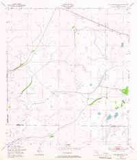
1953 Map of Fort Kissimmee NE
USGS Topo · Published 1965About this map
Pine Island Slough dominates the southern reaches of this landscape where Osceola and Okeechobee counties meet. The terrain is characterized by a dense network of wetlands and seasonal water bodies, typical of the central Florida interior before widespread modern drainage. Remnants of early transportation infrastructure are visible, most notably the Old Railroad Grade and the Peavine Trail, which cut through the palmetto and pine flatwoods. These routes reflect the region's history of logging and cattle ranching, providing essential paths through the marshy ground. Small-scale industrial activity is evidenced by scattered Sand Pits located in the northern sections, while the lack of established towns highlights the area's role as a vital corridor between the Kissimmee River and the Atlantic coast during the mid-20th century.
Find a feature on this map
5 named features on this map. Tap any name to fly to it.
Don’t see what you’re looking for? This feature index may not catch every label — zoom into the map to look around manually.
Map Details
Editions of this 1953 Fort Kissimmee NE Map
3 editions found
Other maps of this area

1952 · Fort Kissimmee
USGS Topo · 1:24,000

1952 · Fort Kissimmee NW
USGS Topo · 1:24,000

1953 · Fort Kissimmee NE
USGS Topo · 1:24,000

1953 · Fort Drum SW
USGS Topo · 1:24,000

1953 · Lake Marian SE
USGS Topo · 1:24,000

1953 · Fort Drum NW
USGS Topo · 1:24,000

1953 · Kenansville SW
USGS Topo · 1:24,000

1953 · Lake Marian SW
USGS Topo · 1:24,000

1953 · Fort Kissimmee SE
USGS Topo · 1:24,000

1956 · Fort Pierce
USGS Topo · 1:250,000