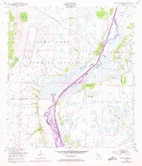
1952 Map of Fort Kissimmee
USGS Topo · Published 1973About this map
The Kissimmee River meanders through the heart of this Central Florida landscape, serving as the border between Highlands and Okeechobee counties. This 1952 survey shows the area during a period of significant military and agricultural transition. Much of the western territory is occupied by the Avon Park Bombing Range, defined by a clear Bombing Range Boundary that separates ordnance testing grounds from the surrounding wetlands.
Find a feature on this map
21 named features on this map. Tap any name to fly to it.
Don’t see what you’re looking for? This feature index may not catch every label — zoom into the map to look around manually.
Map Details
Editions of this 1952 Fort Kissimmee Map
4 editions found
Other maps of this area

1952 · Fort Kissimmee
USGS Topo · 1:24,000

1952 · Fort Kissimmee NW
USGS Topo · 1:24,000

1952 · Lake Arbuckle NE
USGS Topo · 1:24,000

1952 · Lake Arbuckle SE
USGS Topo · 1:24,000

1952 · Lorida
USGS Topo · 1:24,000

1953 · Basinger
USGS Topo · 1:24,000

1953 · Fort Kissimmee NE
USGS Topo · 1:24,000

1953 · Basinger NW
USGS Topo · 1:24,000

1953 · Fort Kissimmee SE
USGS Topo · 1:24,000

1956 · Fort Pierce
USGS Topo · 1:250,000