
1952 Map of Lake Arbuckle NE
USGS Topo · Published 1953About this map
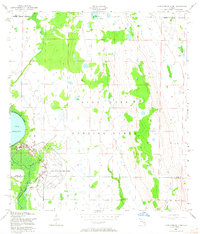
Avon Park Air Force Base occupies a substantial portion of this landscape along the border of Polk and Highlands Counties. The military installation's presence is marked by a complex of infrastructure, including a Beacon, a Sewage Disposal plant, and the Government Railroad that terminates within the base. The eastern shoreline of Lake Arbuckle is defined by a Rim Canal, while the broader terrain is designated as the Avon Park Bombing Range, delineated by a clear Bombing Range Boundary. This 1950s survey shows the integration of military aviation needs with the hydrology of Central Florida, where Morgan Hole Creek winds through the wetlands east of the main airfield. The map serves as a detailed record of Cold War-era military land use and local geography before later 20th-century developments.
Find a feature on this map
12 named features on this map. Tap any name to fly to it.
Don’t see what you’re looking for? This feature index may not catch every label — zoom into the map to look around manually.
Map Details
Editions of this 1952 Lake Arbuckle NE Map
4 editions found
Other maps of this area

1952 · Fort Kissimmee
USGS Topo · 1:24,000

1952 · Lake Weohyakapka SE
USGS Topo · 1:24,000

1952 · Lake Arbuckle SW
USGS Topo · 1:24,000

1952 · Fort Kissimmee NW
USGS Topo · 1:24,000

1952 · Lake Arbuckle SE
USGS Topo · 1:24,000

1952 · Lake Arbuckle
USGS Topo · 1:24,000

1952 · Lake Weohyakapka
USGS Topo · 1:24,000

1953 · Lake Marian SW
USGS Topo · 1:24,000

1956 · Fort Pierce
USGS Topo · 1:250,000

1958 · Fort Pierce
USGS Topo · 1:250,000