
1952 Map of Lake Arbuckle
USGS Topo · Published 1953About this map
The Avon Park Bombing Range dominates the eastern landscape of this Florida interior region, showing a significant military presence just after mid-century. A network of hydrology defines the area, with Lake Arbuckle and Reedy Lake connected by the wandering course of Livingston Creek. The low-lying terrain is punctuated by the dense Blue Jordan Swamp and smaller water bodies such as Lake David and Lake Isabell.
Find a feature on this map
20 named features on this map. Tap any name to fly to it.
Don’t see what you’re looking for? This feature index may not catch every label — zoom into the map to look around manually.
Map Details
Editions of this 1952 Lake Arbuckle Map
3 editions found
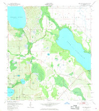
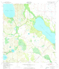
Other maps of this area

1952 · Lake Weohyakapka SE
USGS Topo · 1:24,000

1952 · Lake Arbuckle SW
USGS Topo · 1:24,000

1952 · Lake Arbuckle NE
USGS Topo · 1:24,000

1952 · Lake Arbuckle SE
USGS Topo · 1:24,000

1952 · Babson Park
USGS Topo · 1:24,000

1952 · Lake Weohyakapka
USGS Topo · 1:24,000

1953 · Frostproof
USGS Topo · 1:24,000

1953 · Avon Park
USGS Topo · 1:24,000

1956 · Fort Pierce
USGS Topo · 1:250,000

1958 · Fort Pierce
USGS Topo · 1:250,000