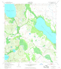
1952 Map of Lake Arbuckle
USGS Topo · Published 1968About this map
The expansive Lake Arbuckle and Reedy Lake anchor this survey of Central Florida, where the landscape is defined by an intricate network of wetlands and seasonal water bodies. The terrain transitions from the dense Blue Jordan Swamp in the north to the meandering courses of Livingston Creek, Reedy Creek, and Bonnet Creek. A notable man-made feature is the U S Government Railroad (Abandoned), which cuts east-west across the center of the sheet, providing evidence of mid-century military logistics and infrastructure.
Find a feature on this map
19 named features on this map. Tap any name to fly to it.
Don’t see what you’re looking for? This feature index may not catch every label — zoom into the map to look around manually.
Map Details
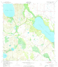
Editions of this 1952 Lake Arbuckle Map
3 editions found
Other maps of this area

1952 · Lake Weohyakapka SE
USGS Topo · 1:24,000

1952 · Lake Arbuckle SW
USGS Topo · 1:24,000

1952 · Lake Arbuckle NE
USGS Topo · 1:24,000

1952 · Lake Arbuckle SE
USGS Topo · 1:24,000

1952 · Babson Park
USGS Topo · 1:24,000

1952 · Lake Arbuckle
USGS Topo · 1:24,000

1952 · Lake Weohyakapka
USGS Topo · 1:24,000

1953 · Frostproof
USGS Topo · 1:24,000

1953 · Avon Park
USGS Topo · 1:24,000

1956 · Fort Pierce
USGS Topo · 1:250,000