Old Maps of Lake Placid, Florida
Explore 17 old maps of Lake Placid, spanning from 1952 to today. These high-resolution historic maps reveal how streets, neighborhoods, landmarks, and natural features evolved over time — perfect for genealogy, metal detecting, research, and local history exploration.
What you can do with these maps:
- See how Lake Placid changed over time: Compare historical maps to modern-day views to trace roads, homesites, rail lines & more.
- View detailed metadata: Each map includes creators, publishers, year, scale, and archive source.
- Overlay maps with satellite & LiDAR: Visualize the past alongside modern tools to explore terrain & human change.
- Trusted historical sources: Maps sourced from the USGS, Library of Congress, and other archives.
- Access maps your way: View online, download high-res files, or order prints for personal or research use.
Start exploring old maps of Lake Placid to uncover forgotten places, hidden landmarks, and the deep history beneath your feet.
Lake Placid, FL maps
(17)- 1952 Map of Lake Placid, 1953 Print
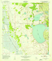
 1952 Lake Placid1953 Print · USGSFlorida's lake country is captured here in the early fifties as citrus groves and rail lines shaped the Highlands County interior. Researchers can trace the dual routes of the Atlantic Coast Line and Seaboard Air Line through Lake Placid and Sunvale.4 unique versions available
 - 1953 Map of Lake June In Winter, 1954 Print
 1953 Lake June In Winter1954 Print · USGSHighlands County in the early fifties is characterized here by its vast network of lakes and shifting wetlands before extensive modern drainage. Researchers can trace the early boundaries of Lake Placid and locate local landmarks like Hog Island Hammock or the Pumping Station near Fisheating Creek.3 unique versions available
 - 1956 Map of Fort Pierce, 1965 Print
 1956 Fort Pierce1965 Print · USGSCentral and coastal Florida appear here during a period of rapid post-war growth and industrial expansion. Researchers can trace the mid-century rail-to-highway transition along the Sunshine State Parkway or locate old settlements like Ankona, Walton, and Indrio.4 unique versions available
 - 1958 Map of Fort Pierce
 1958 Fort Pierce1958 Print · USGSCentral and South Florida are captured here in the late fifties as the citrus and ranching interior met the modern highway era. Researchers can trace the early path of the Sunshine State Parkway and locate established rail depots in Sebring, Okeechobee, and Arcadia.
 - 1959 Map of Fort Pierce
 1959 Fort Pierce1959 Print · USGSCentral Florida and the Treasure Coast are shown here in the late fifties, during a period of steady citrus and coastal growth. Trace the historic routes of the Florida East Coast Ry or locate the boundaries of the Seminole Indian Reservation and Highlands Hammock State Park.3 unique versions available
 - 1978 Map of Arcadia, 1980 Print
 1978 Arcadia1980 Print · USGSDeSoto and Highlands counties are shown here in the late seventies, a landscape defined by the Peace River and extensive citrus groves. Genealogists and researchers can trace the SEABOARD COAST LINE railroad through old settlements like Nocatee, Zolfo Springs, and Fort Ogden.
 - 1988 Map of Fort Pierce
 1988 Fort Pierce1988 Print · USGSThe Atlantic coast and Florida’s interior lakelands are captured in the late eighties, just as the Treasure Coast was experiencing rapid development. Genealogists and historians can trace the rail lines of the Florida East Coast and explore the bounds of the Brighton Indian Reservation.
 - 2012 Map of Lake June In Winter, 2012 Print
 2012 Lake June In Winter2012 Print · USGSCovers Lake Placid, including Hen Scratch, Highlands County, and other nearby areas
 - 2012 Map of Lake Placid, 2012 Print
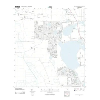
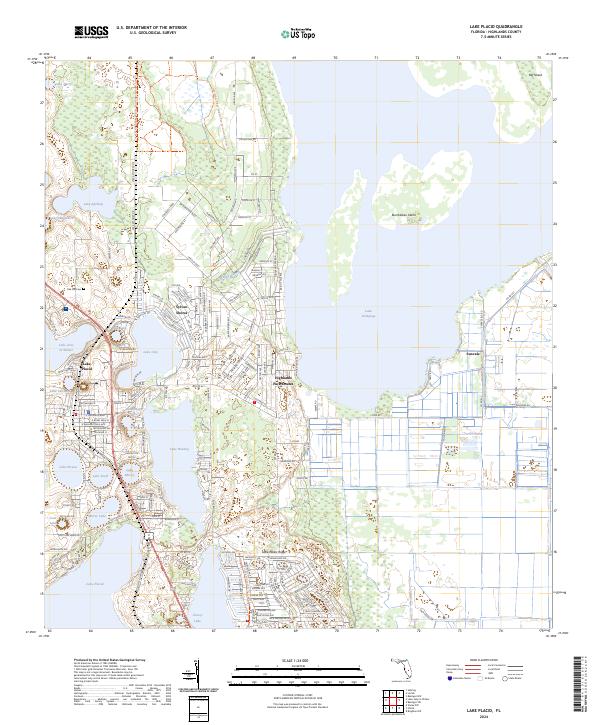
 2012 Lake Placid2012 Print · USGSCovers Lake Placid, including Sunvale, Sylvan Shores, and other nearby areas
 - 2015 Map of Lake June In Winter, 2015 Print
 2015 Lake June In Winter2015 Print · USGSCovers Lake Placid, including Hen Scratch, Highlands County, and other nearby areas
 - 2015 Map of Lake Placid, 2015 Print
 2015 Lake Placid2015 Print · USGSCovers Lake Placid, including Sunvale, Sylvan Shores, and other nearby areas
 - 2018 Map of Lake Placid, 2018 Print
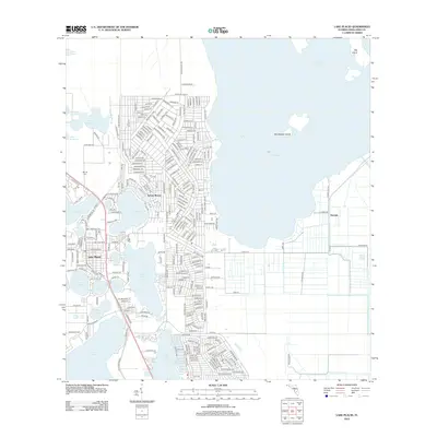
 2018 Lake Placid2018 Print · USGSCovers Lake Placid, including Sunvale, Sylvan Shores, and other nearby areas
 - 2018 Map of Lake June In Winter, 2018 Print
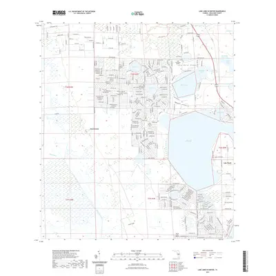
 2018 Lake June In Winter2018 Print · USGSCovers Lake Placid, including Hen Scratch, Highlands County, and other nearby areas
 - 2021 Map of Lake June In Winter, 2021 Print
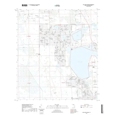
 2021 Lake June In Winter2021 Print · USGSCovers Lake Placid, including Hen Scratch, Highlands County, and other nearby areas
 - 2021 Map of Lake Placid, 2021 Print
 2021 Lake Placid2021 Print · USGSCovers Lake Placid, including Sunvale, Sylvan Shores, and other nearby areas
 - 2024 Map of Lake Placid, 2024 Print
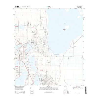
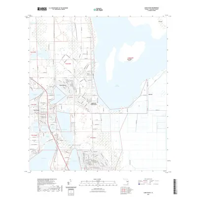
 2024 Lake Placid2024 Print · USGSFlorida's lake country is on full display in this contemporary look at the settlements and citrus-growing regions around the town of Lake Placid. Genealogists and researchers can trace local neighborhoods and landmarks like Oak Hill Cem, Sunvale, and the varied shorelines of Lake Huntley.
 - 2024 Map of Lake June In Winter, 2024 Print
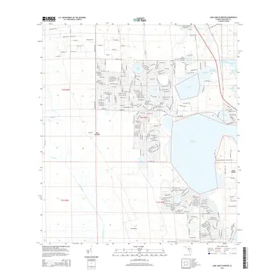
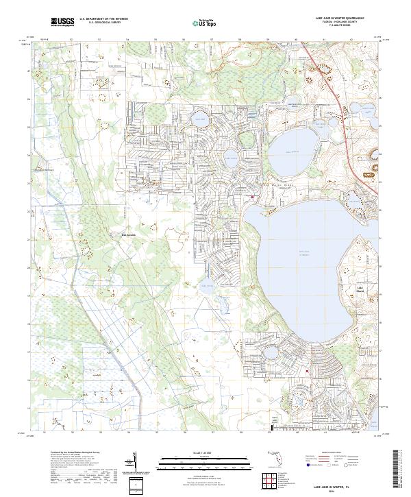 2024 Lake June In Winter2024 Print · USGSHighlands County's ridge and lake country is captured here during a period of significant residential and aviation growth. Researchers can trace the development of Lake Placid and locate local landmarks like Hen Scratch or the Lake Persimmon Airstrip.
End of results
Showing maps 1-17 of 17
Top cities near Lake Placid
Frequently asked questions
- What are the different types of historical maps available for Lake Placid?
- What is the oldest map of Lake Placid?
- Where can I purchase historical maps of Lake Placid for my home or office?
- Where can I download high-res historical maps of Lake Placid?
- Are there historical topographic maps available for Lake Placid?
- Is there historical aerial imagery available for Lake Placid?
- Where are historical maps of Lake Placid sourced from?