
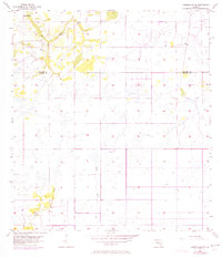
1956 Map of Crewsville SW
USGS Topo · Published 1957About this map
The boundary between Hardee Co and De Soto Co runs through this sparsely settled landscape of central Florida as it appeared in the mid-1950s. The terrain is defined by a complex network of seasonal wetlands and drainages, most notably the meandering course of Fish Branch in the northwest and Joshua Creek in the southwest. A lone Flowing Well is marked near the northern edge, indicating the importance of groundwater access in this cattle and citrus region. The surveying work, based on aerial photography from 1952 and planetable surveys from 1956, captures a moment before intensive modern development, where intermittent water features like Mossy Gully dictated the placement of roads and the rhythm of rural life.
Find a feature on this map
5 named features on this map. Tap any name to fly to it.
Don’t see what you’re looking for? This feature index may not catch every label — zoom into the map to look around manually.
Map Details
Editions of this 1956 Crewsville SW Map
3 editions found
Other maps of this area

1953 · Crewsville SE
USGS Topo · 1:24,000

1953 · Crewsville
USGS Topo · 1:24,000

1956 · Gardner
USGS Topo · 1:24,000

1956 · Sweetwater
USGS Topo · 1:24,000

1956 · Zolfo Springs
USGS Topo · 1:24,000

1956 · Fort Pierce
USGS Topo · 1:250,000

1957 · Long Island Marsh NW
USGS Topo · 1:24,000

1957 · Arcadia
USGS Topo · 1:24,000

1957 · Long Island Marsh NE
USGS Topo · 1:24,000

1958 · Fort Pierce
USGS Topo · 1:250,000