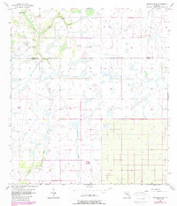
1956 Map of Crewsville SW
USGS Topo · Published 1987About this map
Joshua Creek and its drainage network define this low-lying region along the border of Hardee and DeSoto counties. This survey reflects the landscape as it appeared in the mid-1950s, characterized by expansive wetlands and drainage features like Mossy Gully and Fish Branch. The terrain is largely dominated by agricultural tracts and marshes, with scattered signs of rural infrastructure such as a remote Landing Strip in the northeast and a Flowing Well in the northwest. These details provide a look at land management and water control in South Florida before late-20th-century development altered many of the state's rural interiors. The map is particularly useful for tracking historical watercourses and identifying early property boundaries in this sparsely populated cattle and citrus region.
Find a feature on this map
6 named features on this map. Tap any name to fly to it.
Don’t see what you’re looking for? This feature index may not catch every label — zoom into the map to look around manually.
Map Details
Editions of this 1956 Crewsville SW Map
3 editions found
Other maps of this area

1953 · Crewsville SE
USGS Topo · 1:24,000

1953 · Crewsville
USGS Topo · 1:24,000

1956 · Gardner
USGS Topo · 1:24,000

1956 · Sweetwater
USGS Topo · 1:24,000

1956 · Zolfo Springs
USGS Topo · 1:24,000

1956 · Crewsville SW
USGS Topo · 1:24,000

1956 · Fort Pierce
USGS Topo · 1:250,000

1957 · Long Island Marsh NW
USGS Topo · 1:24,000

1957 · Arcadia
USGS Topo · 1:24,000

1957 · Long Island Marsh NE
USGS Topo · 1:24,000