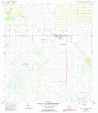
1957 Map of Long Island Marsh NW
USGS Topo · Published 1987About this map
Sheep Pen Marsh and the surrounding DeSoto County wetlands dominate this landscape, which transitioned from wild drainage patterns toward institutional land use by the late 1950s. The northern reaches are defined by hydrologic features like Joshua Creek and Honey Run, while the southern expanse is a network of slow-moving waters including Tiger Bay Slough and Slippery Slough. A distinct linear feature, the Old Railroad Grade, cuts diagonally across the center, marking a former industrial or logistical route through the hammocks. This survey includes the footprint of the De Soto Correctional Institution, a significant local landmark situated near Fourmile Island. Family-named sites like Parker Ranch and distinctive natural features such as Turkey Hammock and Sour Orange Hammock provide essential reference points for those tracing the agricultural and ranching history of this humid Florida interior.
Find a feature on this map
14 named features on this map. Tap any name to fly to it.
Don’t see what you’re looking for? This feature index may not catch every label — zoom into the map to look around manually.
Map Details
Editions of this 1957 Long Island Marsh NW Map
3 editions found
Other maps of this area

1953 · Crewsville SE
USGS Topo · 1:24,000

1956 · Gardner
USGS Topo · 1:24,000

1956 · Arcadia SE
USGS Topo · 1:24,000

1956 · Crewsville SW
USGS Topo · 1:24,000

1956 · Long Island Marsh SW
USGS Topo · 1:24,000

1956 · Fort Pierce
USGS Topo · 1:250,000

1957 · Long Island Marsh NW
USGS Topo · 1:24,000

1957 · Long Island Marsh SE
USGS Topo · 1:24,000

1957 · Arcadia
USGS Topo · 1:24,000

1957 · Long Island Marsh NE
USGS Topo · 1:24,000