
1956 Map of Arcadia SE
USGS Topo · Published 1957About this map
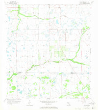
Prairie Creek meanders across this landscape south of Hog Bay, defining a terrain characterized by low-lying wetlands and seasonal drainage patterns. This 1956 survey of the Florida interior captures the interface between De Soto County and Charlotte County, illustrating a largely undeveloped expanse of the Gulf Coastal Plain before the onset of modern intensive agricultural drainage. The hydrological network is the most prominent feature, with Hawthorne Creek feeding into the northern reaches while Myrtle Slough drains the southern territory. This map is particularly useful for understanding the natural water flow and primitive road network of the mid-1950s, showing a patchwork of marshy depressions and hammocks that dictated the placement of early ranching and forestry tracks.
Find a feature on this map
5 named features on this map. Tap any name to fly to it.
Don’t see what you’re looking for? This feature index may not catch every label — zoom into the map to look around manually.
Map Details
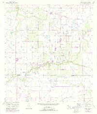
Editions of this 1956 Arcadia SE Map
3 editions found
Other maps of this area

1956 · Cleveland
USGS Topo · 1:24,000

1956 · Telegraph Swamp NW
USGS Topo · 1:24,000

1956 · Ft. Ogden
USGS Topo · 1:24,000

1956 · Nocatee
USGS Topo · 1:24,000

1956 · Long Island Marsh SW
USGS Topo · 1:24,000

1956 · Bermont
USGS Topo · 1:24,000

1956 · West Palm Beach
USGS Topo · 1:250,000

1956 · Fort Pierce
USGS Topo · 1:250,000

1957 · West Palm Beach
USGS Topo · 1:250,000

1957 · Long Island Marsh NW
USGS Topo · 1:24,000