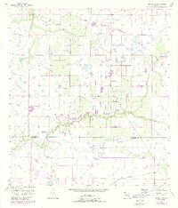
1956 Map of Arcadia SE
USGS Topo · Published 1988About this map
Prairie Creek meanders through the heart of this landscape, marking a winding path across the boundary where De Soto Co meets Charlotte Co. The terrain is defined by a complex network of seasonal wetlands and drainage systems typical of the Florida interior during the mid-twentieth century. Distinctive features like Hog Bay and Myrtle Slough indicate the low-lying, water-dependent nature of the local environment. Human activity is represented by more specialized infrastructure, including a Fish Hatchery and a small Landing Strip, suggesting a transition toward managed land use and aviation access in this rural corridor. Revisions from the 1980s illustrate the expansion of citrus groves and agricultural plots that began to square off the natural contours of the creeks.
Find a feature on this map
7 named features on this map. Tap any name to fly to it.
Don’t see what you’re looking for? This feature index may not catch every label — zoom into the map to look around manually.
Map Details
Editions of this 1956 Arcadia SE Map
3 editions found
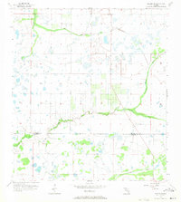
Other maps of this area

1956 · Arcadia SE
USGS Topo · 1:24,000

1956 · Cleveland
USGS Topo · 1:24,000

1956 · Telegraph Swamp NW
USGS Topo · 1:24,000

1956 · Ft. Ogden
USGS Topo · 1:24,000

1956 · Nocatee
USGS Topo · 1:24,000

1956 · Long Island Marsh SW
USGS Topo · 1:24,000

1956 · Bermont
USGS Topo · 1:24,000

1956 · West Palm Beach
USGS Topo · 1:250,000

1956 · Fort Pierce
USGS Topo · 1:250,000

1957 · West Palm Beach
USGS Topo · 1:250,000