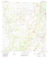
1956 Map of Nocatee
USGS Topo · Published 1987About this map
The Peace River dominates this mid-century landscape in DeSoto County, winding southward through a network of wetlands and citrus groves toward Nocatee. This 1956 survey, later updated with aerial photography in the 1980s, highlights a rural economy defined by water and transport. Extensive drainage systems and an Old Railroad Grade track through the marshes, while the modern C S X line connects the settlement at Arcadia to the north.
Find a feature on this map
16 named features on this map. Tap any name to fly to it.
Don’t see what you’re looking for? This feature index may not catch every label — zoom into the map to look around manually.
Map Details
Editions of this 1956 Nocatee Map
3 editions found
Other maps of this area

1956 · Gardner
USGS Topo · 1:24,000

1956 · Arcadia SE
USGS Topo · 1:24,000

1956 · Edgeville
USGS Topo · 1:24,000

1956 · Murdock SE
USGS Topo · 1:24,000

1956 · Murdock NE
USGS Topo · 1:24,000

1956 · Limestone
USGS Topo · 1:24,000

1956 · Ft. Ogden
USGS Topo · 1:24,000

1956 · Nocatee
USGS Topo · 1:24,000

1956 · Tampa
USGS Topo · 1:250,000

1956 · Fort Pierce
USGS Topo · 1:250,000