
1956 Map of Murdock SE
USGS Topo · Published 1957About this map
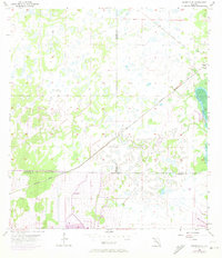
Peace River and its surrounding wetlands dominate this 1950s landscape, providing a clear view of the hydrological patterns at the intersection of Sarasota, De Soto, and Charlotte counties. The terrain is characterized by an intricate network of marshes and small water bodies, with Deep Cr branching off the main river channel. The small settlement of Platt appears in the northeast corner, serving as a rare point of human habitation in this largely undeveloped area. The infrastructure of the era is most evident in the Seaboard Air Line Railroad Grade and active Seaboard Air Line tracks, which slice diagonally across the map. These rail lines illustrate the historical importance of transportation corridors in moving through the Florida interior during the mid-20th century, before major suburban expansion altered the local drainage and land use.
Find a feature on this map
8 named features on this map. Tap any name to fly to it.
Don’t see what you’re looking for? This feature index may not catch every label — zoom into the map to look around manually.
Map Details
Editions of this 1956 Murdock SE Map
3 editions found
Other maps of this area

1956 · Murdock
USGS Topo · 1:24,000

1956 · Murdock NE
USGS Topo · 1:24,000

1956 · Cleveland
USGS Topo · 1:24,000

1956 · Ft. Ogden
USGS Topo · 1:24,000

1956 · Nocatee
USGS Topo · 1:24,000

1956 · Murdock NW
USGS Topo · 1:24,000

1956 · West Palm Beach
USGS Topo · 1:250,000

1956 · Tampa
USGS Topo · 1:250,000

1956 · Fort Pierce
USGS Topo · 1:250,000

1956 · Charlotte Harbor
USGS Topo · 1:250,000