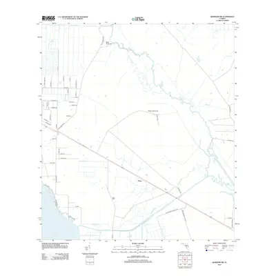
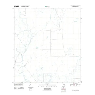
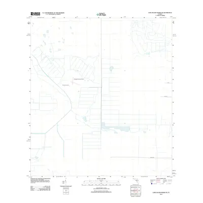
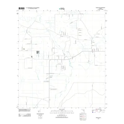
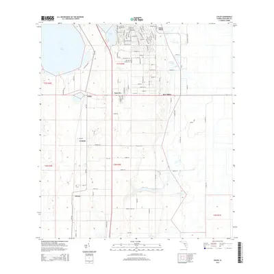
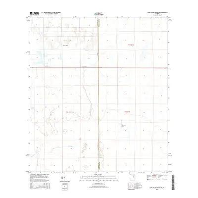
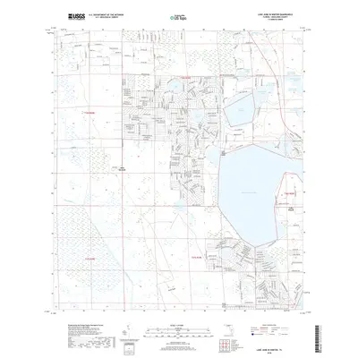
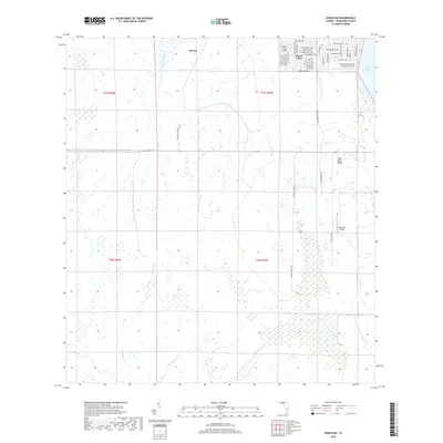
1957 Map of Long Island Marsh NE
USGS Topo · Published 1973About this map
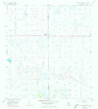
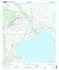
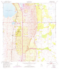
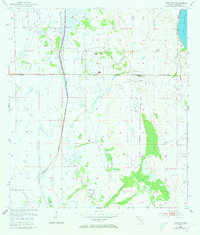
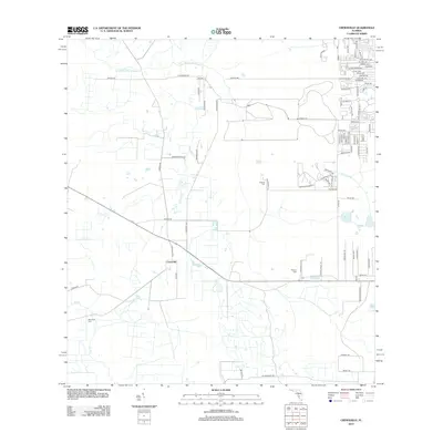
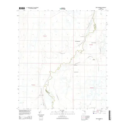
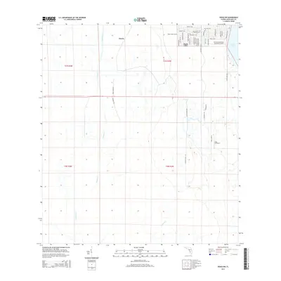
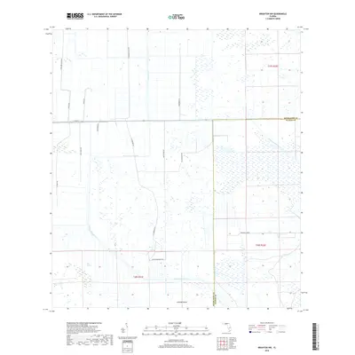
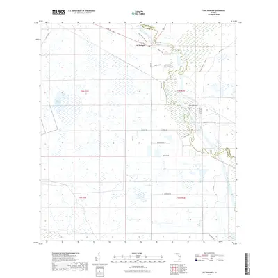
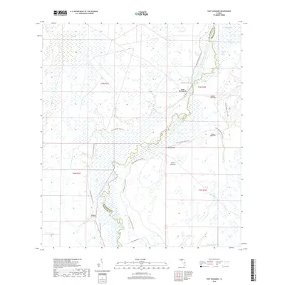
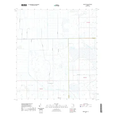
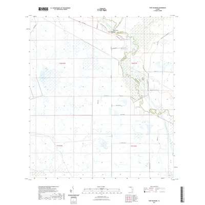
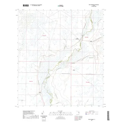
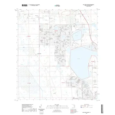
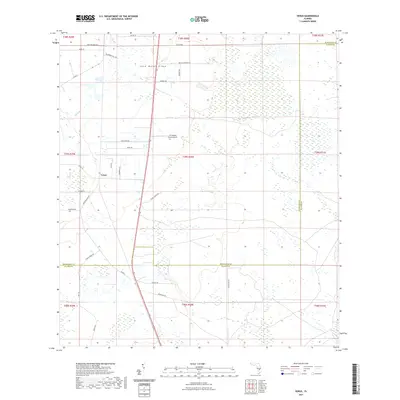
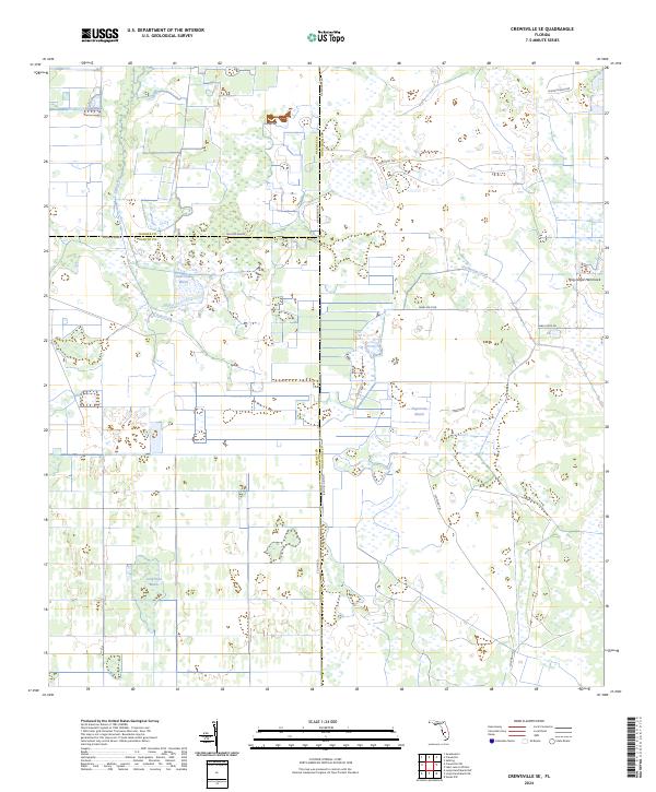
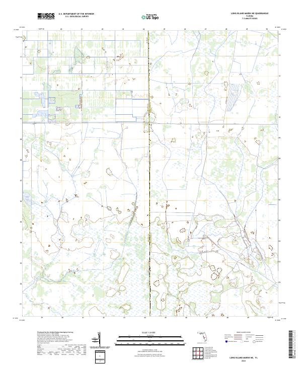
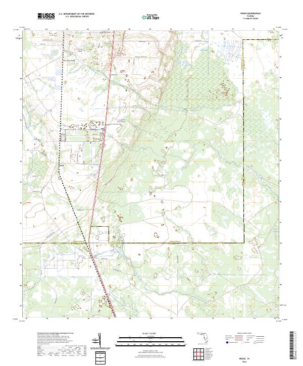
Cow Slough winds through the southern reaches of this interior Florida landscape, marking a terrain defined by wet prairies and seasonal marshes. The boundary between De Soto and Highlands counties bisects the northern half of the survey, where the land transitions from open wetlands into areas delineated by long Fence Lines. This 1957 topographic study, photorevised in 1972, reflects the sparse, rural nature of the region before significant drainage or modern development altered the hydrography. The map provides a clear view of the natural water distribution and the simple survey lines that governed land use and cattle ranching in the mid-20th century.
Find a feature on this map
3 named features on this map. Tap any name to fly to it.
Don’t see what you’re looking for? This feature index may not catch every label — zoom into the map to look around manually.
Map Details
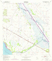
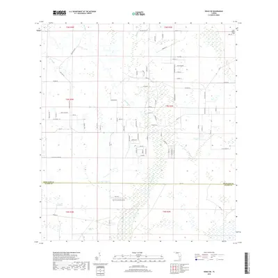
Editions of this 1957 Long Island Marsh NE Map
2 editions found

Historical Maps of Highlands County Through Time
102 maps found
1952 Fort Kissimmee
Highlands County, FL
1952 Lake Arbuckle SE
Highlands County, FL
1952 Lake Arbuckle SW
Highlands County, FL
1952 Lorida
Highlands County, FL
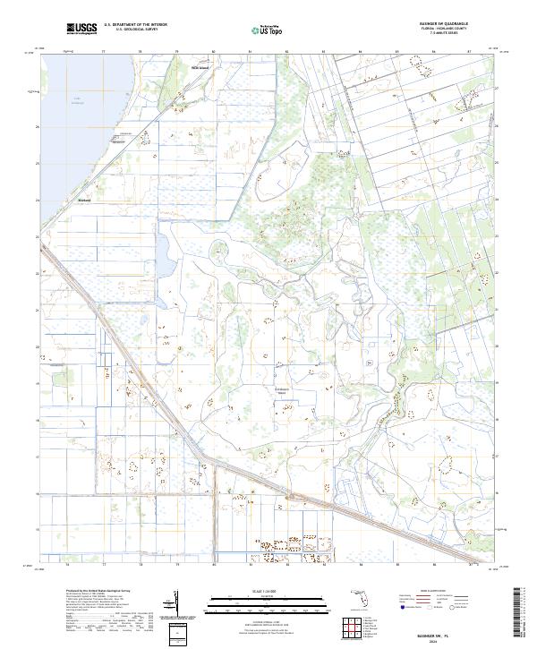
1953 Basinger NW
Highlands County, FL
1953 Basinger SW
Highlands County, FL
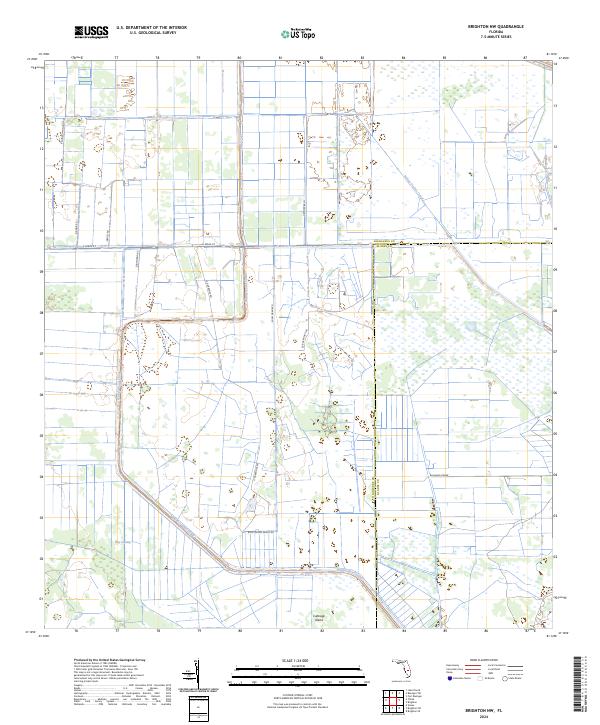
1953 Brighton NW
Highlands County, FL
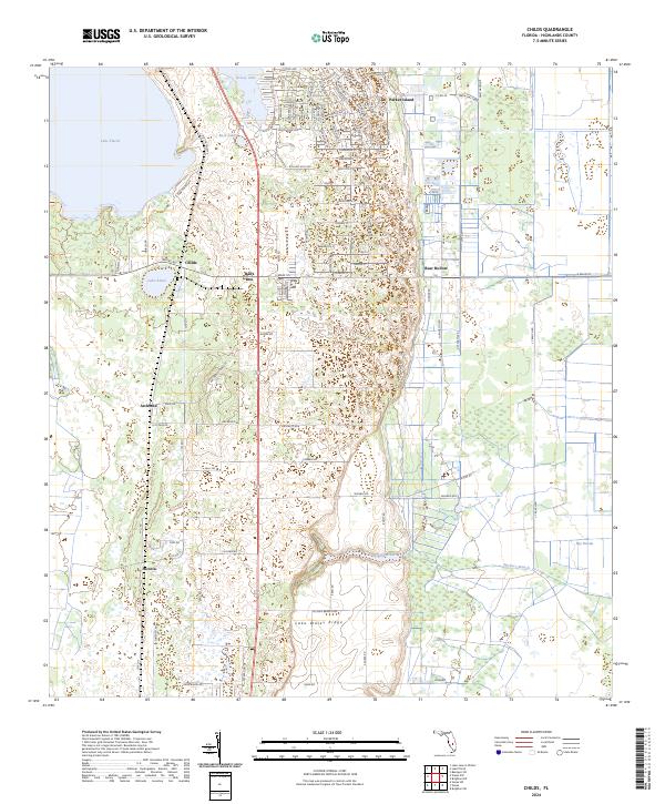
1953 Childs
Highlands County, FL
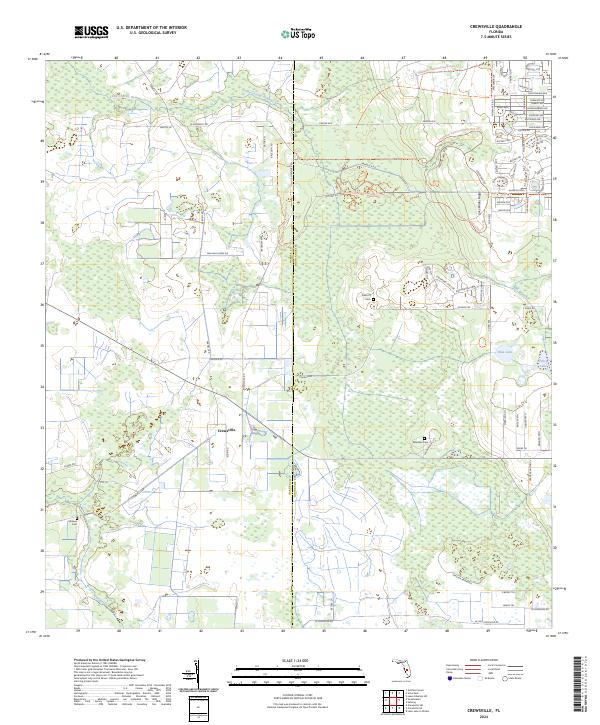
1953 Crewsville
Highlands County, FL
1953 Crewsville SE
Highlands County, FL

1953 Fort Basinger
Highlands County, FL
1953 Lake June In Winter
Highlands County, FL
1953 Venus NW
Highlands County, FL
1957 Long Island Marsh NE
Highlands County, FL
1957 Long Island Marsh SE
Highlands County, FL
1957 Venus
Highlands County, FL
1957 Venus SW
Highlands County, FL
2012 Basinger NW
Highlands County, FL
2012 Basinger SW
Highlands County, FL
2012 Brighton NW
Highlands County, FL
2012 Childs
Highlands County, FL
2012 Crewsville
Highlands County, FL
2012 Crewsville SE
Highlands County, FL
2012 Fort Basinger
Highlands County, FL
2012 Fort Kissimmee
Highlands County, FL
2012 Lake Arbuckle SE
Highlands County, FL
2012 Lake Arbuckle SW
Highlands County, FL
2012 Lake June In Winter
Highlands County, FL
2012 Long Island Marsh NE
Highlands County, FL
2012 Long Island Marsh SE
Highlands County, FL
2012 Lorida
Highlands County, FL
2012 Venus
Highlands County, FL
2012 Venus NW
Highlands County, FL
2012 Venus SW
Highlands County, FL
2015 Basinger NW
Highlands County, FL
2015 Basinger SW
Highlands County, FL
2015 Brighton NW
Highlands County, FL
2015 Childs
Highlands County, FL
2015 Crewsville
Highlands County, FL
2015 Crewsville SE
Highlands County, FL
2015 Fort Basinger
Highlands County, FL
2015 Fort Kissimmee
Highlands County, FL
2015 Lake Arbuckle SE
Highlands County, FL
2015 Lake Arbuckle SW
Highlands County, FL
2015 Lake June In Winter
Highlands County, FL
2015 Long Island Marsh NE
Highlands County, FL
2015 Long Island Marsh SE
Highlands County, FL
2015 Lorida
Highlands County, FL
2015 Venus
Highlands County, FL
2015 Venus NW
Highlands County, FL
2015 Venus SW
Highlands County, FL
2018 Basinger NW
Highlands County, FL
2018 Basinger SW
Highlands County, FL
2018 Brighton NW
Highlands County, FL
2018 Childs
Highlands County, FL
2018 Crewsville
Highlands County, FL
2018 Crewsville SE
Highlands County, FL
2018 Fort Basinger
Highlands County, FL
2018 Fort Kissimmee
Highlands County, FL
2018 Lake Arbuckle SE
Highlands County, FL
2018 Lake Arbuckle SW
Highlands County, FL
2018 Lake June In Winter
Highlands County, FL
2018 Long Island Marsh NE
Highlands County, FL
2018 Long Island Marsh SE
Highlands County, FL

2018 Lorida
Highlands County, FL
2018 Venus
Highlands County, FL
2018 Venus NW
Highlands County, FL
2018 Venus SW
Highlands County, FL
2021 Basinger NW
Highlands County, FL
2021 Basinger SW
Highlands County, FL
2021 Brighton NW
Highlands County, FL
2021 Childs
Highlands County, FL
2021 Crewsville
Highlands County, FL
2021 Crewsville SE
Highlands County, FL
2021 Fort Basinger
Highlands County, FL
2021 Fort Kissimmee
Highlands County, FL
2021 Lake Arbuckle SE
Highlands County, FL
2021 Lake Arbuckle SW
Highlands County, FL
2021 Lake June In Winter
Highlands County, FL
2021 Long Island Marsh NE
Highlands County, FL
2021 Long Island Marsh SE
Highlands County, FL
2021 Lorida
Highlands County, FL
2021 Venus
Highlands County, FL
2021 Venus NW
Highlands County, FL
2021 Venus SW
Highlands County, FL
2024 Basinger NW
Highlands County, FL
2024 Basinger SW
Highlands County, FL
2024 Brighton NW
Highlands County, FL
2024 Childs
Highlands County, FL
2024 Crewsville
Highlands County, FL
2024 Crewsville SE
Highlands County, FL
2024 Fort Basinger
Highlands County, FL
2024 Fort Kissimmee
Highlands County, FL
2024 Lake Arbuckle SE
Highlands County, FL

2024 Lake Arbuckle SW
Highlands County, FL
2024 Lake June In Winter
Highlands County, FL
2024 Long Island Marsh NE
Highlands County, FL
2024 Long Island Marsh SE
Highlands County, FL
2024 Lorida
Highlands County, FL
2024 Venus
Highlands County, FL
2024 Venus NW
Highlands County, FL
2024 Venus SW
Highlands County, FL