Old Maps of Flagler County, Florida for Metal Detecting
Plan your next treasure hunt with 107 historic maps of Flagler County. Find old homesites, ghost towns, trails, and gathering spots that may be lost to time — perfect for identifying promising metal detecting locations.
- Locate forgotten sites: Uncover places like long-lost settlements, abandoned rail lines, or gathering spots.
- Plan better hunts: Use map overlays combined with LiDAR or satellite views to narrow in on historically rich areas.
- Made for detectorists: Thousands of hobbyists use these maps to discover relics, coins, and hidden history.
Use these historic maps to boost your research and find new opportunities beneath the surface of Flagler County.
Flagler County, FL maps
(107)- 1912 Map of Palatka
 1912 Palatka1912 Print · USGSFlorida's St. Johns River corridor comes alive in the early twentieth century, showing a landscape defined by steamboat routes and citrus-belt railroads. Genealogists and historians can trace old community hubs like Yelvington PO, the Hardin Memorial Church, and the winding Rodman Lumber RR.
 - 1915 Map of Palatka
 1915 Palatka1915 Print · USGSFlorida's riverfront and rail corridors are captured here just after the turn of the century as Palatka thrived as a major transport junction. Researchers can trace family-named landmarks and vanished rural infrastructure like Sutherlands Still, Baptizing Lake, and Seven Pines School.6 unique versions available
 - 1927 Map of Matanzas
 1927 Matanzas1927 Print · USGSThe Florida coast near the border of St. Johns and Flagler Counties comes to life in this mid-1930s survey. Researchers can trace the early path of State Hy No 140 and locate vanished coastal sites like Summer Haven, Shell, and Hopper.
 - 1937 Map of Dinner Island
 1937 Dinner Island1937 Print · USGSThe Florida interior of the late 1930s is revealed here as a landscape of vast wetlands punctuated by isolated ridges and timber outposts. Researchers can trace the path of the Old Kings Road or locate early stations like Dinner Island Sta. and Neoga Sta.
 - 1937 Map of Ormond
 1937 Ormond1937 Print · USGSCoastal Florida in the late thirties is defined by a landscape of vast cypress swamps and emerging rail towns. Genealogists and historians can trace old homesteads and industrial sites like the Relay Turpentine Still, Haywood Sta., and National Gardens.
 - 1943 Map of Dinner Island, 1957 Print
 1943 Dinner Island1957 Print · USGSNortheast Florida in the early 1940s was a landscape defined by isolated interior ridges and vital coastal rail lines. Researchers can trace the original route of the Old Dixie Highway and locate vanished siding stops like Neoga Sta and Byrd.
 - 1943 Map of Matanzas, 1957 Print
 1943 Matanzas1957 Print · USGSThe Florida coast near the St. Johns and Flagler line is captured here during the mid-century, before massive development altered the shoreline. Researchers can trace the path of the Old Kings Road and locate sites like Marineland and Ft Matanzas.
 - 1944 Map of Ormond
 1944 Ormond1944 Print · USGSThe Florida coast south of Flagler Beach is captured here during the mid-forties as the railroad and the historic Old Kings Road shaped the shoreline. Genealogists and researchers can trace the early footprints of Ormond and Flagler Beach or locate the interior Turpentine Still.2 unique versions available
 - 1944 Map of Dinner Island
 1944 Dinner Island1944 Print · USGSMid-century Northeast Florida comes into focus along the coastal marshes and pine islands where the St. Johns and Flagler county lines meet. Trace the historic Dixie Highway and Florida East Coast railroad through Espanola, Spuds, and Neoga Sta.
 - 1944 Map of Matanzas
 1944 Matanzas1944 Print · USGSThe Florida coast near the St. Johns and Flagler line is shown here in the mid-1940s, just as the region began its modern growth. Researchers can trace the historical Old Kings Road and locate early landmarks like Ft Matanzas, Summer Haven, and Marineland.
 - 1954 Map of Daytona Beach, 1974 Print
 1954 Daytona Beach1974 Print · USGSNortheast Florida is captured in the mid-1950s, showing the transition from river-based commerce to coastal tourism. Researchers can trace the Florida East Coast rail lines and find historic sites like Castillo de San Marcos Nat Mon and Palatka.
 - 1956 Map of Dinner Island NE, 1960 Print
 1956 Dinner Island NE1960 Print · USGSThe coastal wetlands of St. Johns and Flagler Counties are captured here in the mid-fifties, just as the modern era met the old Florida landscape. Genealogists and local historians can trace legacy routes like the Old Kings Road and locate rural landmarks such as Pellicer Creek Cem and Midway Ch.4 unique versions available
 - 1956 Map of Favoretta, 1960 Print
 1956 Favoretta1960 Print · USGSThe borderlands of Flagler and Volusia counties are captured here in the mid-1950s, defined by the expansive wetlands of the Florida lowlands. Researchers can trace the rail corridor at Favoretta or locate the site of the Tomoka Airport and National Gardens.5 unique versions available
 - 1956 Map of Matanzas Inlet, 1960 Print
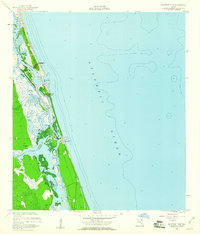 1956 Matanzas Inlet1960 Print · USGSAlong the Atlantic coast in the mid-1950s, this area preserves the strategic landscape surrounding the Matanzas Inlet. Researchers can trace the early layout of Summer Haven and Marineland, or explore the historical site of Ft Matanzas on the Matanzas River.4 unique versions available
 - 1956 Map of Flagler Beach East, 1960 Print
 1956 Flagler Beach East1960 Print · USGSThe Florida coast at Flagler Beach is shown in the mid-fifties as the region's inland waterways and marshes remained largely undeveloped. Researchers can trace the Intracoastal Waterway past Mound Grove and locate the U S Coast Guard Reservation.3 unique versions available
 - 1956 Map of Flagler Beach West, 1960 Print
 1956 Flagler Beach West1960 Print · USGSCoastal Florida in the mid-fifties is captured here as the interior marshes met growing transit corridors. Researchers can trace the legacy of the Florida East Coast railway or find local landmarks like the Good Hope Cem and Bulow Ruins State Monument.5 unique versions available
 - 1956 Map of Beverly Beach, 1961 Print
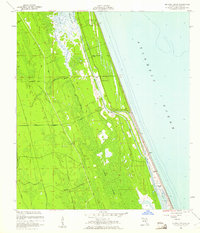 1956 Beverly Beach1961 Print · USGSThe Florida coast in the mid-fifties shows a delicate balance between new beachfront growth and the wild interior marshes. Genealogists and historians can trace the early layout of Beverly Beach or locate sites like Johnson Memorial Chapel and the historic Old Kings Road.5 unique versions available
 - 1957 Map of Espanola, 1960 Print
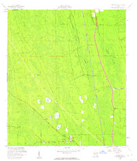 1957 Espanola1960 Print · USGSFlagler County's flatwoods and cypress strands are captured here in the late fifties, showing a landscape defined by rail and early roads. Genealogists and local historians can trace the community of Espanola, locating the St Pauls Ch, Espanola Cem, and the path of the Old Brick Road.5 unique versions available
 - 1958 Map of Daytona Beach
 1958 Daytona Beach1958 Print · USGSThe Florida coast and St. Johns River valley are captured in the late 1950s, showing a landscape defined by citrus-belt rail towns and Atlantic shorelines. Genealogists can trace family roots through riverside settlements like Palatka and Welaka or coastal hubs like Daytona Beach.2 unique versions available
 - 1964 Map of Daytona Beach
 1964 Daytona Beach1964 Print · USGSCoastal Florida in the mid-1960s shows a fascinating balance between burgeoning beach tourism and the deep interior wilderness of the Ocala National Forest. Researchers can trace the path of the Florida East Coast railway through historic settlements like St. Augustine, Marineland, and Palatka.
 - 1968 Map of San Mateo, 1971 Print
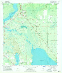 1968 San Mateo1971 Print · USGSPutnam County in the late sixties is revealed through its intricate waterways and rail lines during a period of planned hydraulic change. Genealogists and researchers can locate family sites like Mt Tabor Ch, Yelvington Cem, and the riverfront at San Mateo.3 unique versions available
 - 1970 Map of Crescent City, 1972 Print
 1970 Crescent City1972 Print · USGSCrescent City and the surrounding citrus country are captured here in the early seventies as the rail-and-lake economy defined Putnam County. Researchers can locate family sites near Pomona Park, trace the Seaboard Coast Line, or find old burial grounds like Eden Cem.3 unique versions available
 - 1970 Map of Seville, 1973 Print
 1970 Seville1973 Print · USGSSeville and Pierson appear in the early 1970s as vital rural hubs along the Seaboard Coast Line railroad. You can trace local landmarks like the Lookout Tower near Seville or map the expansive shores of Lake Disston and Saw Grass Bay.3 unique versions available
 - 1970 Map of Bunnell, 1973 Print
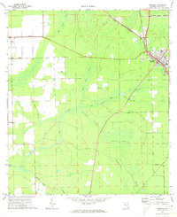 1970 Bunnell1973 Print · USGSFlagler County's rail-and-agriculture hub is captured here during the early 1970s, as development centered around the Florida East Coast corridor. Researchers can trace the layout of Bunnell and the smaller settlement of Bimini, or explore the extensive canal and swamp networks like Big Cypress Swamp and Parker Canal.3 unique versions available
 - 1970 Map of Dinner Island, 1973 Print
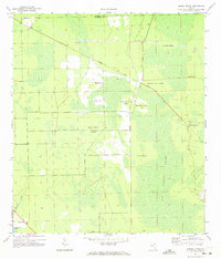 1970 Dinner Island1973 Print · USGSFlorida's interior wetlands are captured here in the 1970s, showing the elevated islands and remote settlements of Flagler County. Genealogists and researchers can trace the diagonal Florida East Coast line through Roy and locate family landmarks like Jack O'Neck Island and Shell Bluff.3 unique versions available
Showing maps 1-25 of 107
Top cities of Flagler County
- Palm Coast historical maps
- Flagler Beach historical maps
- Bunnell historical maps
- Beverly Beach historical maps
Frequently asked questions
- What are the different types of historical maps available for Flagler County?
- What is the oldest map of Flagler County?
- Where can I purchase historical maps of Flagler County for my home or office?
- Where can I download high-res historical maps of Flagler County?
- Are there historical topographic maps available for Flagler County?
- Is there historical aerial imagery available for Flagler County?
- Where are historical maps of Flagler County sourced from?