Old Maps of Old Bayshore Point, Tampa for Hiking & Exploration
Hike through history with 16 historic maps of Old Bayshore Point. Explore old trails, ghost towns, and forgotten backroads — perfect for outdoor adventurers and local explorers.
- Rediscover forgotten places: Map out old mining camps, roads, and footpaths that no longer exist on modern maps.
- Layer with modern tools: Combine with LiDAR or satellite views to plan hikes through historical terrain.
- Made for exploration: Popular among hikers, overlanders, and local history lovers.
Use these maps to find adventure and explore the hidden past of Old Bayshore Point.
Old Bayshore Point, Tampa maps
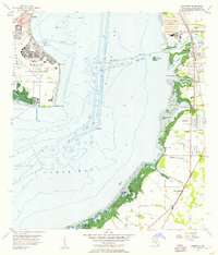
(16)- 1921 Map of Tampa
 1921 Tampa1921 Print · USGSCoastal Florida in the early twenties shows a landscape of growing towns and deep-water ports linked by expanding railroads. Genealogists and local historians can trace the early footprints of Ybor City, locate the Turpentine Still near Limona, and follow old routes like Bull Frog Road.
 - 1945 Map of Gadsden Point
 1945 Gadsden Point1945 Print · USGSThe eastern shores of Tampa Bay are captured here during the height of the Second World War. Researchers can trace the layout of Macdill Field, the coastal facilities at Gadsden Point, and small established communities like Gibsonton and Adamsville.
 - 1947 Map of Gadsden Point
 1947 Gadsden Point1947 Print · USGSCoastal Hillsborough County is captured here just after the war, showing the expansion of Mac Dill Field and the fishing villages of the eastern bay. Trace old family sites in Gibsonton and Adamsville or locate the historic U S Quarantine Station.
 - 1956 Map of Gibsonton, 1957 Print
 1956 Gibsonton1957 Print · USGSHillsborough Bay in the mid-1950s shows the strategic footprint of Mac Dill Air Force Base alongside a developing eastern shoreline. Genealogists and historians can trace the early layout of Gibsonton, Gardenville, and Adamsville along the Atlantic Coast Line railroad.6 unique versions available
 - 1956 Map of Tampa, 1964 Print
 1956 Tampa1964 Print · USGSThe Florida Gulf Coast thrived in the mid-fifties, from the bustling docks of Tampa to the quiet shores of Sanibel. Genealogists and historians can trace old rail lines like the Atlantic Coast Line or find early layouts of Port Charlotte and Bokeelia.2 unique versions available
 - 1959 Map of Tampa
 1959 Tampa1959 Print · USGSThe Florida Gulf Coast appears in this late fifties survey during a period of steady coastal growth and established rail commerce. Researchers can trace historic neighborhoods and transit lines from Tampa to St Petersburg, or locate landmarks like Mac Dill AFB and Boca Grande.
 - 1960 Map of Tampa
 1960 Tampa1960 Print · USGSThe Florida Gulf Coast was undergoing a major transformation at the start of the sixties, with new bridges linking burgeoning cities across the bays. Researchers can trace the mid-century footprints of St Petersburg and Tampa, or locate coastal landmarks like Mac Dill AFB and the Sunshine Skyway.2 unique versions available
 - 1972 Map of Tampa, 1974 Print
 1972 Tampa1974 Print · USGSThe Florida Gulf Coast appears in a period of significant growth during the early seventies, from the urban centers of the bay to the quiet southern keys. Researchers can trace the expansion of St Petersburg or locate family sites near Safety Harbor, Valrico, and Boca Ciega.
 - 1981 Map of St Petersburg, 1983 Print
 1981 St Petersburg1983 Print · USGSThe Tampa Bay region is shown here in the early eighties as the urban centers of St Petersburg and Tampa expanded along the coastline. Genealogists and historians can trace rail lines like the Seaboard Coast Line and landmarks from Mac Dill Air Force Base to the Sunshine Skyway.
 - 1988 Map of St Petersburg
 1988 St Petersburg1988 Print · USGSThe Florida Gulf Coast reached a peak of late-twentieth-century development as seen in this late-1980s look at the growing corridor from St Petersburg to Port Charlotte. Researchers can trace the expansion of coastal infrastructure, including MacDill Air Force Base, the Seaboard System RR, and regional parks like Fort De Soto Park.
 - 1998 Map of Gibsonton, 2002 Print
 1998 Gibsonton2002 Print · USGSThe eastern shores of Hillsborough Bay come to life in the late nineties as residential canal communities and industrial riverfronts converge. Trace the coastal evolution from Mac Dill Air Force Base across to the Alafia River and the settlements of Gibsonton and Apollo Beach.
 - 2012 Map of Gibsonton, 2012 Print
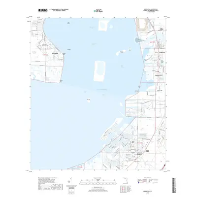
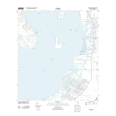 2012 Gibsonton2012 Print · USGSCovers Old Bayshore Point, including Tampa, Apollo Key Village, and other nearby areas
 - 2015 Map of Gibsonton, 2015 Print
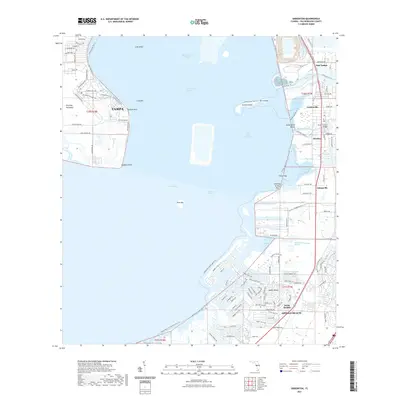
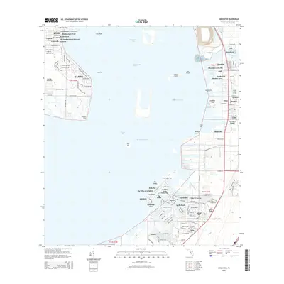 2015 Gibsonton2015 Print · USGSCovers Old Bayshore Point, including Tampa, Apollo Key Village, and other nearby areas
 - 2018 Map of Gibsonton, 2018 Print
 2018 Gibsonton2018 Print · USGSCovers Old Bayshore Point, including Tampa, Apollo Key Village, and other nearby areas
 - 2021 Map of Gibsonton, 2021 Print
 2021 Gibsonton2021 Print · USGSCovers Old Bayshore Point, including Tampa, Apollo Key Village, and other nearby areas
 - 2024 Map of Gibsonton, 2024 Print
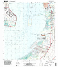
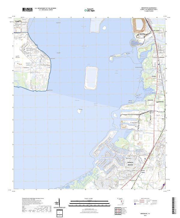 2024 Gibsonton2024 Print · USGSCoastal Hillsborough County and the eastern edge of the Interbay Peninsula appear here in the early twenty-first century. Researchers can trace the layout of MacDill Air Force Base and locate smaller settlements like Remlap, Adamsville, and Gardenville.
End of results
Showing maps 1-16 of 16
Top cities near Old Bayshore Point
- Tampa historical maps
- Saint Petersburg historical maps
- Clearwater historical maps
- Brandon historical maps
- Largo historical maps
- Riverview historical maps
See more
Frequently asked questions
- What are the different types of historical maps available for Old Bayshore Point?
- What is the oldest map of Old Bayshore Point?
- Where can I purchase historical maps of Old Bayshore Point for my home or office?
- Where can I download high-res historical maps of Old Bayshore Point?
- Are there historical topographic maps available for Old Bayshore Point?
- Is there historical aerial imagery available for Old Bayshore Point?
- Where are historical maps of Old Bayshore Point sourced from?