1980s Maps of Jackson County, Florida
Explore 25 historic maps of Jackson County from the 1980s. These maps offer a rare glimpse into what life looked like during the 1980s — showing old roads, neighborhoods, homes, and landmarks that have changed or disappeared over time.
Whether you're researching your family's past, planning a metal detecting trip, or studying how Jackson County's landscape evolved across the 1980s, these high-resolution maps are a powerful tool for exploring the history of this region.
- Focus on a specific era: All maps on this page are from the 1980s, giving you a focused view of this time period.
- See what’s changed: Compare century-old streets, trails, and buildings to today's modern landscape using overlays and satellite layers.
- Research with precision: Use these maps for genealogy, historical research, land use analysis, or educational projects.
- View, download, or print: Maps are fully viewable online in high resolution, and can be downloaded or printed for your own records.
Start exploring Jackson County's history through authentic maps from the 1980s. This is your window into the past.
Jackson County, FL maps
(25)- 1981 Map of Dothan, 1982 Print
 1981 Dothan1982 Print · USGSSoutheast Alabama and the tri-state border region are shown here in the early 1980s as the area thrived on military and rail connectivity. Researchers can trace historic transit lines like the Hartford and Slocomb railroad or locate family roots in Ozark, Headland, and Geneva.
 - 1982 Map of Campbellton
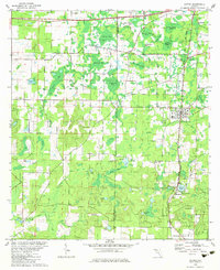
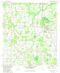 1982 Campbellton1982 Print · USGSJackson County and the Florida-Alabama border appear here in the early eighties as a landscape of crossroads settlements and small-town junctions. Genealogists can trace family landmarks like Hinson Cem and Salem Ch along the Atlanta and Saint Andrews Bay rail line.2 unique versions available
 - 1982 Map of Cottondale East
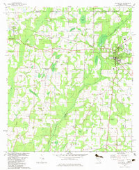
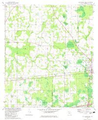
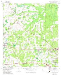 1982 Cottondale East1982 Print · USGSJackson County is captured here in the early 1980s, showing the settlement corridor between MARIANNA and Cottondale. Genealogists and historians can trace family landmarks like Waddells Cem, Christoff Ferry Landing, and the Dozier Training Sch.
 - 1982 Map of Kynesville
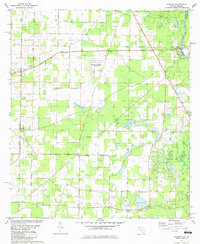
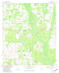
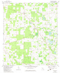
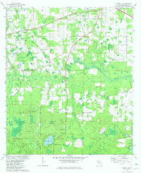 1982 Kynesville1982 Print · USGSJackson County rural life is captured here in the early eighties, showcasing a landscape of family-named lakes and country churches. Genealogists can locate significant sites like Victory Cem, Lee and McCormick Ch, and the settlement of Kynesville.
 - 1982 Map of Oakdale
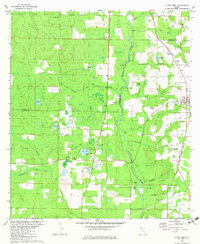
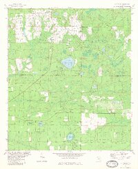
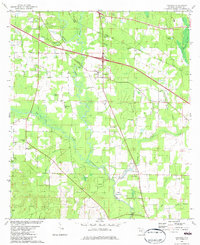 1982 Oakdale1982 Print · USGSJackson County rural life in the early eighties is centered here on the Chipola River and its many winding tributaries. Genealogists can trace family roots through numerous small burial sites and community centers like Pledger Cem, Marvin Ch, and Simsville.
 - 1982 Map of Compass Lake
 1982 Compass Lake1982 Print · USGSThe Florida Panhandle's lake country is captured here in the early eighties as the borders of four counties converge. Genealogists and local historians can locate rural landmarks like Sandy Mountain Ch, the small community of Betts, and the rail line of the Atlanta and Saint Andrews Bay Railway.
 - 1982 Map of Bascom
 1982 Bascom1982 Print · USGSUpper Jackson County at the Georgia border shows a landscape of river landings and rural crossroads in the early eighties. Genealogists can locate family landmarks like Bazzell Cem, Shiloh Ch, and the site of Auxiliary Field No 3 (Abandoned).
 - 1982 Map of Chipley
 1982 Chipley1982 Print · USGSChipley and its surrounding bayous are captured here in the early eighties as the town grew at the intersection of rail and road. Researchers can trace family roots at Limestone Cem, find the Richter Crossroads settlement, or locate the Tri County Airport.
 - 1982 Map of Sneads
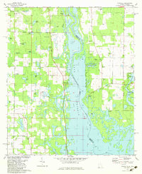
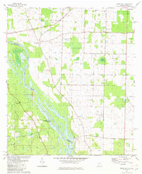
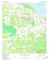 1982 Sneads1982 Print · USGSThe Florida-Georgia borderlands come to life in this early 1980s record of Jackson County, where the massive reservoir meets the winding river system. Genealogists and local historians can trace family sites at Yan Cem and Sinai Cem or locate the infrastructure of Sneads and Grand Ridge.
 - 1982 Map of Altha East
 1982 Altha East1982 Print · USGSThe rural border of Jackson and Calhoun counties is captured here in the early 1980s as a landscape of timber and wetlands. Local historians can trace the foundations of Alliance and Macedonia or locate family sites like Barton Cem and Henderson Mill.
 - 1982 Map of Chattahoochee, 1983 Print
 1982 Chattahoochee1983 Print · USGSFlorida's riverfront history is on display here in the early 1980s, where the Flint and Apalachicola Rivers converge at the state line. Trace the extensive STATE HOSPITAL grounds and the rail junction at River Junction, or locate family sites like Farrell Cem and Rosedale.
 - 1982 Map of Altha West, 1983 Print
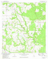
 1982 Altha West1983 Print · USGSNorth Florida’s riverine landscape is captured here in the early eighties, centered on the Chipola River and the rural town of Altha. Local researchers can trace family landmarks like Ritchards Cem and Page Ch, or follow the path of the Old Railroad Grade.
 - 1982 Map of Graceville, 1983 Print
 1982 Graceville1983 Print · USGSThe Florida-Alabama borderlands come into focus in the early eighties, showcasing the agricultural and rail-oriented landscape around Graceville. Genealogists and historians can trace community roots at Cem Liberty Hill Ch, Damascus Ch, and the site of Collins Mill.2 unique versions available
 - 1982 Map of Malone, 1983 Print
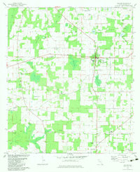 1982 Malone1983 Print · USGSUpper Jackson County during the early eighties shows a transition from structured town centers to a landscape of named ponds and bays. Genealogists and local historians can trace the locations of Union Grove Sch, Coonrod Cem, and the U. S. Coast Guard Station.
 - 1982 Map of Cypress, 1983 Print
 1982 Cypress1983 Print · USGSJackson County's rural character is on full display in the early eighties, centered on the historic rail corridor between Cypress and Grand Ridge. Genealogists and local historians can trace legacy landmarks like Providence Ch, Logan Cem, and Lake Finney.
 - 1982 Map of Alford SE, 1983 Print
 1982 Alford SE1983 Print · USGSThe Florida Panhandle near the Jackson and Calhoun county line is shown here in the early eighties as residential growth began to meet rural tradition. Genealogists and local historians can locate Melvin, the Camps Head Ch, and family landmarks like Pippin Cem.
 - 1982 Map of Cottondale West, 1983 Print
 1982 Cottondale West1983 Print · USGSThe Florida Panhandle's rail and timber landscape is well-preserved here in the early eighties, showing the junction of the Louisville and Nashville and Atlanta and St Andrews Bay lines. Researchers can trace rural church history at Pilgrim Rest Ch or locate family landmarks like Gilberts Mill Creek and Still Hammock.
 - 1982 Map of Fairchild, 1983 Print
 1982 Fairchild1983 Print · USGSThe Georgia-Florida borderlands come into focus in the early eighties as Lake Seminole reshapes the river valley. Genealogists and local historians can trace family-named sites like Wooten Cem, Butlers Ferry Landing, and the settlement at Haynes.
 - 1982 Map of Alford, 1983 Print
 1982 Alford1983 Print · USGSJackson County in the early eighties shows a landscape of timber-rich wetlands and rail-line settlements. Genealogists can trace family names and local sites like Kent Mill, Gilberts Mill, and Sapp Cem along the Atlanta and Saint Andrews Bay rail corridor.
 - 1982 Map of Rock Bluff, 1983 Print
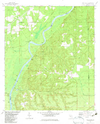 1982 Rock Bluff1983 Print · USGSThe Apalachicola River bluffs of Liberty County are captured here in the early eighties, centered on the diverse terrain of Torreya State Park. Researchers can trace old river access points like Hickory Landing and Porters Landing alongside several local churches and burial sites.
 - 1982 Map of Steam Mill, 1983 Print
 1982 Steam Mill1983 Print · USGSThe Florida-Georgia borderland along the Chattahoochee River is captured here in the early eighties as Lake Seminole reaches into the Seminole County countryside. Researchers can trace family history through numerous sites like Williams Cem, Lela Courthouse, and the settlement at Steam Mill.
 - 1982 Map of Sills, 1983 Print
 1982 Sills1983 Print · USGSThe Florida-Alabama borderlands in the early eighties were a mosaic of wetlands and small rural congregations. Genealogists can trace family footprints through numerous community landmarks like Waddells Mill Pond, Ephesus Ch, and the Hart Cem.
 - 1982 Map of Dellwood, 1983 Print
 1982 Dellwood1983 Print · USGSJackson County in the early eighties was a landscape of small farming communities and numerous named basins. You can trace family roots through several landmarks like Two Egg, Fulgum Cem, and Cypress Grove Ch.
 - 1982 Map of Marianna, 1983 Print
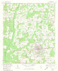
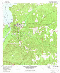
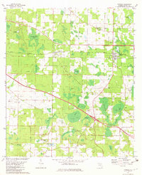
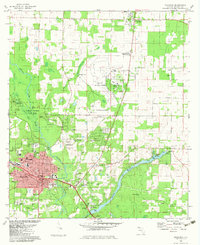 1982 Marianna1983 Print · USGSJackson County during the early eighties reveals a hub of education, rail transport, and unique geology. Genealogists and historians can trace the foundations of Marianna through its schools and churches, including Jackson Christian Sch and the well-placed Riverside Cem.
 - 1988 Map of Tallahassee
 1988 Tallahassee1988 Print · USGSThe Florida Panhandle and South Georgia are captured here in the late eighties, showing the expansion of the regional highway network and coastal growth. Genealogists and historians can trace rail lines like the Seaboard System Railroad or locate family roots in Blountstown, Graceville, or Crawfordville.2 unique versions available
End of results
Showing maps 1-25 of 25
Top cities of Jackson County
- Marianna historical maps
- Graceville historical maps
- Malone historical maps
- Sneads historical maps
- Cottondale historical maps
- Grand Ridge historical maps
See more
Frequently asked questions
- What are the different types of historical maps available for Jackson County?
- What is the oldest map of Jackson County?
- Where can I purchase historical maps of Jackson County for my home or office?
- Where can I download high-res historical maps of Jackson County?
- Are there historical topographic maps available for Jackson County?
- Is there historical aerial imagery available for Jackson County?
- Where are historical maps of Jackson County sourced from?