Old Maps of Grand Ridge, Florida for Metal Detecting
Plan your next treasure hunt with 23 historic maps of Grand Ridge. Find old homesites, ghost towns, trails, and gathering spots that may be lost to time — perfect for identifying promising metal detecting locations.
- Locate forgotten sites: Uncover places like long-lost settlements, abandoned rail lines, or gathering spots.
- Plan better hunts: Use map overlays combined with LiDAR or satellite views to narrow in on historically rich areas.
- Made for detectorists: Thousands of hobbyists use these maps to discover relics, coins, and hidden history.
Use these historic maps to boost your research and find new opportunities beneath the surface of Grand Ridge.
Grand Ridge, FL maps
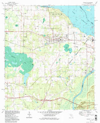
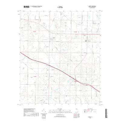
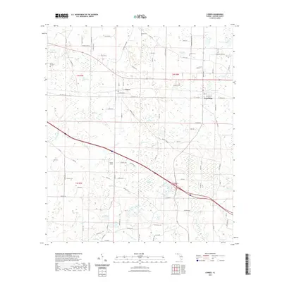
(23)- 1952 Map of Cypress, 1953 Print
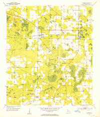 1952 Cypress1953 Print · USGSJackson County in the early fifties shows a landscape of rail-side towns and scattered rural homesteads defined by its unique cypress wetlands. Genealogists can trace family names through numerous landmarks like Logan Cemetery, Antioch Church, and Strickland Lake.
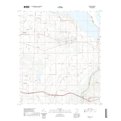
 - 1954 Map of Sneads, 1955 Print
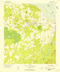 1954 Sneads1955 Print · USGSSneads and the surrounding Jackson County bottomlands are captured here in the mid-1950s as the riverfront landscape was being reshaped by the Jim Woodruff Reservoir. Researchers can trace family-named sites and rural institutions like Inwood Ch, Pope Cem, and the Grand Ridge Lookout Tower.2 unique versions available
 - 1954 Map of Tallahassee, 1967 Print
 1954 Tallahassee1967 Print · USGSThe Florida Panhandle and South Georgia are captured here during a period of mid-century growth and military expansion. Researchers can trace the development of Panama City, the footprint of Tyndall Air Force Base, and the rail lines of the Atlantic Coast Line.4 unique versions available
 - 1959 Map of Tallahassee
 1959 Tallahassee1959 Print · USGSFlorida's Panhandle and the Big Bend region appear here in the mid-fifties, showing a landscape defined by its great river systems and developing coast. Trace the early layout of Panama City, the expansive Apalachicola National Forest, and the coastal St Marks Lighthouse.
 - 1960 Map of Tallahassee
 1960 Tallahassee1960 Print · USGSThe Florida Panhandle and southern Georgia are captured here in the mid-twentieth century, showing a region defined by its rivers and military installations. Genealogists and historians can trace the growth of Tallahassee or locate coastal landmarks like the St Marks Lighthouse and Tyndall Air Force Base.
 - 1978 Map of Bainbridge, 1980 Print
 1978 Bainbridge1980 Print · USGSIn the late seventies, this Georgia-Florida borderland was defined by the confluence of the Flint and Chattahoochee rivers. Trace the region's infrastructure via the Seaboard Coast Line Railroad and find sites like Bainbridge State Hospital.
 - 1979 Map of Marianna, 1980 Print
 1979 Marianna1980 Print · USGSFlorida's northern panhandle and the neighboring Alabama-Georgia borderlands are captured here in the late seventies. Genealogists and local historians can trace family roots through settlements like Graceville and Cottondale or follow the historic Louisville and Nashville rail lines.2 unique versions available
 - 1982 Map of Sneads
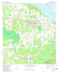 1982 Sneads1982 Print · USGSThe Florida-Georgia borderlands come to life in this early 1980s record of Jackson County, where the massive reservoir meets the winding river system. Genealogists and local historians can trace family sites at Yan Cem and Sinai Cem or locate the infrastructure of Sneads and Grand Ridge.
 - 1982 Map of Cypress, 1983 Print
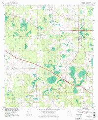
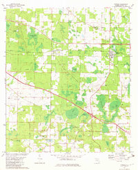 1982 Cypress1983 Print · USGSJackson County's rural character is on full display in the early eighties, centered on the historic rail corridor between Cypress and Grand Ridge. Genealogists and local historians can trace legacy landmarks like Providence Ch, Logan Cem, and Lake Finney.
 - 1988 Map of Tallahassee
 1988 Tallahassee1988 Print · USGSThe Florida Panhandle and South Georgia are captured here in the late eighties, showing the expansion of the regional highway network and coastal growth. Genealogists and historians can trace rail lines like the Seaboard System Railroad or locate family roots in Blountstown, Graceville, or Crawfordville.2 unique versions available
 - 1994 Map of Sneads, 1998 Print
 1994 Sneads1998 Print · USGSJackson County, Florida, is captured here in the 1990s as a vital crossroads of river commerce and state conservation. Researchers can trace historic family burial sites and local congregations including Sardis Cem, St Peter Cem, and Sinai Ch.
 - 1994 Map of Cypress, 1998 Print
 1994 Cypress1998 Print · USGSJackson County in the 1990s remained a landscape of quiet crossroads and extensive wetlands. Researchers can trace family history through numerous small burial grounds like Stephens Cem or locate rural centers such as Grand Ridge and Cypress.
 - 2011 Map of Sneads, 2011 Print
 2011 Sneads2011 Print · USGSCovers Grand Ridge, including Sneads, Inwood, and other nearby areas
 - 2012 Map of Cypress, 2012 Print
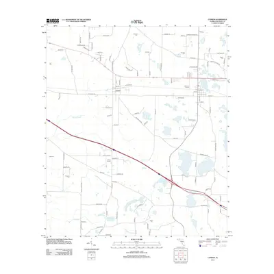 2012 Cypress2012 Print · USGSCovers Grand Ridge, including Cypress, Jackson County, and other nearby areas
 - 2012 Map of Sneads, 2012 Print
 2012 Sneads2012 Print · USGSCovers Grand Ridge, including Sneads, Inwood, and other nearby areas
 - 2015 Map of Cypress, 2015 Print
 2015 Cypress2015 Print · USGSCovers Grand Ridge, including Cypress, Jackson County, and other nearby areas
 - 2015 Map of Sneads, 2015 Print
 2015 Sneads2015 Print · USGSCovers Grand Ridge, including Sneads, Inwood, and other nearby areas
 - 2018 Map of Sneads, 2018 Print
 2018 Sneads2018 Print · USGSCovers Grand Ridge, including Sneads, Inwood, and other nearby areas
 - 2018 Map of Cypress, 2018 Print
 2018 Cypress2018 Print · USGSCovers Grand Ridge, including Cypress, Jackson County, and other nearby areas
 - 2021 Map of Sneads, 2021 Print
 2021 Sneads2021 Print · USGSCovers Grand Ridge, including Sneads, Inwood, and other nearby areas
 - 2021 Map of Cypress, 2021 Print
 2021 Cypress2021 Print · USGSCovers Grand Ridge, including Cypress, Jackson County, and other nearby areas
 - 2024 Map of Sneads, 2024 Print
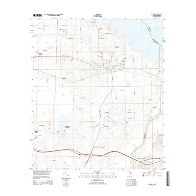
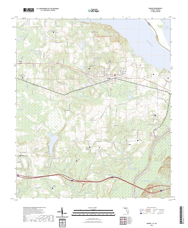 2024 Sneads2024 Print · USGSThe eastern edge of Jackson County meets the Georgia state line at the wide Chattahoochee River in this modern topographic survey. Genealogists and local historians can locate several family burial sites, including the Angel Rest Family Cem and Childs Memorial Family Gardens Cem, alongside the established communities of Sneads and Grand Ridge.
 - 2024 Map of Cypress, 2024 Print
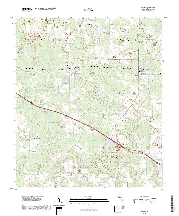 2024 Cypress2024 Print · USGSJackson County settlement and agriculture are on full display in this modern survey of the Grand Ridge area. Family historians can locate dozens of local landmarks, from Stephens Cem and Logan Cem to the namesake Cypress Community Church.
End of results
Showing maps 1-23 of 23
Top cities near Grand Ridge
- Marianna historical maps
- Chattahoochee historical maps
- Sneads historical maps
- Greenwood historical maps
- Altha historical maps
Frequently asked questions
- What are the different types of historical maps available for Grand Ridge?
- What is the oldest map of Grand Ridge?
- Where can I purchase historical maps of Grand Ridge for my home or office?
- Where can I download high-res historical maps of Grand Ridge?
- Are there historical topographic maps available for Grand Ridge?
- Is there historical aerial imagery available for Grand Ridge?
- Where are historical maps of Grand Ridge sourced from?