Old Maps of Bonita Springs, Lee County for Genealogy
Trace your family roots with 10 historic maps of Bonita Springs. These high-res maps reveal old neighborhoods, homesites, landmarks, and streets — helping you uncover where your ancestors lived and how the area evolved over time.
- Explore historic neighborhoods: Identify where your relatives may have lived in the 1800s or 1900s.
- Compare maps over time: Trace the changes in streets, buildings, and landmarks for multi-generational research.
- Perfect for genealogy & ancestry research: Used by family historians and researchers to map out lineage and migration.
These maps are an incredible resource for exploring your personal connection to Bonita Springs's past.
Bonita Springs, Lee County maps
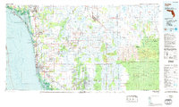
(10)- 1956 Map of West Palm Beach, 1964 Print
 1956 West Palm Beach1964 Print · USGSCovers Bonita Springs, including Fort Lauderdale, Cape Coral, and other nearby areas2 unique versions available
 - 1957 Map of West Palm Beach
 1957 West Palm Beach1957 Print · USGSCovers Bonita Springs, including Fort Lauderdale, Cape Coral, and other nearby areas
 - 1958 Map of West Palm Beach
 1958 West Palm Beach1958 Print · USGSCovers Bonita Springs, including Fort Lauderdale, Cape Coral, and other nearby areas2 unique versions available
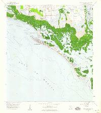
 - 1958 Map of Bonita Springs, 1959 Print
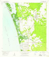 1958 Bonita Springs1959 Print · USGSCovers Bonita Springs, including Pelican Bay, Hawthorne, and other nearby areas5 unique versions available
 - 1958 Map of Corkscrew NW, 1959 Print
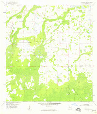 1958 Corkscrew NW1959 Print · USGSCovers Bonita Springs, including Wildcat Run, Corkscrew Lakes, and other nearby areas4 unique versions available
 - 1958 Map of Estero, 1959 Print
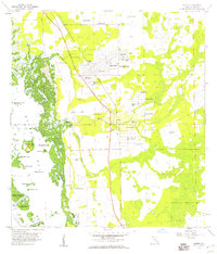 1958 Estero1959 Print · USGSCovers Bonita Springs, including El Dorado Acres, Forest Island Park, and other nearby areas6 unique versions available
 - 1958 Map of Corkscrew SW, 1959 Print
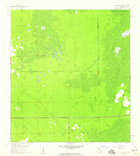 1958 Corkscrew SW1959 Print · USGSCovers Bonita Springs, including Bonita National Golf & Country Club, Village Walk, and other nearby areas4 unique versions available
 - 1958 Map of Fort Myers Beach, 1959 Print
 1958 Fort Myers Beach1959 Print · USGSCovers Bonita Springs, including Fort Myers Beach, Bayside Estates, and other nearby areas5 unique versions available
 - 1985 Map of Naples, 1986 Print
 1985 Naples1986 Print · USGSCovers Bonita Springs, including Immokalee, Immokalee, and other nearby areas2 unique versions available
 - 1987 Map of West Palm Beach, 1988 Print
 1987 West Palm Beach1988 Print · USGSCovers Bonita Springs, including Fort Lauderdale, Cape Coral, and other nearby areas2 unique versions available
End of results
Showing maps 1-10 of 10
Frequently asked questions
- What are the different types of historical maps available for Bonita Springs?
- What is the oldest map of Bonita Springs?
- Where can I purchase historical maps of Bonita Springs for my home or office?
- Where can I download high-res historical maps of Bonita Springs?
- Are there historical topographic maps available for Bonita Springs?
- Is there historical aerial imagery available for Bonita Springs?
- Where are historical maps of Bonita Springs sourced from?