Old Maps of Bonita Springs, Lee County for Hiking & Exploration
Hike through history with 10 historic maps of Bonita Springs. Explore old trails, ghost towns, and forgotten backroads — perfect for outdoor adventurers and local explorers.
- Rediscover forgotten places: Map out old mining camps, roads, and footpaths that no longer exist on modern maps.
- Layer with modern tools: Combine with LiDAR or satellite views to plan hikes through historical terrain.
- Made for exploration: Popular among hikers, overlanders, and local history lovers.
Use these maps to find adventure and explore the hidden past of Bonita Springs.
Bonita Springs, Lee County maps
(10)- 1956 Map of West Palm Beach, 1964 Print
 1956 West Palm Beach1964 Print · USGSCovers Bonita Springs, including Fort Lauderdale, Cape Coral, and other nearby areas2 unique versions available
 - 1957 Map of West Palm Beach
 1957 West Palm Beach1957 Print · USGSCovers Bonita Springs, including Fort Lauderdale, Cape Coral, and other nearby areas
 - 1958 Map of West Palm Beach
 1958 West Palm Beach1958 Print · USGSCovers Bonita Springs, including Fort Lauderdale, Cape Coral, and other nearby areas2 unique versions available
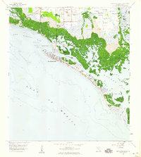
 - 1958 Map of Bonita Springs, 1959 Print
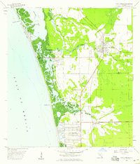 1958 Bonita Springs1959 Print · USGSCovers Bonita Springs, including Pelican Bay, Hawthorne, and other nearby areas5 unique versions available
 - 1958 Map of Corkscrew NW, 1959 Print
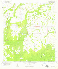 1958 Corkscrew NW1959 Print · USGSCovers Bonita Springs, including Wildcat Run, Corkscrew Lakes, and other nearby areas4 unique versions available
 - 1958 Map of Estero, 1959 Print
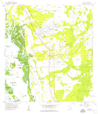 1958 Estero1959 Print · USGSCovers Bonita Springs, including El Dorado Acres, Forest Island Park, and other nearby areas6 unique versions available
 - 1958 Map of Corkscrew SW, 1959 Print
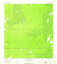 1958 Corkscrew SW1959 Print · USGSCovers Bonita Springs, including Bonita National Golf & Country Club, Village Walk, and other nearby areas4 unique versions available
 - 1958 Map of Fort Myers Beach, 1959 Print
 1958 Fort Myers Beach1959 Print · USGSCovers Bonita Springs, including Fort Myers Beach, Bayside Estates, and other nearby areas5 unique versions available
 - 1985 Map of Naples, 1986 Print
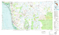 1985 Naples1986 Print · USGSCovers Bonita Springs, including Immokalee, Immokalee, and other nearby areas2 unique versions available
 - 1987 Map of West Palm Beach, 1988 Print
 1987 West Palm Beach1988 Print · USGSCovers Bonita Springs, including Fort Lauderdale, Cape Coral, and other nearby areas2 unique versions available
End of results
Showing maps 1-10 of 10
Frequently asked questions
- What are the different types of historical maps available for Bonita Springs?
- What is the oldest map of Bonita Springs?
- Where can I purchase historical maps of Bonita Springs for my home or office?
- Where can I download high-res historical maps of Bonita Springs?
- Are there historical topographic maps available for Bonita Springs?
- Is there historical aerial imagery available for Bonita Springs?
- Where are historical maps of Bonita Springs sourced from?