1940s Maps of Jensen Beach, Florida
Explore 4 historic maps of Jensen Beach from the 1940s. These maps offer a rare glimpse into what life looked like during the 1940s — showing old roads, neighborhoods, homes, and landmarks that have changed or disappeared over time.
Whether you're researching your family's past, planning a metal detecting trip, or studying how Jensen Beach's landscape evolved across the 1940s, these high-resolution maps are a powerful tool for exploring the history of this region.
- Focus on a specific era: All maps on this page are from the 1940s, giving you a focused view of this time period.
- See what’s changed: Compare century-old streets, trails, and buildings to today's modern landscape using overlays and satellite layers.
- Research with precision: Use these maps for genealogy, historical research, land use analysis, or educational projects.
- View, download, or print: Maps are fully viewable online in high resolution, and can be downloaded or printed for your own records.
Start exploring Jensen Beach's history through authentic maps from the 1940s. This is your window into the past.
Jensen Beach, FL maps
(4)- 1948 Map of Palm City, 1956 Print
 1948 Palm City1956 Print · USGSThe St. Lucie River waterfront comes alive in this post-war survey, showing the rail and river networks of the Florida coast. Researchers can trace the development of Stuart and Palm City alongside landmarks like the Roosevelt Bridge and Union Ch.5 unique versions available
 - 1948 Map of Ankona, 1956 Print
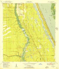 1948 Ankona1956 Print · USGSThe St. Lucie riverfront and coastal lagoons appear here in the late 1940s, just as the regional drainage and transport networks were maturing. Researchers can trace early infrastructure through the Florida East Coast rail line and communities like White City and Ankona.4 unique versions available
 - 1948 Map of St. Lucie Inlet, 1958 Print
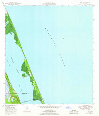
 1948 St. Lucie Inlet1958 Print · USGSCoastal Martin County comes alive in this post-war survey of the riverfronts and barrier islands near the St Lucie Inlet. Researchers can trace the rail corridor of the Florida East Coast, early neighborhoods like Rio and Salerno, and the sprawling grounds of Witham Field.4 unique versions available
 - 1948 Map of Eden, 1965 Print
 1948 Eden1965 Print · USGSThe Florida coast near the St. Lucie and Martin County line appears here just after the war, defined by the narrow barrier of Hutchinson Island. You can trace the path of the Florida East Coast railway through Eden and find the early footprint of Jensen Beach.3 unique versions available
End of results
Showing maps 1-4 of 4
Top cities near Jensen Beach
- Port Saint Lucie historical maps
- Fort Pierce historical maps
- Stuart historical maps
- Port Salerno historical maps
- River Park historical maps
- White City historical maps
See more
Top neighborhoods of Jensen Beach
Frequently asked questions
- What are the different types of historical maps available for Jensen Beach?
- What is the oldest map of Jensen Beach?
- Where can I purchase historical maps of Jensen Beach for my home or office?
- Where can I download high-res historical maps of Jensen Beach?
- Are there historical topographic maps available for Jensen Beach?
- Is there historical aerial imagery available for Jensen Beach?
- Where are historical maps of Jensen Beach sourced from?