Old Maps of Fernandina Beach, Nassau County for Hiking & Exploration
Hike through history with 23 historic maps of Fernandina Beach. Explore old trails, ghost towns, and forgotten backroads — perfect for outdoor adventurers and local explorers.
- Rediscover forgotten places: Map out old mining camps, roads, and footpaths that no longer exist on modern maps.
- Layer with modern tools: Combine with LiDAR or satellite views to plan hikes through historical terrain.
- Made for exploration: Popular among hikers, overlanders, and local history lovers.
Use these maps to find adventure and explore the hidden past of Fernandina Beach.
Fernandina Beach, Nassau County maps
(23)- 1919 Map of Fernandina
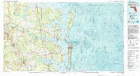
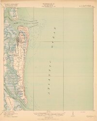 1919 Fernandina1919 Print · USGSCoastal Florida and Georgia meet at the mouth of the St Marys River in this survey from the late nineteen-teens. Historians can trace the early waterfront at Fernandina, the military grounds of Ft Clinch, and the remote settlement of Franklintown.4 unique versions available
 - 1944 Map of Fernandina
 1944 Fernandina1944 Print · USGSThe Florida-Georgia borderlands come to life in this mid-forties coastal survey of Nassau County and its barrier islands. Genealogists and historians can trace the early footprints of Old Fernandina and Franklintown or locate landmarks like Ft Clinch and the U S Quarantine Sta.
 - 1948 Map of Jacksonville
 1948 Jacksonville1948 Print · USGSNortheast Florida and Southeast Georgia's coastal waterways and railroad towns are captured here in the years following the war. Genealogists can trace family connections through river towns like St Marys or identify long-standing military landmarks like Jacksonville NAS.
 - 1957 Map of Jacksonville, 1967 Print
 1957 Jacksonville1967 Print · USGSCoastal Florida and Georgia meet in the late fifties, showcasing a landscape of naval aviation, deep-water terminals, and barrier island communities. Researchers can trace the mid-century footprints of NAS Jacksonville, find small communities like Franklintown, and locate the historic Fort Clinch State Park.3 unique versions available
 - 1958 Map of Fernandina Beach, 1959 Print
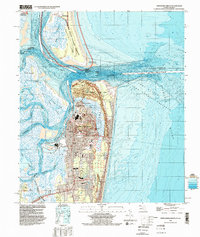
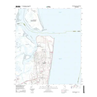
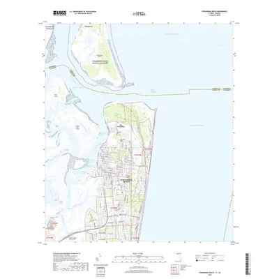
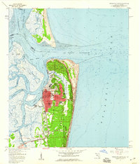 1958 Fernandina Beach1959 Print · USGSCoastal Nassau County comes alive in the late fifties, showcasing the intricate tidal marshes and maritime boundaries of the Florida-Georgia line. Researchers can trace the layout of Fernandina Beach, from St Josephs Academy to the historic Amelia Island Lighthouse.2 unique versions available
 - 1958 Map of Amelia City, 1959 Print
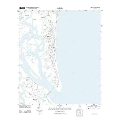
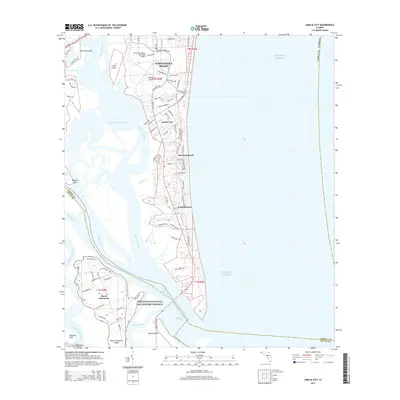
 1958 Amelia City1959 Print · USGSCoastal Amelia Island is captured here in the late fifties, showing the barrier island's early settlements and vast marsh systems. Researchers can locate the historic community of American Beach, the site of St Pauls Ch, and the winding Buccaneer Trail.6 unique versions available
 - 1959 Map of Jacksonville
 1959 Jacksonville1959 Print · USGSNortheast Florida and Southeast Georgia are seen here in the late fifties, dominated by the maritime activity of the St Johns River and the Atlantic coast. Researchers can trace the mid-century layout of Jacksonville and identify sprawling military sites like Camp Blanding Military Reservation and Kings Bay Ammunition Terminal.
 - 1960 Map of Jacksonville
 1960 Jacksonville1960 Print · USGSCoastal Florida and Georgia meet in this mid-century portrait of a region shaped by naval power and the winding St Johns River. Researchers can trace the development of military sites like Cecil Field or locate historic rural landmarks such as Jerusalem Ch and Kings Ferry.
 - 1981 Map of Fernandina Beach
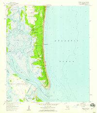
 1981 Fernandina Beach1981 Print · USGSCoastal Florida and Georgia meet at this maritime crossroads in the early eighties, where river and ocean currents converge. Trace the historic fortifications of Fort Clinch and the layout of Old Fernandina alongside the Amelia Island Lighthouse.4 unique versions available
 - 1981 Map of Fernandina Beach, 1982 Print
 1981 Fernandina Beach1982 Print · USGSThe coastal borderlands of Georgia and Florida are captured here in the early eighties, from the barrier islands to the rail towns of the interior. Genealogists and historians can trace family-named bluffs and sites like Franklintown, Dungeness Wharf, and St Marys Historical Park.3 unique versions available
 - 1988 Map of Jacksonville
 1988 Jacksonville1988 Print · USGSCoastal Florida and Georgia are captured here during the late eighties, documenting the rapid growth of the First Coast and its vital military installations. Researchers can trace the development of beach communities like Fernandina Beach and Atlantic Beach or locate family landmarks near Mickler Landing and Orange Park.
 - 1994 Map of Fernandina Beach, 2002 Print
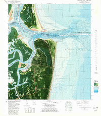
 1994 Fernandina Beach2002 Print · USGSAmelia Island and the Georgia-Florida border are captured here in the mid-nineties, showing the intersection of coastal history and modern infrastructure. Genealogists and historians can locate Old Fernandina, Bosque Bello Cem, and schools like Southside Sch.
 - 2011 Map of Fernandina Beach, 2011 Print
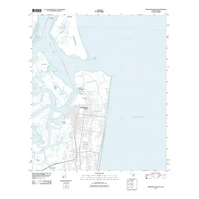 2011 Fernandina Beach2011 Print · USGSCovers Fernandina Beach, including Dungeness, Old Fernandina, and other nearby areas
 - 2012 Map of Fernandina Beach, 2012 Print
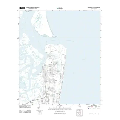 2012 Fernandina Beach2012 Print · USGSCovers Fernandina Beach, including Dungeness, Old Fernandina, and other nearby areas
 - 2012 Map of Amelia City, 2012 Print
 2012 Amelia City2012 Print · USGSCovers Fernandina Beach, including Jacksonville, Franklintown, and other nearby areas
 - 2015 Map of Amelia City, 2015 Print
 2015 Amelia City2015 Print · USGSCovers Fernandina Beach, including Jacksonville, Franklintown, and other nearby areas
 - 2015 Map of Fernandina Beach, 2015 Print
 2015 Fernandina Beach2015 Print · USGSCovers Fernandina Beach, including Dungeness, Old Fernandina, and other nearby areas
 - 2018 Map of Fernandina Beach, 2018 Print
 2018 Fernandina Beach2018 Print · USGSCovers Fernandina Beach, including Dungeness, Old Fernandina, and other nearby areas
 - 2018 Map of Amelia City, 2018 Print
 2018 Amelia City2018 Print · USGSCovers Fernandina Beach, including Jacksonville, Franklintown, and other nearby areas
 - 2021 Map of Amelia City, 2021 Print
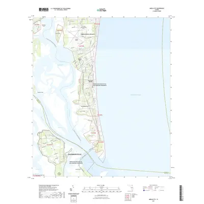 2021 Amelia City2021 Print · USGSCovers Fernandina Beach, including Jacksonville, Franklintown, and other nearby areas
 - 2021 Map of Fernandina Beach, 2021 Print
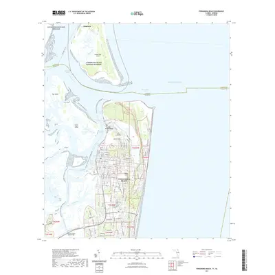 2021 Fernandina Beach2021 Print · USGSCovers Fernandina Beach, including Dungeness, Old Fernandina, and other nearby areas
 - 2024 Map of Amelia City, 2024 Print
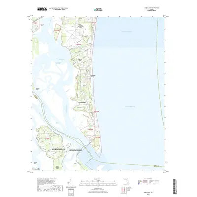
 2024 Amelia City2024 Print · USGSNassau County's barrier islands and maritime forests are detailed in the 2020s, showing the settled coastal reaches of Amelia Island. Researchers can trace the layout of American Beach, locate Franklintown, or study the expansive Timucuan Ecological and Historic Preserve.
 - 2024 Map of Fernandina Beach, 2024 Print
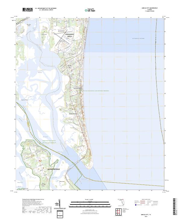
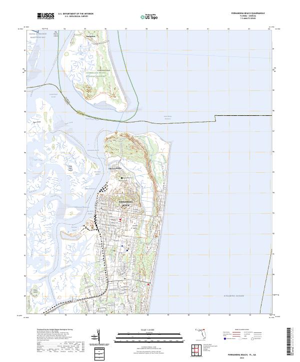 2024 Fernandina Beach2024 Print · USGSAmelia Island and the Georgia-Florida borderlands come into sharp focus in this modern survey of the Nassau County coast. Researchers can trace the historic streets of Fernandina Beach, locate the Bosque Bello Cem, and explore the northern reaches of Fort Clinch State Park.
End of results
Showing maps 1-23 of 23
Frequently asked questions
- What are the different types of historical maps available for Fernandina Beach?
- What is the oldest map of Fernandina Beach?
- Where can I purchase historical maps of Fernandina Beach for my home or office?
- Where can I download high-res historical maps of Fernandina Beach?
- Are there historical topographic maps available for Fernandina Beach?
- Is there historical aerial imagery available for Fernandina Beach?
- Where are historical maps of Fernandina Beach sourced from?