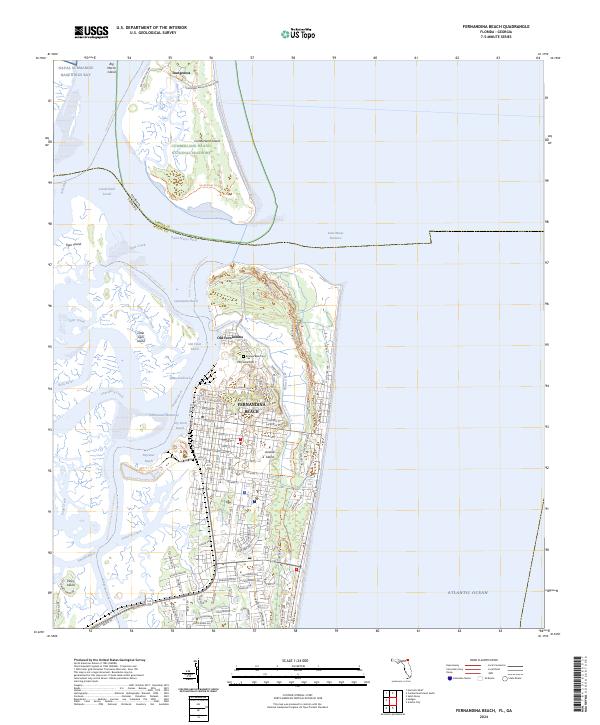
2024 Map of Fernandina Beach
USGS Topo · Published 2024About this map
Amelia Island serves as the focal point for this coastal survey, where the historic grids of Fernandina Beach and Old Fernandina meet the intricate waterways of the Atlantic coast. The map illustrates a complex network of reaches and sounds, including Quarantine Reach and Cumberland Sound, which have long defined the maritime character of this border region between Florida and Georgia. On the northern tip of the island, the grounds of Fort Clinch State Park stand across from the southern end of Cumberland Island National Seashore, separated by the Saint Marys Entrance. Internal landmarks like McClure Hill and the Bosque Bello Cem provide specific points of interest for local historians, while the Intracoastal Waterway winds through the marshes, passing industrial points like Rayonier Reach. This modern survey details the persistent maritime infrastructure and preserved landscapes that characterize the Nassau County shoreline.
Find a feature on this map
51 named features on this map. Tap any name to fly to it.
Don’t see what you’re looking for? This feature index may not catch every label — zoom into the map to look around manually.
Map Details
Editions of this 2024 Fernandina Beach Map
This is the sole edition of this map. No revisions or reprints were ever made.
Other maps of this area

1918 · St Marys
USGS Topo · 1:62,500

1918 · Cumberland Island
USGS Topo · 1:62,500

1918 · Kingsland
USGS Topo · 1:62,500

1919 · Fernandina
USGS Topo · 1:62,500

1919 · St Marys
USGS Topo · 1:62,500

1930 · Cumberland Island
USGS Topo · 1:62,500

1944 · Fernandina
USGS Topo · 1:62,500

1945 · Cumberland Island
USGS Topo · 1:62,500

1948 · Jacksonville
USGS Topo · 1:250,000

1957 · Jacksonville
USGS Topo · 1:250,000