
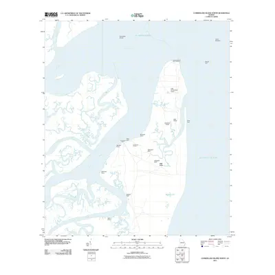
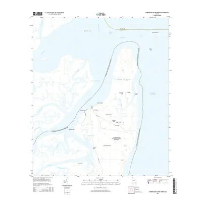
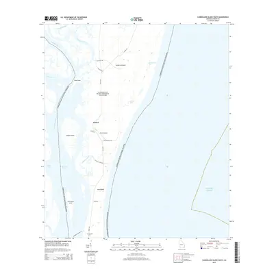
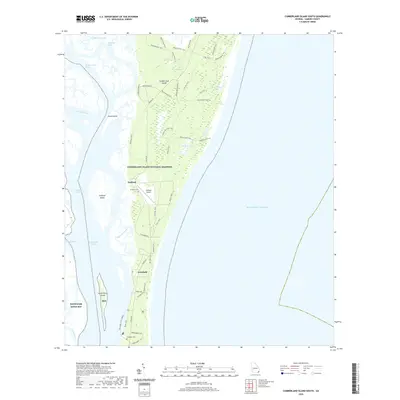
1918 Map of Cumberland Island
USGS Topo · Published 1918About this map
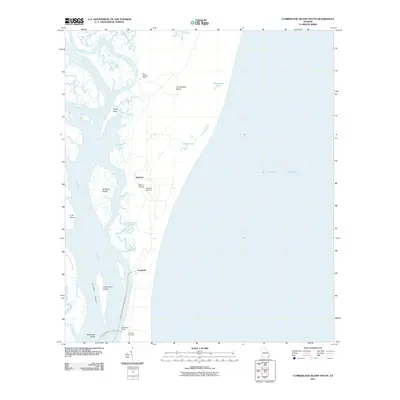
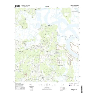
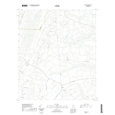
Cumberland Island is shown here as a maritime landscape of isolated wharves and coastal settlements during the early 20th century. At the north end, a Lighthouse (Abandoned) stands near Long Point, marking a shift in coastal navigation. The island's interior is dotted with small bodies of water like Whitney Lake, McCalls Pond, and Johnsons Pond, which supported the land use of the era. The western shore, buffered by Stafford Island and Drum Point Island, served as the primary interface for transport, evidenced by several maritime access points including Plum Orchard Wharf, Stafford Wharf, and Dungeness Wharf. These docks linked the island estates and the settlement at Greyfield to the mainland via the Cumberland River and Cumberland Sound. The mapping captures a moment before modern development, where transit was defined by the tides and river currents of the Satilla River and St Andrews Sound.
Find a feature on this map
30 named features on this map. Tap any name to fly to it.
Don’t see what you’re looking for? This feature index may not catch every label — zoom into the map to look around manually.
Map Details
Editions of this 1918 Cumberland Island Map
This is the sole edition of this map. No revisions or reprints were ever made.
Historical Maps of Greyfield Through Time
68 maps found

1917 Boulogne
Camden County, GA
1918 Cumberland Island
Camden County, GA

1919 Boulogne
Camden County, GA

1930 Cumberland Island
Camden County, GA

1945 Cumberland Island
Camden County, GA

1958 Cumberland Island North
Camden County, GA

1958 Cumberland Island South
Camden County, GA

1958 Harrietts Bluff
Camden County, GA

1958 Kingsland NE
Camden County, GA

1961 Dover Bluff
Camden County, GA

1975 Tarboro
Camden County, GA

1978 Jerusalem
Camden County, GA

1978 Tarboro
Camden County, GA

1979 Cumberland Island North
Camden County, GA

1979 Cumberland Island South
Camden County, GA

1979 Dover Bluff
Camden County, GA

1979 Kingsland NE
Camden County, GA

1979 St Marys
Camden County, GA

1980 Harrietts Bluff
Camden County, GA

1993 Cumberland Island North
Camden County, GA

1993 Dover Bluff
Camden County, GA

1993 Jerusalem
Camden County, GA

1993 Kingsland NE
Camden County, GA

1993 St Marys
Camden County, GA

1993 Tarboro
Camden County, GA

1994 Cumberland Island South
Camden County, GA

1994 Harrietts Bluff
Camden County, GA

1998 Cumberland Island North
Camden County, GA
2011 Cumberland Island North
Camden County, GA
2011 Cumberland Island South
Camden County, GA

2011 Dover Bluff
Camden County, GA
2011 Harrietts Bluff
Camden County, GA
2011 Jerusalem
Camden County, GA
2011 Kingsland NE
Camden County, GA
2011 Saint Marys
Camden County, GA
2011 Tarboro
Camden County, GA
2014 Cumberland Island North
Camden County, GA
2014 Cumberland Island South
Camden County, GA

2014 Dover Bluff
Camden County, GA
2014 Harrietts Bluff
Camden County, GA
2014 Jerusalem
Camden County, GA
2014 Kingsland NE
Camden County, GA
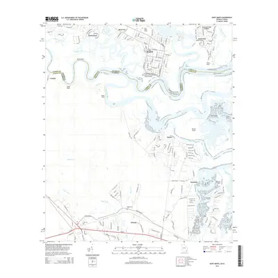
2014 Saint Marys
Camden County, GA
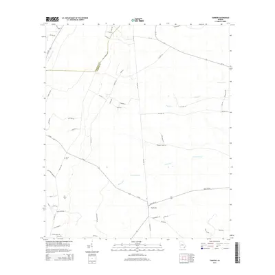
2014 Tarboro
Camden County, GA
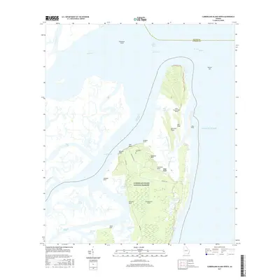
2017 Cumberland Island North
Camden County, GA
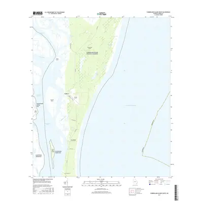
2017 Cumberland Island South
Camden County, GA

2017 Dover Bluff
Camden County, GA
2017 Harrietts Bluff
Camden County, GA
2017 Jerusalem
Camden County, GA
2017 Kingsland NE
Camden County, GA
2017 Saint Marys
Camden County, GA
2017 Tarboro
Camden County, GA

2020 Cumberland Island North
Camden County, GA
2020 Cumberland Island South
Camden County, GA

2020 Dover Bluff
Camden County, GA

2020 Harrietts Bluff
Camden County, GA
2020 Jerusalem
Camden County, GA
2020 Kingsland NE
Camden County, GA

2020 Saint Marys
Camden County, GA
2020 Tarboro
Camden County, GA

2024 Cumberland Island North
Camden County, GA

2024 Cumberland Island South
Camden County, GA

2024 Dover Bluff
Camden County, GA

2024 Harrietts Bluff
Camden County, GA

2024 Jerusalem
Camden County, GA

2024 Kingsland NE
Camden County, GA

2024 Saint Marys
Camden County, GA

2024 Tarboro
Camden County, GA