Loading...
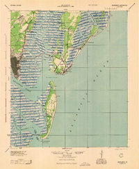
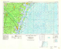
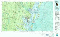
Loading map...1945 Map of Brunswick
USGS Topo · Published 1945About this map
Fort Frederica National Monument anchors the historic coastline of St Simon Island in this mid-1940s survey. The landscape is defined by its complex tidal network, where the Frederica River and Mackay River wind through extensive salt marshes. Coastal development is centered around the settlement of Brunswick and the growing aviation infrastructure at Malcolm McKinnon Airport.
Find a feature on this map
45 named features on this map. Tap any name to fly to it.
Don’t see what you’re looking for? This feature index may not catch every label — zoom into the map to look around manually.
Map Details
Date Portrayed1945
Date Published1945
PublisherU.S. Geological Survey
Map TypeTopographic
Scale1:62,500
Physical Dimensions17.8 x 21.7 inches
Editions of this 1945 Brunswick Map
This is the sole edition of this map. No revisions or reprints were ever made.
Historical Maps of Brunswick Through Time
7 maps found


Featured Locations
Source Details
SourceU.S. Geological Survey
CopyrightPublic Domain