1970s Maps of Okaloosa County, Florida
Explore 22 historic maps of Okaloosa County from the 1970s. These maps offer a rare glimpse into what life looked like during the 1970s — showing old roads, neighborhoods, homes, and landmarks that have changed or disappeared over time.
Whether you're researching your family's past, planning a metal detecting trip, or studying how Okaloosa County's landscape evolved across the 1970s, these high-resolution maps are a powerful tool for exploring the history of this region.
- Focus on a specific era: All maps on this page are from the 1970s, giving you a focused view of this time period.
- See what’s changed: Compare century-old streets, trails, and buildings to today's modern landscape using overlays and satellite layers.
- Research with precision: Use these maps for genealogy, historical research, land use analysis, or educational projects.
- View, download, or print: Maps are fully viewable online in high resolution, and can be downloaded or printed for your own records.
Start exploring Okaloosa County's history through authentic maps from the 1970s. This is your window into the past.
Okaloosa County, FL maps
(22)- 1970 Map of Niceville, 1972 Print
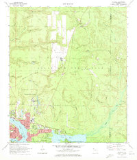 1970 Niceville1972 Print · USGSNiceville and Valparaiso are shown here at the start of the 1970s, shaped by the waters of Boggy Bayou and the expansion of Eglin Air Force Base. Trace local history through Rocky Cem, Pinecrest Community Ch, and the old Claypit sites.4 unique versions available
 - 1970 Map of Holt SW, 1972 Print
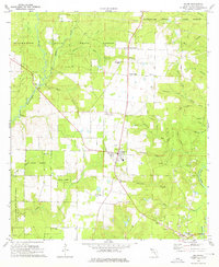
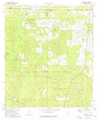
 1970 Holt SW1972 Print · USGSOkaloosa County was deeply integrated with military aviation by the early seventies, as shown in this detailed topographic record. Researchers can trace the perimeter of Eglin Air Force Base, find the settlement of Piccolo, and locate specialized sites like Aux Field No 5.2 unique versions available
 - 1970 Map of Destin, 1972 Print
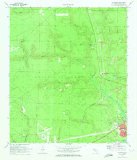
 1970 Destin1972 Print · USGSThe Florida Panhandle's Emerald Coast is captured here in the early seventies, showing a transitioning landscape of military installations and quiet fishing villages. Researchers can trace the layout of early Destin, the grounds of Eglin Air Force Base, and local landmarks like the Destin Sch.3 unique versions available
 - 1970 Map of Valparaiso, 1972 Print
 1970 Valparaiso1972 Print · USGSValparaiso and Niceville border the extensive Eglin military reservation during the early seventies. Researchers can trace the path of the U S Government Railroad, identify remote sites like Aux Field No 5, and locate old burial grounds such as the Cem near Juniper Creek.4 unique versions available
 - 1970 Map of Fort Walton Beach, 1972 Print
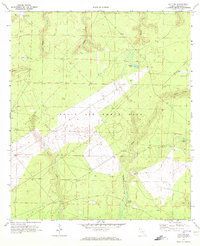
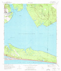
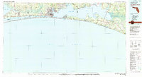
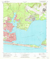 1970 Fort Walton Beach1972 Print · USGSFort Walton Beach and the surrounding bayous were entering a period of significant coastal development and military expansion during the early seventies. Trace the growth of Eglin Village, locate the US Government Railroad, and explore the shoreline from Destin to Santa Rosa Island.4 unique versions available
 - 1970 Map of Navarre, 1972 Print
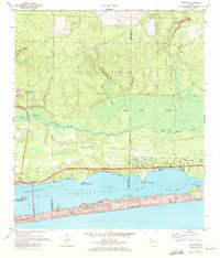 1970 Navarre1972 Print · USGSThe Florida Panhandle coast near the turn of the 1970s shows a landscape defined by military range lands and emerging beach communities. Researchers can trace the mid-century layout of Navarre, Wynnehaven Beach, and the installations within Eglin Air Force Base.3 unique versions available
 - 1970 Map of Mary Esther, 1972 Print
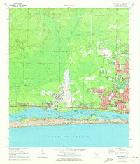 1970 Mary Esther1972 Print · USGSThe Florida Panhandle in the early seventies shows a landscape defined by the growth of Fort Walton Beach and the military footprint of Eglin Air Force Base. Researchers can trace old neighborhoods and landmarks like the Beal Cemetery, Aux Field No 9, and the original Mary Esther Ch.4 unique versions available
 - 1970 Map of Harold SE, 1973 Print
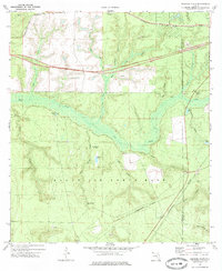
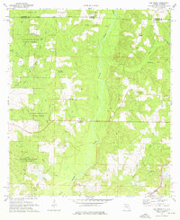
 1970 Harold SE1973 Print · USGSThe Yellow River corridor in the Florida Panhandle is captured here during the early 1970s, showing a mix of rural river life and military expansion. Genealogists and historians can locate Parkerville, the Flowers Field Cem, and the aircraft facilities at Aux Field No 7.2 unique versions available
 - 1973 Map of Spencer Flats, 1975 Print
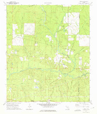
 1973 Spencer Flats1975 Print · USGSThe Florida panhandle comes into focus in the early seventies as military lands and railroad corridors intersect. Genealogists and researchers can trace the rail lines through Nashville and Deerland, or locate landmarks like the Ramer Lookout Tower and Spencer Flats.3 unique versions available
 - 1973 Map of Dorcas, 1975 Print
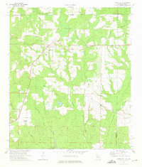
 1973 Dorcas1975 Print · USGSOkaloosa and Walton Counties are captured here in the early 1970s as the Shoal River valley sustained quiet rural communities and rail transport. Researchers can trace family history at Old Dorcas Cem, Welcome Ch, and the small settlement of Deerland.2 unique versions available
 - 1973 Map of Laurel Hill, 1975 Print
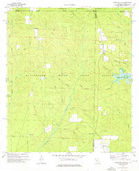
 1973 Laurel Hill1975 Print · USGSLaurel Hill and the surrounding Okaloosa County pinelands are captured here in the early seventies as the railroad still anchored the local economy. Researchers can trace family roots at Travelers Rest Cemetery, Mt Zion Church, and the settlement of Svea.2 unique versions available
 - 1973 Map of Hurricane Lake, 1976 Print
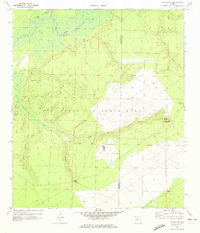
 1973 Hurricane Lake1976 Print · USGSThe Florida-Alabama borderlands appear as a dense network of timberlands and creek basins in the early seventies. Researchers can trace rural landmarks like Bullard Ch, Hobbs Cem, and the waters of Hurricane Lake.
 - 1973 Map of Baker, 1976 Print
 1973 Baker1976 Print · USGSThe Okaloosa County timberlands and river valleys are captured here during the 1970s, showing the rural communities of Baker and Milligan in detail. Genealogists can trace family landmarks like Griffith Cem and Golan Ch among the many creeks and branches.2 unique versions available
 - 1973 Map of Crestview North, 1976 Print
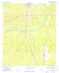
 1973 Crestview North1976 Print · USGSNorth of the growing hub of Crestview in the 1970s, the Okaloosa County landscape was shaped by the Louisville and Nashville railroad and dense state forests. Researchers can locate family landmarks such as Live Oak Cemetery, the old Fauck Ferry site, and Sikes Airport.3 unique versions available
 - 1973 Map of Holt, 1976 Print
 1973 Holt1976 Print · USGSOkaloosa County remains a mix of deep state forests and military reservation lands during the mid-seventies. Genealogists and local historians can trace the Louisville and Nashville rail corridor through Holt and Milligan, or locate Garr Cem and Beulah Ch.2 unique versions available
 - 1973 Map of Floridale, 1976 Print
 1973 Floridale1976 Print · USGSSanta Rosa and Okaloosa counties in the early 1970s show a landscape shaped by the Blackwater and Yellow Rivers. Researchers can trace the Louisville and Nashville railroad through Floridale or find family history at New Canoe Cem and Canoe Cem.3 unique versions available
 - 1973 Map of Munson, 1976 Print
 1973 Munson1976 Print · USGSThe Florida Panhandle in the early 1970s reveals a landscape defined by the deep woods of the Blackwater River State Forest. Researchers can trace old family sites like the Ates Cem and rural congregations at Good Hope Ch.3 unique versions available
 - 1973 Map of Blackman, 1976 Print
 1973 Blackman1976 Print · USGSUpper Okaloosa County is captured in the early 1970s as a landscape of timberlands and quiet crossroads settlements. You can trace family history at Red Oak Cem or locate the old Sand Hill Lookout Tower and Olive Branch Ch.3 unique versions available
 - 1973 Map of Oak Grove, 1976 Print
 1973 Oak Grove1976 Print · USGSThe Florida-Alabama borderlands come to life in this early 1970s survey of the Yellow River valley and its surrounding timberlands. Researchers can trace rural heritage through sites like Old Ebenezer Ch, the Louisville and Nashville rail line, and family cemeteries like Peaden Cem.2 unique versions available
 - 1973 Map of Crestview South, 1976 Print
 1973 Crestview South1976 Print · USGSThe Florida Panhandle's mid-century growth meets the strategic footprint of the military during the 1970s. Researchers can trace the rail corridor of the Louisville and Nashville or locate landmarks like the Drive-in Theater and Aux Field No 3.3 unique versions available
 - 1978 Map of Fort Walton Beach, 1980 Print
 1978 Fort Walton Beach1980 Print · USGSThe Florida Panhandle in the late seventies reveals a landscape defined by the growth of Eglin Air Force Base and the shoreline of Choctawhatchee Bay. Genealogists and historians can trace the early footprints of Fort Walton Beach, Destin, and remote coastal outposts like Point Washington.2 unique versions available
 - 1978 Map of Crestview, 1982 Print
 1978 Crestview1982 Print · USGSThe Florida Panhandle and southern Alabama borderlands appear here in the late seventies as the military and timber industries shaped the landscape. Genealogists can trace family roots through small settlements like Cannon Town or Svea, and locate old sites like Aux Field No 4 (Abandoned).2 unique versions available
End of results
Showing maps 1-22 of 22
Top cities of Okaloosa County
- Crestview historical maps
- Fort Walton Beach historical maps
- Destin historical maps
- Niceville historical maps
- Valparaiso historical maps
- Mary Esther historical maps
See more
Frequently asked questions
- What are the different types of historical maps available for Okaloosa County?
- What is the oldest map of Okaloosa County?
- Where can I purchase historical maps of Okaloosa County for my home or office?
- Where can I download high-res historical maps of Okaloosa County?
- Are there historical topographic maps available for Okaloosa County?
- Is there historical aerial imagery available for Okaloosa County?
- Where are historical maps of Okaloosa County sourced from?